City of Hume

Last updated

City of Hume
Victoria
MelbLGA-Hume.gif
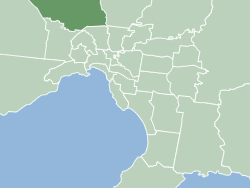
Location within Melbourne metropolitan area
Population243,901 (2021) [1]  (22nd)
 • Density483.9/km2 (1,253.4/sq mi)
Area504 km2 (194.6 sq mi) [1]
MayorNaim Kurt
Council seat Broadmeadows
Region Greater Melbourne
State electorate(s)
Federal division(s)
HumeCouncilLogo.svg
Website City of Hume
LGAs around City of Hume:
Macedon Ranges Macedon Ranges Mitchell
Melton City of Hume Whittlesea
Melton Brimbank Merri-bek

The City of Hume is a local government area located within the metropolitan area of Melbourne, Victoria, Australia. [2] It includes the outer north-western suburbs and a number of rural localities between 13 and 40 kilometres from the Melbourne city centre.

Contents

It has an area of 504 square kilometres, and in June 2018 it had a population of 224,394. [1] The City was formed on 15 December 1994 after the amalgamation of most of the City of Broadmeadows, the Shire of Bulla and parts of the City of Keilor and City of Whittlesea.

The City is unique in Australia in that it was the first local government to introduce a Bill of Rights for its denizens in 2004, following the establishment of a Social Justice Charter in 2001. [3] This Bill of Rights predates the State Government's Charter of Rights and Responsibilities by three years, and is more sweeping in that it explicitly includes economic, social, and cultural rights.[ citation needed ]

Council

Mayors (1997– current)

No. Mayor No.Deputy MayorTerm
1Carl Lewis1Bill Muir1997-1998
2Bill Muir2Dott White1998–1999
3Jack Ogilvie3Graeme Marr1999–2000
4Gary Jungwirth4Drew Jessop2000–2001
5Drew Jessop5Burhan Yigit2001–2002
6Ann Potter6Mohamad Abbouche2002–2003
7Burhan Yigit7Kevin Sheahan2003–2004
8Mohamad Abbouche8Gary Jungwirth2004
9Kevin Sheehan9Adem Atmaca2004–2005
10Adem Atmaca10Ann Potter2005–2006
(4)Gary Jungwirth(4)Drew Jessop2006–2007
(8)Mohamad Abbouche11Moya Kathryn2007–2008
(3)Jack Ogilvie12 Ros Spence 2008–2009
11Geoff Porter(12)Ros Spence2009–2010
12Helen Patsikatheodorou(12)Ros Spence2010–2011
13Ros Spence13Vic Dougall2011-2012
(11)Geoff Porter14Casey Nunn2012–2013
14Casey Nunn(9)Adem Atmaca2013–2014
(10)Adem Atmaca15Alan Bolton2014–2015
(12)Helen Patsikatheodorou16Chandra Bamunusinghe2015–2016
(5)Drew Jessop(10)Ann Potter2016-2017
(11)Geoff Porter17Carly Moore2017-2018
15Carly Moore18Naim Kurt2018-2019
(15)Carly Moore19Karen Sherry2019-2020
20Jack Medcraft
16Joseph Haweil(20)Jack Medcraft2020-2021
(15)Carly Moore21Sam Misho2021-2022
(16)Joseph Haweil(19)Karen Sherry2022-2023
17Naim Kurt(19)Karen Sherry2023-2024


Current composition and election method

Since 2012, Hume has been divided into three wards – Aitken, Jacksons Creek and Meadow Valley — each of which elect a total of 11 Councillors:

Council elections are counted using single transferable vote. Voting is compulsory for residents who are on the voters' roll for local council elections, but voters aged 70 years or over are not obliged to vote at local council elections. The Mayor is a serving councillor, chosen annually by councillors. The most recent council election was held in October 2020. [4] The next election will take place in October 2024.

2020–2024

WardCouncillor [5] Notes
AitkenCarly Moore
Jodi Jackson
Joseph Haweil
Jim Overend
Jacksons CreekJack Medcraft
Jarrod Bell
Trevor Dance
Meadow ValleyChris Hollow
Karen SherryDeputy Mayor
Naim KurtMayor
Sam Misho

Townships and localities

The 2021 census, the city had a population of 243,901 up from 197,376 in the 2016 census [6]

Population
Locality20162021
Attwood 3,4193,309
Broadmeadows 11,97012,524
Bulla 675668
Campbellfield 5,0564,977
Clarkefield^320303
Coolaroo 3,1913,193
Craigieburn 50,34765,178
Dallas 6,8106,762
Diggers Rest^2,7635,669
Fawkner^14,04314,274
Gladstone Park 8,3388,213
Greenvale 15,46621,274
Jacana 2,1282,187
Kalkallo 1055,548
Keilor^5,8535,906
Meadow Heights 14,84214,890
Melbourne Airport 10464
Mickleham 3,14217,452
Oaklands Junction 433439
Roxburgh Park 21,81724,129
Somerton 06
Sunbury 36,08438,851
Tullamarine^6,6056,733
Westmeadows 5,8486,502
Wildwood 216244
Yuroke 142123

^ - Territory divided with another LGA

See also

Related Research Articles

<span class="mw-page-title-main">City of Hobsons Bay</span> Local government area in Victoria, Australia

The City of Hobsons Bay is a local government area in Melbourne, Victoria, Australia. It comprises the south-western suburbs between 6 and 20 km from the Melbourne city centre.

<span class="mw-page-title-main">City of Wyndham</span> Local government area in Victoria, Australia

The City of Wyndham is a local government area in Victoria, Australia in the outer south-western suburbs of Melbourne, within the Melbourne Metropolitan Area, between Melbourne and the regional city of Geelong. It has an area of 542 square kilometres (209 sq mi). The city had a population of 255,322 in June 2018. For the year to 2018 the City of Wyndham increased its population by 14,251, the largest number of any LGA in Victoria, as well as being the second most populous and the second fastest growing at a rate of 5.9 per cent.

<span class="mw-page-title-main">City of Moonee Valley</span> Local government area in Victoria, Australia

The City of Moonee Valley is a local government area located within the metropolitan area of Melbourne, Victoria, Australia. It comprises the north-western suburbs between 3 and 13 kilometres from the Melbourne city centre, and in June 2018, the city had a population of 127,883.

<span class="mw-page-title-main">Yarra Ranges Shire</span> Local government area in Victoria, Australia

The Shire of Yarra Ranges, also known as Yarra Ranges Council, is a local government area in Victoria, Australia, located in the outer eastern and northeastern suburbs of Melbourne extending into the Yarra Valley and Dandenong Ranges. It has an area of 2,468 square kilometres (953 sq mi), of which 3% is classified as urban. In June 2018, it had a population of 158,173.

<span class="mw-page-title-main">City of Banyule</span> Local government area in Victoria, Australia

The City of Banyule is a local government area in Victoria, Australia in the north-eastern suburbs of Melbourne. It was created under the Local Government Act 1989 and established in 1994 as an amalgamation of former councils. It has an area of 63 square kilometres (24.3 sq mi) and lies between 7 and 21 km from central Melbourne. In 1994 it had a population of 116,000. In June 2018 Banyule had a population of 130,237. The Yarra River runs along the City's southern border while its western border is defined by Darebin Creek.

<span class="mw-page-title-main">City of Brimbank</span> Local government area in Victoria, Australia

The City of Brimbank is a local government area located within the metropolitan area of Melbourne, Victoria, Australia. It comprises the western suburbs between 10 and 20 km west and northwest from the Melbourne city centre.

<span class="mw-page-title-main">City of Melbourne</span> Local government area in Victoria, Australia

The City of Melbourne is a local government area in Victoria, Australia, located in the central city area of Melbourne. In 2021, the city has an area of 37.7 square kilometres (14.6 sq mi) and had a population of 149,615. The city's motto is "Vires acquirit eundo" which means "(She) gathers strength as she goes" or, more figuratively, "(She gathers) strength through progress".

<span class="mw-page-title-main">City of Melton</span> Local government area in Victoria, Australia

The City of Melton is a local government area in Victoria, Australia, on Melbourne's western rural–urban fringe.

<span class="mw-page-title-main">City of Greater Geelong</span> Local government area in Victoria, Australia

The City of Greater Geelong is a local government area in the Barwon South West region of Victoria, Australia, located in the western part of the state. It covers an area of 1,248 square kilometres (482 sq mi) and, had a population of 271,057 as of the 2021 Australian census. It is primarily urban with the vast majority of its population living in the Greater Geelong urban area, while other significant settlements within the LGA include Anakie, Balliang, Barwon Heads, Batesford, Ceres, Clifton Springs, Drysdale, Lara, Ocean Grove, Portarlington and St Leonards. It was formed in 1993 from the amalgamation of the Rural City of Bellarine, Shire of Corio, City of Geelong, City of Geelong West, City of Newtown, City of South Barwon, and parts of Shire of Barrabool and Shire of Bannockburn.

<span class="mw-page-title-main">City of Greater Bendigo</span> Local government area in Victoria, Australia

The City of Greater Bendigo is a local government area in Victoria, Australia, located in the central part of the state. It covers an area of 3,000 square kilometres (1,200 sq mi) and, in August 2021, had a population of 121,470. It includes the city of Bendigo and the towns of Axedale, Elmore, Heathcote, Marong, Raywood and Strathfieldsaye. It was formed in 1994 from the amalgamation of the former City of Bendigo with the Borough of Eaglehawk, Shire of Strathfieldsaye, Shire of Huntly and parts of the Rural City of Marong and Shire of McIvor. It is the state’s third largest economy base and is considered a service and infrastructure centre for north central Victoria. The city is surrounded by 40,000 hectares of regional, state and national parkland.

<span class="mw-page-title-main">City of Warrnambool</span> Local government area in Victoria, Australia

The City of Warrnambool is a local government area in the Barwon South West region of Victoria, Australia, located in the south-western part of the state. It covers an area of 121 square kilometres (47 sq mi) and in June 2018 had a population of 34,862. It is entirely surrounded by the Shire of Moyne and the Southern Ocean. It is one of only a few regional councils in Victoria to remain serving just one urban district after the amalgamation process of 1994, although through that process it did gained some portions of the former Shire of Warrnambool.

<span class="mw-page-title-main">City of Wodonga</span> Local government area in Victoria, Australia

The City of Wodonga is a local government area in the Hume region of Victoria, Australia, located in the north-east part of the state. It covers an area of 433 square kilometres (167 sq mi) and in August 2021, had a population of 43,253.

<span class="mw-page-title-main">Shire of Central Goldfields</span> Local government area in Victoria, Australia

Central Goldfields Shire is a local government area in Victoria, Australia, located in the central part of the state. It covers an area of 1,533 square kilometres (592 sq mi) and, in August 2021 had a population of 13,483.

<span class="mw-page-title-main">Shire of Hepburn</span> Local government area in Victoria, Australia

The Shire of Hepburn is a local government area in Victoria, Australia, located in the central part of the state. It covers an area of 1,473 square kilometres (569 sq mi) and, in the 2021 Census the shire had a population of 16,604.

<span class="mw-page-title-main">Shire of Hindmarsh</span> Local government area in Victoria, Australia

The Shire of Hindmarsh is a local government area in Victoria, Australia, located in the western part of the state. It covers an area of 7,527 square kilometres (2,906 sq mi) and in June 2018 had a population of 5,645, having fallen from 5,852 in June 2013.

<span class="mw-page-title-main">Shire of Mitchell</span> Local government area in Victoria, Australia

The Mitchell Shire is a local government area in the Hume region of Victoria, Australia, located North of Melbourne. It covers an area of 2,862 square kilometres (1,105 sq mi) and, in August 2021, had a population of 49,460. It includes the towns of Broadford, Kilmore, Seymour, Tallarook, Pyalong and Wallan. It was formed in 1994 from the amalgamation of the Shire of Pyalong, the Shire of Kilmore, most of the Shire of Broadford, and parts of the Shire of McIvor and Rural City of Seymour.

<span class="mw-page-title-main">Shire of Moorabool</span> Local government area in Victoria, Australia

The Shire of Moorabool is a local government area in Victoria, Australia, located in the western part of the state. It covers an area of 2,111 square kilometres (815 sq mi) and, in June 2018, had a population of 34,158. It includes the towns of Ballan, Bacchus Marsh, Balliang, Mount Wallace, Myrniong, Blackwood, Greendale, Gordon, Korweinguboora and Mount Egerton, Bungaree, Elaine and Wallace. It was formed in 1994 from the amalgamation of the Shire of Bacchus Marsh, Shire of Ballan and parts of the Shire of Bungaree and City of Werribee.

<span class="mw-page-title-main">Shire of Pyrenees</span> Local government area in Victoria, Australia

The Shire of Pyrenees is a local government area (LGA) in Victoria, Australia, located in the western part of the state. It covers an area of 3,435 square kilometres (1,326 sq mi) and in June 2018 had a population of 7,353.

<span class="mw-page-title-main">Shire of Wellington</span> Local government area in Victoria, Australia

The Shire of Wellington is a local government area in Victoria, Australia, located in the eastern part of the state. It covers an area of 10,817 square kilometres (4,176 sq mi) and in June 2018 had a population of 44,019.

<span class="mw-page-title-main">Local government in Victoria</span> Third tier of government in Victoria, Australia

Local government in the Australian state of Victoria consists of 79 local government areas (LGAs). Also referred to as municipalities, Victorian LGAs are classified as cities (34), shires (38), rural cities (6) and boroughs (1). In general, an urban or suburban LGA is called a city and is governed by a City Council, while a rural LGA covering a larger rural area is usually called a shire and is governed by a Shire Council. Local councils have the same administrative functions and similar political structures, regardless of their classification.

References

  1. 1 2 3 "3218.0 – Regional Population Growth, Australia, 2017-18: Population Estimates by Local Government Area (ASGS 2018), 2017 to 2018". Australian Bureau of Statistics. Australian Bureau of Statistics. 27 March 2019. Retrieved 25 October 2019. Estimated resident population, 30 June 2018.
  2. "Hume". Liveinmelbourne.vic.gov.au. 16 October 2020. Retrieved 9 November 2021.
  3. editors: Gelber, Katharine and Stone, Adrienne (2007). Hate Speech and Freedom of Speech in Australia. pp. 10–11. ISBN   9781862876538.{{cite book}}: |last= has generic name (help)CS1 maint: multiple names: authors list (link)
  4. "Hume City Council Election Results 2020". Victorian Electoral Commission. October 2012. Retrieved 31 October 2020.
  5. "Hume City Council - Your Councillors". www.hume.vic.gov.au. Retrieved 23 March 2020.
  6. "Census | Australian Bureau of Statistics". www.abs.gov.au. 11 January 2023.

37°41′S144°55′E / 37.683°S 144.917°E / -37.683; 144.917