The Shire of Cardinia is a local government area in Victoria, Australia, in the south-east of Melbourne between Western Port and the Yarra Ranges on the outskirts of Melbourne. It has an area of 1,283 square kilometres, and had a population of 107,120 in June 2018.[1]
Cardinia Shire Council Offices are located in Officer.[2] Prior to 17 November 2014, they were located in Pakenham.
History
The areas within the present-day boundaries of Cardinia Shire were originally parts of the Cranbourne and Berwick districts, which were incorporated in 1860 and 1862 respectively. The Shire of Fern Tree Gully, later Shire of Sherbrooke, split away in 1889 and included areas to the east of Melbourne. In 1973, the City of Berwick, including Berwick and areas closer to Dandenong, split away from the Shire of Berwick, with the remainder being renamed Shire of Pakenham.[3]
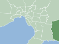
The Shire of Cardinia's predecessor LGAs (green) as they were immediately before their dissolution in December 1994
The Shire of Cardinia contains the only area of Melbourne to use telephone numbers beginning with the exchange prefix 5 - this is a leftover from when it used the area code 059-xx xxxx.
Council
Cardinia Shire Council is divided into nine wards:[5] Beacon Hills, Bunyip, Central, Henty, Officer, Pakenham Hills, Ranges, Toomuc and Westernport. Elections are held every four years, each ward has one councillor. Before October 2020 the shire had three wards: Central, Ranges and Port.
The Council Offices were originally located in Henty Way, Pakenham.[6] On 17 November 2014, the Council moved to a new office on Siding Avenue, Officer, which it uses presently. The Council holds its meetings and all of the administration staff work there.
Cardinia Shire is part of the Casey Cardinia Library Corporation and there are two full-time libraries in Cardinia, in Emerald and Pakenham. In addition, the Mobile Library visits the suburbs of Bunyip, Garfield, Tynong, Beaconsfield, Upper Beaconsfield, Gembrook, Maryknoll, Cockatoo, Lang Lang and Koo Wee Rup.[7]
↑ Victorian Municipal Directory. Brunswick: Arnall & Jackson. 1992. pp.639–40, 805–6, 832–3. Accessed at State Library of Victoria, La Trobe Reading Room.
This page is based on this Wikipedia article Text is available under the CC BY-SA 4.0 license; additional terms may apply. Images, videos and audio are available under their respective licenses.