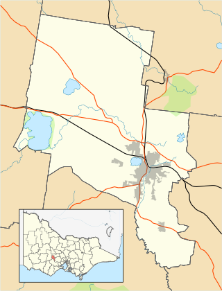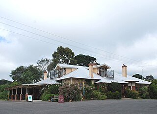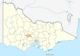
Kingston is a small town and locality of 19.07km2 in the rural Shire of Hepburn in Victoria, Australia, located just off the Midland Highway about 10 kilometres distance from Creswick, and is about 20 km from Daylesford. Kingston's post code is 3364.

The City of Ballarat is a local government area in the west of the state of Victoria, Australia. It covers an area of 739 square kilometres (285 sq mi) and, in June 2018, had a population of 107,325. It is primarily urban with the vast majority of its population living in the Greater Ballarat urban area, while other significant settlements within the LGA include Buninyong, Waubra, Learmonth and Addington. It was formed on 6 May 1994 from the amalgamation of the City of Ballarat, Shire of Ballarat, Borough of Sebastopol and parts of the Shire of Bungaree, Shire of Buninyong, Shire of Grenville and Shire of Ripon.

The City of Greater Bendigo is a local government area in Victoria, Australia, located in the central part of the state. It covers an area of 3,000 square kilometres (1,200 sq mi) and, in August 2021, had a population of 121,470. It includes the city of Bendigo and the towns of Axedale, Elmore, Heathcote, Marong, Raywood and Strathfieldsaye. It was formed in 1994 from the amalgamation of the former City of Bendigo with the Borough of Eaglehawk, Shire of Strathfieldsaye, Shire of Huntly and parts of the Rural City of Marong and Shire of McIvor. It is the state’s third largest economy base and is considered a service and infrastructure centre for north central Victoria. The city is surrounded by 40,000 hectares of regional, state and national parkland.

The Shire of Baw Baw is a local government area in Victoria, Australia, in the eastern part of the state. It covers an area of 4,028 square kilometres (1,555 sq mi) and in 2021 had a population of 57,626.

The Shire of Buloke is a local government area in Victoria, Australia, located in the western part of the state. It covers an area of 8,000 square kilometres (3,100 sq mi) and, in August 2021, had a population of 6,201. It includes the towns of Birchip, Charlton, Donald, Sea Lake and Wycheproof. It was formed in 1995 from the amalgamation of the Shire of Wycheproof, Shire of Birchip, Shire of Charlton, Shire of Donald, and parts of the Shire of Kara Kara.

Shire of Central Goldfields is a local government area in Victoria, Australia, located in the central part of the state. It covers an area of 1,533 square kilometres (592 sq mi) and, in August 2021 had a population of 13,483.

The Shire of Campaspe is a local government area in Victoria, Australia, located in the northern part of the state. It covers an area of 4,519 square kilometres (1,745 sq mi) and in August 2021 had a population of 38,735.

The Shire of Loddon is a local government area in Victoria, Australia, located in the northern part of the state. It covers an area of 6,696 square kilometres (2,585 sq mi) and in 2021 had a population of 7,759.

The Shire of Macedon Ranges is a region in Central Victoria, Australia, best known for its native forests, geographical attraction Hanging Rock, and artisan food and wine industries. The region covers an area of 1,748 square kilometres (675 sq mi). It is located in between the cities of Bendigo and Melbourne. In August 2021 the shire had a population of 51,458. It includes the towns of Gisborne, Gisborne South, Kyneton, Lancefield, Macedon, Malmsbury, Mount Macedon, New Gisborne, Riddells Creek, Romsey and Woodend.

The Shire of Moorabool is a local government area in Victoria, Australia, located in the western part of the state. It covers an area of 2,111 square kilometres (815 sq mi) and, in June 2018, had a population of 34,158. It includes the towns of Ballan, Bacchus Marsh, Balliang, Mount Wallace, Myrniong, Blackwood, Greendale, Gordon, Korweinguboora and Mount Egerton, Bungaree, Elaine and Wallace. It was formed in 1994 from the amalgamation of the Shire of Bacchus Marsh, Shire of Ballan and parts of the Shire of Bungaree and City of Werribee.

The Mount Alexander Shire is a local government area in Victoria, Australia, located in the central part of the state. It covers an area of 1,530 square kilometres (590 sq mi) and, in August 2021, had a population of 20,253. It includes the towns of Castlemaine, Chewton, Elphinstone, Maldon, Newstead, Harcourt, Taradale, Vaughan, Fryerstown and Campbells Creek. It was formed in 1995 from the amalgamation of the City of Castlemaine, Shire of Newstead, and most of the Shire of Maldon and Shire of Metcalfe. The traditional owners of the land are Dja Dja Wurrung.

The Shire of Pyrenees is a local government area (LGA) in Victoria, Australia, located in the western part of the state. It covers an area of 3,435 square kilometres (1,326 sq mi) and in June 2018 had a population of 7,353.

The Shire of Northern Grampians is a local government area in the Wimmera region of Victoria, Australia, located in the western part of the state. It covers an area of 5,730 square kilometres (2,210 sq mi) and in June 2018 had a population of 11,431, having fallen from 12,087 in 2008. It includes the city of Stawell and the towns of St Arnaud, Great Western, Marnoo, Glenorchy, Stuart Mill, Navarre and the tourist town of Halls Gap. It was formed in 1995 from the amalgamation of the City of Stawell, Town of St Arnaud, Shire of Stawell, Shire of Kara Kara and parts of the Shire of Wimmera, Shire of Dunmunkle and Shire of Donald.

Clunes is a town in Victoria, Australia, 36 kilometres north of Ballarat, in the Shire of Hepburn. At the 2016 census it had a population of 1,728.

Glenlyon is a small village in the Shire of Hepburn local government area, Victoria, Australia around 10 km from Daylesford along the Daylesford–Malmsbury Road, and around 101 km from the Melbourne CBD via Kyneton and Malmsbury.

The Shire of Creswick was a local government area about 120 kilometres (75 mi) west-northwest of Melbourne, the state capital of Victoria, Australia. The shire covered an area of 551.66 square kilometres (213.0 sq mi), and existed from 1859 until 1995.

The Shire of Daylesford and Glenlyon was a local government area about 110 kilometres (68 mi) northwest of Melbourne, the state capital of Victoria, Australia. The shire covered an area of 609.3 square kilometres (235.3 sq mi), and existed from 1966 until 1995.

Lyonville is a town located in the Shire of Hepburn, Victoria, Australia. East of Daylesford on the Trentham road, the town takes its name from James Lyon who had arrived in the Glenlyon district in the 1860s. At the 2016 census, Lyonville had a population of 175.

Leonards Hill is a village located in the Shire of Hepburn, Victoria, Australia. At the 2016 census, Leonards Hill had a population of 45.
Strangways is a locality split between the local government areas of Hepburn Shire and Mount Alexander Shire, in Central Victoria, Australia. It covers an area of 20.105 square kilometres between the townships of Guidford to the east, Newstead to the north-west and Clydesdale to the south.


