Daylesford, Victoria

Last updated

Daylesford
Victoria
Daylesfordsnow.jpg
Daylesford as seen from Wombat Hill
Australia Victoria Hepburn Shire location map.svg
Red pog.svg
Daylesford
Daylesford, Victoria
Coordinates 37°21′0″S144°09′0″E / 37.35000°S 144.15000°E / -37.35000; 144.15000
Population2,781 (2021 census) [1]
 • Density76.82/km2 (198.97/sq mi)
Established1852
Postcode(s) 3460
Elevation616 m (2,021 ft)
Area36.2 km2 (14.0 sq mi)
Time zone AEST (UTC+10)
 • Summer (DST) AEDT (UTC+11)
Location
LGA(s) Shire of Hepburn
County Talbot
State electorate(s) Macedon
Federal division(s) Ballarat
Mean max tempMean min tempAnnual rainfall
15.5 °C
60 °F
7.0 °C
45 °F
882.4 mm
34.7 in
Localities around Daylesford:
Hepburn Hepburn Springs Coomoora
Eganstown Daylesford Musk
Musk Vale Musk Vale Musk

Daylesford is a town located in the foothills of the Great Dividing Range, within the Shire of Hepburn, Victoria, Australia, approximately 114 kilometres north-west of Melbourne. First established in 1852 as a gold mining town, Daylesford has a population of 2,781 as of the 2021 census. [1]

Contents

As one of Australia's few spa towns, Daylesford is a notable tourist destination. The town's numerous spas, restaurants and galleries are popular alongside the many gardens and country-house-conversion styled bed and breakfasts. [2]

The broader area around the town, including Hepburn Springs to the north, is known for its natural spring mineral spas and is the location of over 80 per cent of Australia's effervescent mineral water reserve. [3]

It is also the filming location for the third season of The Saddle Club , and scenes from the 2004 film Love's Brother . [4]

History

J. Tenseld, Main Street, Daylesford, 1862, State Library of Victoria Main Street, Daylesford.jpg
J. Tenseld, Main Street, Daylesford, 1862, State Library of Victoria

Prior to European settlement, the area was occupied by the Dja Dja Wurrung people. Pastoralists occupied the Jim Crow and Upper Loddon districts following early white settlement in 1838, [5] and Edward Stone Parker established a farming protectorate for the Dja Dja Wurrung at Franklinford in 1841. The beginning of the Victorian Gold Rush a decade later imposed further suffering on the Dja Dja Wurrung in the area, and by 1863, most of the protectorate's survivors had been moved to the Coranderrk reserve at Healesville. [6]

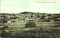
In 1851, Irish immigrant John Egan and a party of searchers found alluvial gold in the bed of Wombat Creek, now covered by Lake Daylesford, initiating the local gold rush. Other finds quickly followed and a townsite was surveyed and founded in 1854, initially named Wombat but soon renamed Daylesford after the birthplace of Warren Hastings, the first governor-general of India.

Agricultural activity followed the gold rush, with many of the Chinese in the area also operating market gardens, and Italians in particular establishing vineyards. [5] [6] A post office opened on 1 February 1858, [7] and a telegraph office opened in August 1859, [8] the same year Daylesford became a municipality. By that time, its population had risen to approximately 7,000, with around 3,400 diggers involved in mining efforts, and the town's first council was formed. [5] [6]

Daylesford was declared a borough in the early 1860s. The alluvial gold was exhausted by then and a shift to quartz reef mining began. This continued on and off into the 1930s, though by the 1920s many miners had already departed for Western Australia. [5] [6]

The arrival of the railway in 1881 helped to boost Daylesford's reputation as a fashionable spa resort. The town fell out of favour as a tourist destination in the Great Depression, with visitors' interest returning in the early 1980s. [5]

On 30 June 1867, three boys from Connells Gully, near Table Hill (William Graham, 7, his brother Thomas, 4, and Alfred Burman, 5), wandered into the bush near Daylesford. [9] [10] Despite exhaustive searches for nearly a month after the boys' disappearance, their remains were not found until 13 September, when a farmer's dog found a boot about 10 kilometres away. [10] Today, there is a park, a memorial cairn, and a 16-kilometre long "Lost Children's Walk" that visitors can hike. [11] [12] The Daylesford Primary School also has a prize, the Graham Dux Award, presented annually since 1889 in their memory. [13]

The Daylesford Magistrates' Court closed on 1 January 1990. [14]

Climate

At 616 metres (2,021 ft) above sea level, Daylesford has a cooler, wetter climate than Melbourne. Summer (January–February) temperatures range from 10 to 37 °C (50 to 99 °F), while July temperatures are cold, ranging from about 1–2 °C (34–36 °F) to 9 °C (48 °F). Annual precipitation, occasionally falling as snow, averages about 880 mm (35 in) but has ranged from 445 mm (17.5 in) to over 1,350 mm (53 in) per year.

Economy

Lake Daylesford Daylesford Lake Victoria Australia (7085530203).jpg
Lake Daylesford
Aerial panorama of Lake Daylesford in summer, 2018. Aerial panorama of Lake Daylesford.jpg
Aerial panorama of Lake Daylesford in summer, 2018.

With 65 mineral springs, the Daylesford-Hepburn Springs region accounts for more than 80 per cent of Australia's known mineral water springs. [15] As a result, the region has a number of spa developments including Hepburn Bathhouse & Spa, Mineral Spa at Peppers Springs Retreat, and the Salus Spa at Lake House. The town is also known for hosting a number of annual events, including the ChillOut Festival held during the Victorian Labour Day long weekend in March each year, the largest LGBTQ festival in rural and regional Australia; the Harvest Week Festival; the Lavandula's Festivals; and the Hepburn Springs Swiss Italian Festival celebrating the town's Swiss-Italian heritage. [16] The annual Daylesford Highland Gathering features pipes and drums, Highland heavy games, a street march, dancing and cultural food and drink, and highlights a variety of Scottish clans and local clubs. [17] [18]

Major industries in the economy of Daylesford today are healthcare, accommodation and food, and retail trade respectively. [19]

Education

Daylesford State School (b. 1875) post card State School, Daylesford.jpg
Daylesford State School (b. 1875) post card

The town is served by a number of primary schools and one public secondary school, Daylesford Secondary College. The town's Secondary College was originally established as a mining school, in 1890. In 1961 the college was established as the sole provider of secondary education in the Shire of Hepburn and has just over 500 pupils. [20] Daylesford Primary School, formerly known as Daylesford State School, is the oldest and longest-running provider of primary education in Daylesford. [21] Other primary schools in the area include St. Michael's Primary School and Daylesford Dharma School. Since 2010, Daylesford Primary School is host to an annual book fair where used and unwanted books are donated to raise funds that go towards improving children's literacy. [22]

Transport

Aerial perspective of Daylesford Boathouse Aerial perspective of Daylesford Boathouse.jpg
Aerial perspective of Daylesford Boathouse

The Midland Highway runs directly through the town linking it with Castlemaine in the north and Ballarat in the south-west. The Western Freeway is the main route linking Daylesford to Melbourne, the State Capital of Victoria.

The railway to the town closed in 1978. [23] The railway layout at Daylesford station was unusual in that the lines from Creswick and Carlsruhe both entered the station from the same end. [24] The Daylesford Spa Country Railway currently operates a Sunday tourist service to Musk and Bullarto along the line towards Carlsruhe.[ citation needed ]

Sport

The town has an Australian Rules football team and a netball team competing in the Central Highlands Football Netball League. [25] Daylesford is also home to the Daylesford and Hepburn United Soccer Club, also known as the Saints or the Sainters. The Saints have won four league titles in their 20-year history along with two cup finals. [26]

Incidents

The Royal Hotel at Daylesford Daylesford Royal Hotel 001.JPG
The Royal Hotel at Daylesford

In November 2023, a car crashed into the beer garden of the Royal Daylesford Hotel, resulting in the deaths of five people. [27] The accident has been described as "devastating" by some locals of the small town. [27]

Notable people

See also

Related Research Articles

<span class="mw-page-title-main">Bendigo</span> City in Victoria, Australia

Bendigo is a city in north-central Victoria, Australia, located in the Bendigo Valley near the geographical centre of the state and approximately 150 kilometres (93 mi) north-west of Melbourne, the state capital.

<span class="mw-page-title-main">Castlemaine, Victoria</span> City in Victoria, Australia

Castlemaine is a town in west central Victoria, Australia, in the Goldfields region about 120 kilometres northwest by road from Melbourne and about 40 kilometres from the major provincial centre of Bendigo. It is the administrative and economic centre of the Shire of Mount Alexander. Castlemaine was named by the chief goldfield commissioner, Captain W. Wright, in honour of his Irish uncle, Viscount Castlemaine. At the 2021 census, Castlemaine had a population of 7,506.

<span class="mw-page-title-main">Kingston, Victoria</span> Town in Victoria, Australia

Kingston is a town in the Shire of Hepburn in Victoria, Australia, located just off the Midland Highway about 10 kilometres distance from Creswick, and is about 20 km from Daylesford. Kingston's post code is 3364.

<span class="mw-page-title-main">Shire of Hepburn</span> Local government area in Victoria, Australia

The Shire of Hepburn is a local government area in Victoria, Australia, located in the central part of the state. It covers an area of 1,473 square kilometres (569 sq mi) and, in the 2021 Census the shire had a population of 16,604.

<span class="mw-page-title-main">Daylesford Spa Country Railway</span> Tourist railway located in Victoria, Australia

The Daylesford Spa Country Railway is a volunteer-operated 1,600 mm gauge tourist railway located in Victoria, Australia. It operates on a section of the closed and dismantled Daylesford line, and currently runs services between Daylesford and the hamlet of Bullarto.

<span class="mw-page-title-main">St Arnaud, Victoria</span> Town in Victoria, Australia

St Arnaud is a town in the Wimmera region of Victoria, Australia, 244 kilometres north west of the capital Melbourne. It is in the Shire of Northern Grampians local government area. At the 2021 census, St Arnaud had a population of 3,453.

<span class="mw-page-title-main">Clunes, Victoria</span> Town in Victoria, Australia

Clunes is a town in Victoria, Australia, 36 kilometres north of Ballarat, in the Shire of Hepburn. At the 2016 census it had a population of 1,728.

<span class="mw-page-title-main">Creswick, Victoria</span> Town in Victoria, Australia

Creswick is a town in west-central Victoria, Australia, 18 kilometres north of Ballarat and 122 kilometres northwest of Melbourne, in the Shire of Hepburn. It is 430 metres above sea level. At the 2016 census, Creswick had a population of 3,170. Creswick was named after the Creswick family, the pioneer settlers of the region.

<span class="mw-page-title-main">Woodend, Victoria</span> Town in Victoria, Australia

Woodend is a town in Victoria, Australia. The town is in the Shire of Macedon Ranges local government area and is bypassed to the east and north by the Calder Freeway (M79), located about halfway between Melbourne and Bendigo. At the 2021 census, Woodend had a population of 6,732 and is located on the Country of the Dja Dja Wurrung, Taungurung and Wurundjeri Woi Wurrung Peoples who are traditional custodians of this area.

<span class="mw-page-title-main">Trentham, Victoria</span> Town in Victoria, Australia

Trentham is a town in the Shire of Hepburn and Shire of Moorabool local government area of West Central Victoria, Australia. At the 2016 census, Trentham had a population of 1,180, with a median age of 55 years. Located at an altitude of 700 metres (2,297 ft), the town is 87 kilometres (54 mi) north-west of Melbourne. The Trentham area is located on the traditional lands of the Dja Dja Wurrung Aboriginal people.

<span class="mw-page-title-main">Ballan, Victoria</span> Town in Victoria, Australia

Ballan is a town in Victoria, Australia. At the 2021 census, Ballan had a population of 3,392.

<span class="mw-page-title-main">Hepburn Springs, Victoria</span> Town in Victoria, Australia

Hepburn Springs is a resort town located in the middle of the largest concentration of mineral springs in Australia, situated in Victoria, 48 km northeast of Ballarat. In the 2021 census, Hepburn had a population of 631, and Hepburn Springs had a population of 368. The total population of Hepburn Springs was 928. The town is named after Captain John Hepburn, who was an early squatter in central Victoria. The traditional owners of the land are the Dja Dja Wurrung.

The Convent Gallery is located in the Spa region of Daylesford, in Central Victoria, Australia.

<span class="mw-page-title-main">Djadjawurrung</span> Aboriginal Australian people in Victoria

The Djadjawurrung or Dja Dja Wurrung, also known as the Djaara or Jajowrong people and Loddon River tribe, are an Aboriginal Australian people who are the traditional owners of lands including the water catchment areas of the Loddon and Avoca rivers in the Bendigo region of central Victoria, Australia. They are part of the Kulin alliance of Aboriginal Victorian peoples. There are 16 clans, which adhere to a patrilineal system. Like other Kulin peoples, there are two moieties: Bunjil the eagle and Waa the crow.

<span class="mw-page-title-main">Franklinford, Victoria</span> Town in Victoria, Australia

Franklinford is a locality in the Central Highlands of Victoria, Australia, located in the Shire of Hepburn.

<span class="mw-page-title-main">Lyonville, Victoria</span> Town in Victoria, Australia

Lyonville is a town located in the Shire of Hepburn, Victoria, Australia. East of Daylesford on the Trentham road. The town takes its name from James Lyon who arrived in the Glenlyon district in the 1860s. At the 2016 census, Lyonville had a population of 175.

<span class="mw-page-title-main">Wombat State Forest</span> Protected area in Victoria, Australia

The Wombat State Forest is located 50 kilometres (31 mi) west of Melbourne, Victoria, Australia, between Woodend and Daylesford, at the Great Dividing Range. The forest is approximately 70,000 hectares in size and sits upon Ordovician or Cenozoic sediments. The Bullarook Wombat State Forest was proclaimed in 1871.

<span class="mw-page-title-main">Jim Crow goldfield</span> Nineteenth-century gold mine in Victoria, Australia

The Jim Crow goldfield was part of the Goldfields region of Victoria, Australia, where gold was mined from the mid- to the late-nineteenth century.

<span class="mw-page-title-main">Mount Franklin (Victoria)</span> Mountain in Victoria, Australia

Mount Franklin is an extinct volcano about 10 km north of Daylesford and 4.6 km south east of Franklinford in Victoria, Australia. A road spirals round the outside slopes covered with pine trees, into a flat 50 acre caldera, and onto the rim which hosts a fire lookout, parking area and picnic ground.

Strangways is a locality split between the local government areas of Hepburn Shire and Mount Alexander Shire, in Central Victoria, Australia. It covers an area of 20.105 square kilometres between the townships of Guidford to the east, Newstead to the north-west and Clydesdale to the south.

References

  1. 1 2 Australian Bureau of Statistics (28 June 2022). "Daylesford (State Suburb)". 2021 Census QuickStats. Retrieved 15 September 2023. OOjs UI icon edit-ltr-progressive.svg
  2. "Woodend to Daylesford". Archived from the original on 25 February 2015. Retrieved 18 September 2014.
  3. "Tourism industry resources" (PDF). Tourism.vic.gov.au. Department of Economic Development, Jobs, Transport and Resources. 9 March 2021.[ permanent dead link ]
  4. "Love's Brother (2004)". IMDb.com. Retrieved 3 March 2021.
  5. 1 2 3 4 5 "History of Daylesford". Archived from the original on 1 February 2014. Retrieved 29 January 2014.
  6. 1 2 3 4 "Short History of Daylesford : Updated December 2019" (PDF). Visit Hepburn Shire. Archived from the original (PDF) on 2 November 2022. Retrieved 21 July 2022.
  7. Freeman, Hugh H; GeoffT. White (2001). The Numeral Cancellations of Victoria. Melbourne: The Royal Philatelic Society of Victoria. ISBN   0-947345-16-7.
  8. Gibbs, Christine (1984). History of Postal Services in Victoria. Melbourne: Australia Post.
  9. "The lost boys of Daylesford - a calamity in the colony". The Canberra Times. 17 June 2022. Retrieved 3 March 2023.
  10. 1 2 "The Lost Boys of Daylesford". ABC Radio National. 16 March 2021. Retrieved 3 March 2023.
  11. "Lost Magazine - Daylesford's Lost Boys". Lost Magazine. Retrieved 3 March 2023.
  12. "Three Lost Children Memorial Park". www.goldfieldsguide.com.au. Retrieved 17 March 2023.
  13. "Missing Childrens Memorial, Message Tree and Resident Wombats". www.goldfieldsguide.com.au. Retrieved 17 March 2023.
  14. "Review of Legal Services in Rural and Regional Victoria" (PDF). Parliament of Victoria Law Reform Committee. May 2001. pp. 291–292. Retrieved 12 April 2020.
  15. "Victoria's Spa and Wellbeing Action Plan 2011" (PDF). Tourism Victoria. Archived from the original (PDF) on 18 March 2012. Retrieved 24 October 2011.
  16. "Daylesford Festivals, Markets and Shows". Daylesforddelights.com. Retrieved 12 August 2016.
  17. "About the Daylesford Highland Gathering". Daylesford Highland Gathering. Retrieved 9 July 2022.
  18. "Daylesford Highland Gathering". The Scottish Banner. 29 November 2021. Retrieved 9 July 2022.
  19. "National Regional Profile : Daylesford (Statistical Area Level 2)". Archived from the original on 29 January 2014. Retrieved 29 January 2014.
  20. "Daylesford Secondary College History". Archived from the original on 29 December 2018. Retrieved 3 September 2014.
  21. "Daylesford Primary School History". Daylesps.vic.edu.au. Archived from the original on 3 June 2014. Retrieved 3 September 2014.
  22. "Daylesford Primary School calls for donations for book fair". Hepburnadvocate.com.au. 27 May 2014. Retrieved 3 September 2014.
  23. Osborne, Murrell (1978). Timber, Spuds and Spa. Australian Railway Historical Society. ISBN   0-85849-023-4.
  24. [ dead link ]
  25. Full Points Footy. "Daylesford". Archived from the original on 24 July 2008. Retrieved 25 July 2008.
  26. "Daylesford & Hepburn United Soccer Club". Daylesfordsoccerclub.com.
  27. 1 2 "'Destroyed in an instant': Community in shock after 'beautiful night' ends with five dead". ABC News. 6 November 2023. Retrieved 6 November 2023.

Sources