
The Jim Crow goldfield was part of the Goldfields region of Victoria, Australia, where gold was mined from the mid- to the late-nineteenth century.
The Jim Crow goldfield was part of the Goldfields region of Victoria, Australia, where gold was mined from the mid- to the late-nineteenth century.
The goldfield extended between the localities of Daylesford and Hepburn Springs in the south, and Strangways at its confluence with the Loddon River in the north, [1] concentrated mainly around Yandoit.
Mentions of diggings named 'Jim Crow' appear in the press from 1851, but are vague and reported to be near Clunes. [2] The first Governor of Victoria, Charles Hotham, visited the diggings in September 1854 and it was reported in the Mount Alexander Mail that;
"On arriving at Tarrangower his Excellency and lady put themselves in communication with Commissioner Lowther, visited and inspected the Camp and various offices. After that they went out alone upon the diggings [ . . . ] At Tarrangower it transpired that the McLachlan diggings, between McLachlan's station and the aboriginal station of Mr. Parker, on the lower portion of the Jim Crow Creek, were supposed to be of a highly auriferous character, though making no pretensions to first-class diggings. Several hundred people had been prospecting there, and nuggets had been found an ounce in weight, but nothing further bad been reported with reference to the result of the prospecting. These diggings are about sixteen miles from Castlemaine. The name of the station on the map is Yandit [ Yandoit]." [3]
The goldfield was named for the creek along which the mines were sited; "Jim Crow Creek," now renamed Larni Barramal Yaluk, which winds 26 km due north from Breakneck Gorge in Hepburn Regional Park, joining the Loddon River below the Guildford Plateau at Strangways.
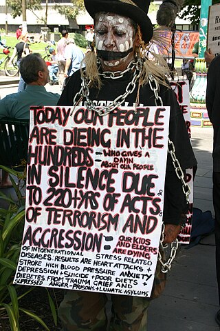
Recent, more enlightened attitudes to First Peoples moved Mount Alexander Shire Council in conjunction with Hepburn Shire Council, [4] North Central Catchment Management Authority and DJAARA (formerly the Dja Dja Wurrung Clans Aboriginal Corporation) in 2021 to rename Jim Crow Creek, first applied to the area of Lalgambook/Mt Franklin by Captain John Hepburn who lived there in the 1830’s. [5] Both Hepburn Shire Council and Mount Alexander Shire Councils voted unanimously in April 2022 to name it, in local Dja Dja Wurrung language, "Larni Barramal Yaluk" (Home of the Emu Creek), acknowledging that the term ‘Jim Crow’ is knowingly derogatory as it stems from international racial segregation and anti-black racism, which was prevalent also in colonial Australia. [6] [7] [8]
Nearly 2,000 miners, many of whom had left the Maryborough diggings, were reported to be on the site in October 1854, though many had little success, [9] and shortage of water for panning and cradling was a problem. [10] Nevertheless a miner who had been on the diggings for two years reported in December 1854 that;
"...many bullock drays arrived during the week, all full of new arrivals, eagerly making for Jim Crow. Some new gullies have been opened, and every appearance of turning out well. The new rush is being worked to great advantage, and likely to continue for some time. Some parties are making three ounces to the tub; four lucky men made, on Wednesday, an ounce and a quarter to the bucket; in short, the whole are making what is commonly called good wages, and most of the old diggers must understand what that means. I have [never seen] a single instance of a digger leaving the Jim Crow being what is termed 'hard up,' but scores of instances I could mention of parties leaving for other diggings, who after a month or two, returned to the old favorite spot, with their pecuniary department embarrassed, highly satisfied with good wages, hitherto a certainty, on the Jim Crow." [11]

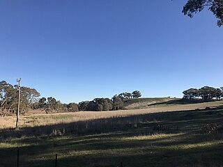
The environmental devastation caused by gold mining was widespread and permanent in the district, decimating and displacing the Dja Dja Wurrung, [12] whose water sources included the Creek and associated underground springs. Mining destroyed the infrastructure they created over generations to maximise seasonal drainage patterns; channels and weirs they built out of timber stakes, to slow receding summer flows, were wrecked; water holes where the people gathered in smaller groups during periods of scarce rainfall and from which they transported water in skin bags when moving, were muddied, polluted and drained; the soaks they had dug between banks into sandy sediment to tap into the water table were likewise obliterated. Some of their waterholes in rock platforms of the Creek that they found or enlarged, then covered with slabs to protect them from animals, may still remain, unidentified. [13] [12] [14]
Mining activity along Larni Barramal Yaluk (Jim Crow Creek) was photographed in 1857/8 on wetplate collodion by Richard Daintree and Antoine Fauchery for their Sun Pictures of Victoria, [15] a copy of which is preserved in the State Library of Victoria. [16] , and traces in the landscape and relics of gold mining activity can still be seen there. [17] [18]
{{cite web}}: CS1 maint: archived copy as title (link){{cite book}}: CS1 maint: location missing publisher (link)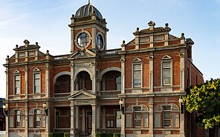
Castlemaine is a town in west central Victoria, Australia, in the Goldfields region about 120 kilometres northwest by road from Melbourne and about 40 kilometres from the major provincial centre of Bendigo. It is the administrative and economic centre of the Shire of Mount Alexander. The population at the 2021 Census was 7,506. Castlemaine was named by the chief goldfield commissioner, Captain W. Wright, in honour of his Irish uncle, Viscount Castlemaine.

The Shire of Loddon is a local government area in Victoria, Australia, located in the northern part of the state. It covers an area of 6,696 square kilometres (2,585 sq mi) and in 2021 had a population of 7,759.

The Mount Alexander Shire is a local government area in Victoria, Australia, located in the central part of the state. It covers an area of 1,530 square kilometres (590 sq mi) and, in August 2021, had a population of 20,253. It includes the towns of Castlemaine, Chewton, Elphinstone, Maldon, Newstead, Harcourt, Taradale, Vaughan, Fryerstown and Campbells Creek. It was formed in 1995 from the amalgamation of the City of Castlemaine, Shire of Newstead, and most of the Shire of Maldon and Shire of Metcalfe. The traditional owners of the land are Dja Dja Wurrung.

Newstead is a town in Victoria, Australia, situated along the Loddon River. It is in the Shire of Mount Alexander local government area. At the 2016 census, Newstead had a population of 572. Newstead has many festivals and folk events and is in the centre of the golden triangle, close to many tourist attractions and events.

Maldon is a town in Victoria, Australia, in the Shire of Mount Alexander local government area. It has been designated "Australia's first notable town" and is notable for its 19th-century appearance, maintained since gold-rush days. At the 2016 census, Maldon had a population of 1,513.

The Loddon River, an inland river of the north–central catchment, part of the Murray-Darling basin, is located in the lower Riverina bioregion and Central Highlands and Loddon Mallee regions of the Australian state of Victoria. The headwaters of the Loddon River rise on the northern slopes of the Great Dividing Range east of Daylesford and descend to flow north into the Little Murray River, near Swan Hill. The river is impounded by the Cairn Curran and Laanecoorie reservoirs.

Dunolly is a town in Victoria, Australia, located on the Dunolly - Maryborough Road, in the Shire of Central Goldfields. At the 2016 census, Dunolly had a population of 893, down from 969 in 2006.

Hepburn Springs is a resort town located in the middle of the largest concentration of mineral springs in Australia, situated in Victoria, 48 km northeast of Ballarat. At the 2016 census, Hepburn had a population of 599 and Hepburn Springs had a population of 329. Total population of Hepburn-Hepburn Springs was 928. The town is named after Captain John Hepburn who was an early squatter of central Victoria. The traditional owners of the land are the Dja Dja Wurrung.

Antoine Julien Nicolas Fauchery was a French adventurer, writer and photographer with republican sympathies. He participated in the national uprising in Poland in 1848, opened a photographic studio in Melbourne, Australia, in 1858, and was commissioned to accompany the French forces as they progressed to Beijing during the last stage of the Second Opium War in 1860. He wrote thirteen long dispatches from the front-line for le Moniteur, the official French government newspaper. He died in Yokohama of dysentery.
Chewton is a town in central Victoria, Australia in the Shire of Mount Alexander local government area, 116 kilometres north west of the state capital, Melbourne. At the 2016 census, Chewton had a population of 1313.

The Shire of Newstead was a local government area about 120 kilometres (75 mi) northwest of Melbourne, the state capital of Victoria, Australia. The shire covered an area of 409.22 square kilometres (158.0 sq mi), and existed from 1860 until 1995.

Campbells Creek is a town in Victoria, Australia.
Dja Dja Wurrung, also known as the Djaara or Jajowrong people and Loddon River tribe, are an Aboriginal Australian people who are the traditional owners of lands including the watersheds of the Loddon and Avoca rivers in the Bendigo region of central Victoria, Australia. They are part of the Kulin alliance of Aboriginal Victorian peoples. There are 16 clans, which adhere to a patrilineal system. Like other Kulin peoples, there are two moieties: Bunjil the eagle and Waa the crow.
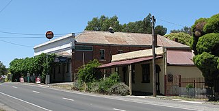
Muckleford is a locality in central Victoria, Australia. The area, also known as Wattle Flat, lies along the Muckleford Creek, a minor tributary of the Loddon River, approximately 127 kilometres north-west of the Melbourne city centre, and within the jurisdiction of the Mount Alexander Shire council. The nearest sizeable town is Castlemaine, approximately 7 km to the east. The original township is named after the English hamlet of the same name in Dorset, UK.

The Goldfields region of Victoria is a region commonly used but typically defined in both historical geography and tourism geography. The region is also known as the Victorian Golden Triangle.
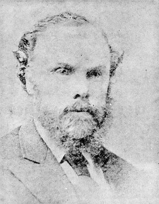
Edward Stone Parker (1802–1865) was a Methodist preacher and assistant Protector of Aborigines in the Aboriginal Protectorate established in the Port Phillip District of colonial New South Wales under George Augustus Robinson in 1838. He established and administered the Franklinford Aboriginal Protectorate Station in the territory of the Dja Dja Wurrung people from January 1841 to the end of 1848.

Franklinford is a locality in the Central Highlands of Victoria, Australia, located in the Shire of Hepburn.

Timor (/ˈtaɪˈmɔː/), short-speak for the adjoining localities of Bowenvale and Timor, in the Central Goldfields Shire of Victoria, Australia. Their shared boundary is 8 kilometres (5 mi) north of Maryborough, Victoria and 178 kilometres (111 mi) northwest of Melbourne, the state capital.

Mount Franklin is an extinct volcano about 10 km north of Daylesford and 4.6 km south east of Franklinford in Victoria, Australia. A road spirals round the outside slopes covered with pine trees, into a flat 50 acre caldera, now used as a camping ground, and onto the rim which hosts a fire lookout, parking area and picnic ground.
Strangways is a locality within the local government area of Mount Alexander, in Central Victoria, Australia. It covers an area of 20.105 square kilometres between the townships of Guidford to the east, Newstead to the north-west and Clydesdale to the south.