City of Manningham

Last updated

City of Manningham
Victoria
MelbLGA-Manningham.gif
Balance of City and Country
Population125,508 (2018) [1]
 • Density1,111/km2 (2,877/sq mi)
Established1994
Area113 km2 (43.6 sq mi) [1]
MayorCr Deirdre Diamante
Council seat Doncaster
Region Greater Melbourne
State electorate(s)
Federal division(s) Menzies
Manningham city logo.svg
Website City of Manningham
LGAs around City of Manningham:
Banyule Nillumbik Yarra Ranges
Banyule City of Manningham Yarra Ranges
Boroondara Whitehorse Maroondah

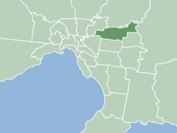
The City of Manningham is a local government area in Victoria, Australia in the north-eastern suburbs of Melbourne and is divided into 12 suburbs, with the largest being Doncaster and Doncaster East. It comprises an area of 113 square kilometres and had a population of 125,508 in June 2018. [1]

Contents

The district spans a roughly east–west direction along the southern banks of the Yarra River and across the undulating valleys of the Koonung, Ruffey and Mullum Mullum Creeks, alternating from typical low density suburban housing in the west to remnant bushland, within a green wedge, in the east. As such, the district encompasses the transition between the built and natural environments in Melbourne's east and promotes itself as a "balance of city and country". [2]

Formerly the City of Doncaster & Templestowe, the district is situated in the Wurundjeri nation's territory. [3] Most of the first European settlers to the area were orchardists, arriving through the 1850s. [4] Gold was first discovered in Victoria around the same time at Andersons Creek, in Warrandyte, however, the district saw varied growth as periods of low density suburban development occurred sporadically throughout the mid-late 20th century. [4]

History

The Manningham municipality was created on 15 December 1994, as part of a general restructure of Melbourne's local government boundaries. [5] The new municipality contains the former City of Doncaster & Templestowe, but with part of Ringwood North ceded to the new City of Maroondah and Wonga Park, annexed from the former Shire of Lillydale.

The name Bulleen, a nearby suburb, was proposed for the new municipality, as it was the name of the shire predating the City of Doncaster and Templestowe.[ citation needed ] However, modern residents believed the name was too localised, so the name of one of the major roads was adopted.[ citation needed ] The origin of Manningham Road comes from the region of Bradford, West Yorkshire, England. Residents' requests for the City to be named after Indigenous Australian names local to the area such as Mullum Mullum or Koonung were rejected.[ citation needed ]

Geography

Mullum Mullum Creek in Victoria, Australia Mullum Mullum Creek.jpg
Mullum Mullum Creek in Victoria, Australia

The main watercourses that border or flow through the City of Manningham include;

Council

Aquarena Aquatic and Leisure Centre located in Templestowe Lower, Victoria, Australia Aquarena Aquatic and Leisure Centre.jpg
Aquarena Aquatic and Leisure Centre located in Templestowe Lower, Victoria, Australia
Doncaster Shoppingtown, redeveloped in 2008 Doncaster-front.jpg
Doncaster Shoppingtown, redeveloped in 2008
Ruffey Lake Park Ruffey Lake Park 2.JPG
Ruffey Lake Park

Manningham was divided into four wards electing two councillors each until 2008. [6]

From 2008 to 2020, Manningham has been divided into three wards, with three councillors elected for each ward. Following reforms to the Local Government Act in 2020, Manningham is divided into 9 wards, each electing one Councillor. [7] Councillors are elected by the community for a four-year term following an election.

The council, as of October 2020, is: [8]

WardPartyCouncillorNotes
Bolin  Liberal [9] Geoff Gough
Currawong Andrew Conlon
Manna  Greens Tomas Lightbody
Ruffey Independent Stephen Mayne
Schramm IndependentLaura Mayne
Tullamore LiberalDeirdre Diamante
Waldau IndependentAnna Chen
Westerfolds LiberalMichelle Kleinert
Yarra IndependentCarli Lange

Federal electorate

The Federal electorate of Menzies covers much of the City of Manningham. It has been held by the Federal Liberal Party since 1984.

State electorates

The City of Manningham encompasses the two Victorian state electorates of Bulleen and Warrandyte, both of which been held predominantly by the Liberal Party.

Past councillors

2000−2020 (multi-member wards)

Manningham comprised four two-member wards until 2008, when Ruffey Ward was abolished and the remaining three wards subsequently became gained a third member, before eventually being replaced by single-member wards in 2020.

Heide Ward
YearCouncillorPartyCouncillorPartyCouncillorParty
2000  Geoff Gough Liberal  John Bruce Independent 2 members (2000−2008)
2003
2005  Grace La Vella Independent
2008   Stephen Mayne Independent
2012  Michelle Kleinert Liberal  Jim Grivokostopoulos Liberal
2016
Koonung Ward
YearCouncillorPartyCouncillorPartyCouncillorParty
2000  Irene Goonan Independent  Bill Larkin Independent 2 members (2000−2008)
2003  Katerina Karanikolopoulos Independent
2005  Warren Welsh Independent
2008  Charles Pick Independent  Ivan Reid Labor  Fred Chuah Independent
2011  Jessica Villarreal Independent  Jennifer Yang Independent
2012  Stephen O'Brien Independent  Dot Haynes Independent
2016  Anna Chen Independent  Mike Zafiropoulos Independent
Mullum Mullum Ward
YearCouncillorPartyCouncillorPartyCouncillorParty
2000  Lionel Allemand Independent  Patricia Young Independent 2 members (2000−2008)
2003  Gerard Dale Independent
2005  Ron Kitchingman Liberal
2008  Meg Downie Labor  David Ellis Independent  Graeme Macmillan Independent
2012  Paul McLeish Independent  Sophy Galbally Independent
2016  Andrew Conlon Liberal
Ruffey Ward
YearCouncillorPartyCouncillorParty
2000  Bob Beynon Independent  Julie Eisenbise Independent
2003
2005  Melanie Randall Independent  Charles Pick Independent

Townships and localities

The city had a population of 124,700 at the 2021 census, up from 116,255 at the 2016 census. [10]

Population
Locality20162021
Bulleen 10,87311,219
Doncaster 20,94625,020
Doncaster East 28,36030,926
Donvale 12,34712,644
Nunawading^11,87612,413
Park Orchards^3,8223,835
Ringwood North^9,8329,964
Templestowe 16,61816,966
Templestowe Lower 13,42914,098
Warrandyte 5,5025,541
Warrandyte South 671671
Wonga Park^3,7963,843

^ - Territory divided with another LGA

Parklands

Covering 70 per cent of the municipality and ranging from large natural areas to intimate pocket parks, these open spaces provide a variety of unstructured play opportunities for children and families. Some of the major parks include;

Education

Primary Schools – Public (14)

Primary Schools – Private (9)

Secondary Schools – Public (4)

Secondary Schools – Private (2)

Other (2)

Libraries (4)

All libraries in the Manningham area are operated by the Whitehorse Manningham Regional Library Corporation.

Manningham Libraries include:

Transport

Manningham is the only area in metropolitan Melbourne without a train line or tram route and therefore the area is heavily reliant on private cars. [11] A Doncaster railway line had been planned for many decades; however the land was sold off in the 1980s. Residents have long campaigned for extension of the route 48 tram along Doncaster Road to Doncaster, Doncaster East or Donvale, although this is heavily supported by Local Governments, the issue has been consistently avoided by State Government.

There are increased bus services to cope with the demand for public transport, including four radial SmartBus routes, and two exclusive Manningham Mover circular routes. Most routes are operated by Kinetic Melbourne, which has a depot in Doncaster East, near the intersection of Blackburn and Doncaster Roads.

Major roadways

Notable residents

See also

Related Research Articles

<span class="mw-page-title-main">Box Hill North, Victoria</span> Suburb of Melbourne, Victoria, Australia

Box Hill North is a suburb of Melbourne, Victoria, Australia, 14 km east from Melbourne's Central Business District, located within the City of Whitehorse local government area. Box Hill North recorded a population of 12,337 at the 2021 census.

<span class="mw-page-title-main">Bulleen, Victoria</span> Suburb of Melbourne, Victoria, Australia

Bulleen is an eastern suburb in Melbourne, Australia, 13 km north-east of the Melbourne central business district, located within the City of Manningham local government area. Bulleen recorded a population of 11,219 at the 2021 census.

<span class="mw-page-title-main">Warrandyte, Victoria</span> Suburb of Melbourne, Victoria, Australia

Warrandyte is a suburb of Melbourne, Victoria, Australia, 24 km north-east of Melbourne's Central Business District, located within the City of Manningham local government area. Warrandyte recorded a population of 5,541 at the 2021 census.

<span class="mw-page-title-main">Doncaster, Victoria</span> Suburb of Melbourne, Victoria, Australia

Doncaster is a suburb of Melbourne, Victoria, Australia, 18 km north-east of Melbourne's Central Business District, located within the City of Manningham local government area. Doncaster recorded a population of 25,020 at the 2021 census.

<span class="mw-page-title-main">Donvale, Victoria</span> Suburb of Melbourne, Victoria, Australia

Donvale is a suburb of Melbourne, Victoria, Australia, 20 kilometres (12 mi) east of Melbourne's Central Business District, located within the City of Manningham local government area.

<span class="mw-page-title-main">Templestowe, Victoria</span> Suburb of Melbourne, Victoria, Australia

Templestowe is a suburb of Melbourne, Victoria, Australia, 16 km north-east of Melbourne's Central Business District, located within the City of Manningham local government area. Templestowe recorded a population of 16,966 at the 2021 census.

<span class="mw-page-title-main">Doncaster East, Victoria</span> Suburb of Melbourne, Victoria, Australia

Doncaster East is a suburb of Melbourne, Victoria, Australia, 20 km east of Melbourne's Central Business District, located within the City of Manningham local government area. Doncaster East recorded a population of 30,926 at the 2021 census.

<span class="mw-page-title-main">Eastern Freeway (Melbourne)</span>

The Eastern Freeway is an urban freeway in eastern Melbourne, the state capital of Victoria, Australia. It is one of the most important freeways in terms of commuting to the city, connecting Alexandra Parade and Hoddle Street in the inner suburbs, with EastLink tollway farther east. It consists of between three and six lanes in each direction, also an inbound transit lane reserved for vehicles with two or more occupants during peak hours.

<span class="mw-page-title-main">Templestowe Lower, Victoria</span> Suburb of Melbourne, Victoria, Australia

Templestowe Lower is a suburb of Melbourne, Victoria, Australia, 14 km northeast of Melbourne's Central Business District, located within the City of Manningham local government area. Templestowe Lower recorded a population of 14,098 at the 2021 census.

<span class="mw-page-title-main">Division of Menzies</span> Australian federal electoral division

The Division of Menzies is an Australian Electoral Division in the state of Victoria.

<span class="mw-page-title-main">Mullum Mullum Creek</span> Creek in Victoria, Australia

Mullum Mullum Creek is a creek in the outer eastern suburbs of Melbourne, Victoria, Australia. It is the main watercourse of the Mullum Mullum Valley, a tributary of the Yarra River and Yarra Valley. For tens of thousands of years it was used as a food and tool source sustainably by the Wurundjeri people, Indigenous Australians of the Kulin nation, who spoke variations of the Woiwurrung language group.

The Electoral district of Doncaster was a metropolitan electorate of the Victorian Legislative Assembly, located approximately 13 kilometres north-east of Melbourne. It was part of the Upper House Eastern Metropolitan Region and sat entirely within the City of Manningham. It was abolished and divided between the Electoral district of Bulleen and the Electoral district of Warrandyte The seat was abolished due to new boundary changes in preparation for the 2014 election.

<span class="mw-page-title-main">Koonung Creek</span> River in Victoria, Australia

Koonung Creek is a small tributary of the Yarra River in Melbourne's east. The creek originates in Nunawading near Springvale Road, and flows to join the Yarra at the border between Ivanhoe East, Bulleen and Balwyn North. The place the two waterways meet forms the borders between these suburbs. Bushy Creek is a tributary to the creek, joining near Elgar Park in Mont Albert North. A shared use path follows the course of the creek, known as the Koonung Creek Trail.

<span class="mw-page-title-main">Mullum Mullum Creek Trail</span>

The Mullum Mullum Creek Trail is a shared use path for cyclists and pedestrians, which follows Mullum Mullum Creek in the outer eastern suburbs in Melbourne, Victoria, Australia.

The Ringwood Bypass is a short stretch of road extending from EastLink to Maroondah Highway in Melbourne, Australia. It allows the Maroondah Highway to bypass Eastland Shopping Centre, in the eastern Melbourne suburb of Ringwood.

<span class="mw-page-title-main">City of Doncaster & Templestowe</span> Local government area in Victoria, Australia

The City of Doncaster & Templestowe was a local government area about 20 kilometres (12 mi) east-northeast of Melbourne, the state capital of Victoria, Australia. The city covered an area of 89.42 square kilometres (34.53 sq mi), and existed from 1915 until 1994. At its peak in the early 1990s, it had a population of just over 100,000.

<span class="mw-page-title-main">Doncaster railway line</span>

The Doncaster railway line was a long-proposed suburban railway in the eastern suburbs of Melbourne, Victoria, Australia, that was anticipated to be built by the late 2020s, as a branch, along with the Hurstbridge line, of the planned future Clifton Hill Loop Line, as part of the 2013 PTV Network Development Plan.

The North East Link is an under construction 10–kilometre tolled motorway scheme in Melbourne, Australia. Its stated objective is to connect the Metropolitan Ring Road at Greensborough with the Eastern Freeway at Bulleen, where the freeway would be upgraded from Hoddle Street to Springvale Road at Nunawading.

<span class="mw-page-title-main">Main Yarra Trail</span>

The Main Yarra Trail, also known as the Yarra Trail is a shared-use path for cyclists and pedestrians, which follows the Yarra River through the northeastern suburbs of Melbourne, Victoria, Australia.

<span class="mw-page-title-main">Bulleen Park and Ride bus station</span> Bus station in Melbourne, Australia

Bulleen Park and Ride is a park and ride bus station and future busway station located in Melbourne, Australia serving the suburb of Bulleen and situated next to the Eastern Freeway. It was opened on 30 April 2023 by the Victorian government as the first piece of public infrastructure delivered by the North East Link project.

References

  1. 1 2 3 "3218.0 – Regional Population Growth, Australia, 2017–18: Population Estimates by Local Government Area (ASGS 2018), 2017 to 2018". Australian Bureau of Statistics. Australian Bureau of Statistics. 27 March 2019. Retrieved 25 October 2019. Estimated resident population, 30 June 2018.
  2. "New residents". City of Manningham. Retrieved 29 October 2020.
  3. "Local indigenous history". City of Manningham. Retrieved 29 October 2020.
  4. 1 2 "Manningham's suburbs". City of Manningham. Retrieved 29 October 2020.
  5. "Local history". Manningham Council. 20 June 2014. Archived from the original on 7 April 2021. Retrieved 27 July 2021.
  6. "2007 Manningham City Council representation review final report" (PDF). Victorian Electoral Commission. 14 May 2007.
  7. "Electoral structure changes for 2020" (PDF). Victorian Electoral Commission. 14 May 2007.
  8. "Manningham City Council election results 2020". vec.vic.gov.au. Retrieved 8 November 2020.
  9. Mann, Simon (4 November 2006). "Winning the eastern bloc". The Age. Retrieved 5 April 2023. At the top end of EastLink, Geoff Gough, a Manningham councillor and Liberal Party member who sits on the Municipal Association's key management board
  10. "Census | Australian Bureau of Statistics". www.abs.gov.au. 11 January 2023.
  11. "Suburban Rail Loop replication via bus service" (PDF). Manningham City Council. Retrieved 26 June 2023.
  12. Professor Roy Robins-Browne receives Order of Australia
  13. "Inaam Barakat OAM". The Governor-General of the Commonwealth of Australia. Retrieved 21 June 2023.

37°46′S145°12′E / 37.767°S 145.200°E / -37.767; 145.200