Mullum Mullum Creek

Last updated

Mullum Mullum Creek
Mullum Mullum Creek in Mitcham.JPG
The Mullum Mullum Creek at Mitcham
Australia Victoria relief location map.jpg
Red pog.svg
Location of the Mullum Mullum Creek mouth in Victoria
Location
Country Australia
State Victoria
LGA City of Maroondah
City of Manningham
City Melbourne
Physical characteristics
Mouth confluence with the Yarra River
  location
Templestowe
  coordinates
37°44′17″S145°9′45″E / 37.73806°S 145.16250°E / -37.73806; 145.16250
  elevation
27 m (89 ft)
Length22 km (14 mi)
Discharge 
  location mouth
Basin features
River system Port Phillip catchment

Mullum Mullum Creek is a creek in the outer eastern suburbs of Melbourne, Victoria, Australia. It is the main watercourse of the Mullum Mullum Valley, a tributary of the Yarra River and Yarra Valley. For tens of thousands of years it was used as a food and tool source sustainably by the Wurundjeri people, Indigenous Australians of the Kulin nation, who spoke variations of the Woiwurrung language group.

Contents

It is one of the only watercourses lying within urban metropolitan Melbourne that is surrounded by native and regenerated bushland for almost its entire length, and is a significant remnant ecosystem in Melbourne. Around 80,000 people live in the creek's catchment area. The remnant bushland across its length provides habitat for significant species such as platypus, rakali, koalas, powerful owl, nankeen night heron, white-winged chough and yellow-tailed black cockatoo.

In recent decades the creek and valley have been central in many of the issues in Melbourne's eastern suburbs, such as; residential housing estates, regeneration of native vegetation and most recently, Tollway construction. The Eastlink Tollway passes underneath the valley through 1.5-km of tunnels to avoid disturbing the remnant ecosystem through the Mullum Mullum Gorge, however through Ringwood, it crosses the creek above ground, resulting in the relocation of the creek through this area.

Etymology

Mullum Mullum is adapted from Woiwurrung language and is thought to mean "place of many big birds" and led many historians to conclude that it meant "Place of Eagles". Many other interpretations have been suggested including; "place of many big swifts" or "place of many big owls" perhaps in reference to the powerful owls of the valley. Some historians suspect Mullum Mullum to be a mistranslation of another Wurundjeri expression Ballum Ballum meaning "place of many butterflies". Around the higher grassy woodlands there are large numbers of butterfly and moth species breeding in the grasslands, many of which have not yet been documented. [1]

Geography and ecology

Location of the Mullum Mullum Creek in relation to the Yarra River and its tributaries Yarra mullum locator map.PNG
Location of the Mullum Mullum Creek in relation to the Yarra River and its tributaries

The creek flows for 22 kilometres (14 mi) through the Mullum Mullum Valley travelling west and then north where it flows into the Yarra River. It passes through many of Melbourne's eastern suburbs including; Croydon, Ringwood, Mitcham, Donvale, East Doncaster, western Warrandyte and Templestowe. It is most often a slight green/brown colour due to the riverbed silt, during heavy rainfall it appears light brown. Its geography is generally divided up into 4 sections; The High Plateau Tract, The Mullum Mullum Gorge, The Valley Tract and The Plains Tract. [2]

High Plateau Tract

Through: Croydon, Ringwood

A ring of high forested hills that separates the Dandenong Valley from the Yarra Valley is the source of the Mullum Mullum Creek. The high plateau is formed by the Wicklow Ridge to Reagh's Hill in the east, Bedford Road and Maroondah Highway in the south, and the Loughnan's Hill, Wonga Road ridge to the west. Commencing in Croydon south of Birt's Hill behind the Yarra Valley School, the Mullum Mullum Creek flows south downstream passing remnant orchards, bushland and parks through Ringwood and past Eastland Shopping Centre. Native hyacinth orchids and small grass trees are present in these remnant forests.

The otter-like rakali feeds in the stream here. Grassy, sedgy woodlands here are home to many undocumented species of butterflies as well as birds and possums. Drier mixed species forests gradually give way to swamp gums and manna gums as the creek heads south. Near New Street, the creek once turned and flowed south of Maroondah Highway down the now dry bed of the upper Heatherdale Creek and into the Dandenong Creek and Port Philip Bay, but a natural 'river capture' has now taken the waters of the creek and diverted them through a narrow gap in the hills to the north and the Yarra River. [2]

Mullum Mullum Gorge

A section of the Mullum Mullum Gorge near Yarran Dheran Mullum Mullum Gorge.JPG
A section of the Mullum Mullum Gorge near Yarran Dheran

Through: Ringwood, Mitcham, Park Orchards, Donvale

With the extra captured water, the Mullum Mullum Creek has carved a steep V-shaped gorge with rocky cascades. Here in the damp shadows, tall old growth riparian forests provide habitat for koalas and native birds species. Maidenhair ferns and tree ferns thrive. The drier hillsides are home to native orchids and echidnas. Passing under the steep bushland escarpment below Poynton Avenue in Ringwood, the rocky cascades and fern covered banks of the Mullum Mullum gorge become apparent. Tall manna gum woodlands, some with treefern understorey, are home to tawny frogmouths and sugar gliders. Near Schwerkolt Cottage, the rocky cascades are bordered by drier open grassy woodlands, rare Valley Heathy Forest rich with native orchids, particularly near Antonio Park, Yarran Dheran, the Hillcrest area at Mitcham, and the Chaim Court bushland and pipe-track at Donvale.

The tall ancient manna gum forests near Whitefriars College are home to ducks (who nest on the tops of old stags) crimson rosellas, galahs and other parrots (who nest in old hollows), rare large powerful owls and rainbow lorikeets. Pied cormorants and night herons cruise the creek pools. Rakali and the occasional platypus, fish for galaxias, gudgeon and yabbies. There are signs of wombat diggings on the hill face but they are rarely seen. The occasional swamp wallaby and eastern grey kangaroo visit the gorge. In warm weather skinks, blue tongue lizards and copperhead snakes can be seen. Other rarely seen species include marbled geckos and white-lipped snakes. [2]

Valley Tract

Vegetation around the creek through the valley tract Mullum Mullum Creek Valley Tract Flora.JPG
Vegetation around the creek through the valley tract

Through: Donvale, Doncaster East, Warrandyte

At Park Road in Park Orchards the valley begins to open up. Here many small tributaries join the Mullum Mullum Creek. Loughnan's Creek connects to Loughie's Bushland and B.J. Hubbard Bushland Reserves in Ringwood North, and many green corridors and urban pathways link to the Mullum Mullum Creek bushland parks on the west. Pockets of good bushland such as the girl guides camp in McGowans Road provide refuge to koalas and tawny frogmouths. Rare yellow box open woodlands with kangaroo grass understorey to the east help protect the resident kangaroos and the breeding white-winged choughs. The higher ground in Park Orchards provides views to the dividing ranges and Mount Macedon and glimpses of the Yarra Valley to the north. Old gold mines in this area are home to bat colonies.

The rural areas of Park Orchards, the bushland from Tindalls Road to Reynolds Road, the Currawong Bush Park, the regenerated bushland near Larnoo Drive at Donvale all provide wonderful bushland habitat and a very significant linear open space. Small tributaries with wetlands, ferns and growling grass frogs link to the Mullum at Currawong Bush Park. Kangaroos, koalas and echidnas are permanent residents in the area, and platypus live in the Creek. The last major tributary, that forms the valley of the Green Gully Linear Park, joins the Mullum Mullum Creek, near Tikalara Park, just opposite the new parklands within the subdivision as the end of Blackburn Road. [2]

Plains Tract

The creek through Mitcham, during low water levels Mullum Mullum Creek rockfall.JPG
The creek through Mitcham, during low water levels

Through: Doncaster East, Templestowe

North of the Heidelberg-Warrandyte Road the creek slowly winds its way towards the Yarra River in Templestowe. Where the Mullum Mullum meets the Yarra, is also where Wurundjeri and European Cultures meet. Tikalara Park, the next stage of the Yarra Valley Metropolitan Park upstream from Petty's Orchard, is particularly a place of significance for the Wurundjeri. Here ancient scar trees and scatter sites provide physical evidence to support the documented evidence that this area was a clan meeting place of the Wurundjeri.

Pontville homestead on the Mullum Mullum Creek near the Yarra River is a site of state historic significance for its associations with early European settlement, and it is a known site of conflict between European and Wurundjeri cultures. The plains where the Mullum Mullum flows into the Yarra are home to kangaroos, wallabies, wombats and is a known platypus breeding ground. The Australian Platypus Conservancy has been studying the significant population of platypus in this area, and their research has confirmed that the Mullum Mullum Creek provides habitat for the highest density of platypus in the whole of the Yarra River catchment. [2]

Settlements

Approximately 70–80,000 people live in the creek's catchment area. The settlements located along its course are listed below, from downstream to upstream;

History

The creek and valley is hypothesised to have been used by Indigenous Australians as a route from modern day Melbourne to Warrandyte. Early European settlement occupied well watered open grassy woodlands on either side of the ridge lines, along the main roads and railway lines, and the more open valleys. Orchards were established on the higher plateaus of Ringwood, Croydon, Park Orchards, and Templestowe.

The natural significance of the valley was recognised early by Naturalists who made excursions to Mitcham to see the remarkable bushlands and rich wildflower displays. In the 1920s and the 1930s it was proposed that the Mullum Mullum Valley should become protected bush parkland, but the remnant bushlands were not threatened by development, the scenery was not spectacular and society at the time had other priorities. After World War II, more people made excursions and day trips to Mitcham, and to Loughnan's Hill and Louhnan's Lake in Ringwood North to enjoy the views and the wonderful bushlands.

By 1946, local town planning schemes again proposed protection of this bushland as parkland, but local planning schemes were being brought together under the MMBW Metropolitan Planning Scheme. In 1954, this scheme first proposed a series of "parkway" roads along our creek valleys, which were made obsolete in the 1969 Melbourne transport plan. Many local residents who chose, in the 1930s and 1940s, to establish their residences next to these bushland, have been fighting for more than 50 years to protect these bushlands from development. [1]

Parklands and recreation

Part of the Mullum Mullum Creek Trail in Ringwood Ringwood Mulu, Mulum Creek1.JPG
Part of the Mullum Mullum Creek Trail in Ringwood

Parks Victoria operate several areas of designated parkland adjoining the Mullum Mullum Creek. Much of this parkland, particularly in the Open Valley Tract was replanted and regenerated, whilst other areas are remnant native bushland. The Mullum Mullum Creek Trail runs through much of this parkland giving cyclists through access to the entire valley. Below is a list of parks adjoining the creek in order from its origin to where it flows into the Yarra River. Adjoining geographic features are shown in bold. [3]

Most of these parklands contain paths or trails, many of which are shared use (pedestrian/cycling). The Mullum Mullum Creek Linear Park follows the course of the creek in the Open Valley Tract between Doncaster East and Donvale, this is where the Mullum Mullum Creek Trail runs beside the creek. Bicycle trails upstream include the Mullum Mullum Valley Path through the gorge and a trail through Ringwood into Croydon beside the creek.

Crossings

The single lane Quarry Road Bridge over the creek near Yarran Dheran Quarry road bridge mullummullumcreek.JPG
The single lane Quarry Road Bridge over the creek near Yarran Dheran

There are many crossings of the Mullum Mullum Creek including around 15 footbridges, many of which are not included in this list as they are only small local pedestrian bridges: [3]

Tollway tunnels

From 2006 to 2008 Eastlink was built, a major tollway servicing Melbourne's eastern and south-eastern suburbs. Eastlink crosses the Mullum Mullum Creek and Valley in Ringwood and Donvale. During the planning stages several proposals were considered for how this crossing would be made, some of which included a 3 km tunnel to go under the entire valley and a surface freeway requiring the destruction of the natural environment. The state government decided on a compromise and two 1.5-km tunnels were subsequently built under the creek and valley. The eastbound tunnel was named after the creek, the other being named after Dame Nellie Melba.

The irony of the situation was that the primary reason this section of the creek was in so natural a state was that it had been protected from other development through the land having been reserved for the section of the proposed F35 Scoresby Freeway (Renamed Eastlink) to join the end of the Eastern Freeway under the 1969 Melbourne Transportation Plan.

Pollution

A tyre embedded in the creek bed through Mitcham Mullum Mullum Creek Pollution.JPG
A tyre embedded in the creek bed through Mitcham

The Mullum Mullum Creek suffers from many of the problems inherent in the development of urban environments and pollution in and around the creek is unfortunately quite prominent. Two of the most significant problems affecting the creek is sewage spills after heavy rain and leakage of septic tank effluent from residential properties into watercourses and subsequently, the creek itself. This is a problem that extends to the Yarra River and has become a major issue affecting the ecology of central Victoria and state politics.

In 2005, three kayakers contracted leptospirosis and suffered bouts of delusion and lung haemorrhaging after swallowing Yarra river water. Tests were conducted in the Yarra River and the Mullum Mullum Creek and the levels of many pathogens were found to have breached local and international standards for recreational water. This is documented in a 2007 report by EPA Victoria in which levels of Human faecal matter and E. coli were recorded and documented. [4] Other major pollutants entering the creek via stormwater drains and surface runoff include dog feces, cigarette butts, packaging and other post-consumer waste.

Solid pollution

In terms of hard pollution, plastics like bags and packaging are most common, they catch in the trees at the high-water mark on the creek banks, tires are also particularly common as well as other car parts such as batteries and pieces of metal. Large pieces of concrete somehow find their way into the creek at various locations and sit amongst the rocks almost blending in if it weren't for the exposed aggregate. Clothing is also common, particularly synthetic items such as gloves, shoes and bags, while clothing such as shirts made from organic materials break down into the environment.

Other information

The creek as it passes between Eastland Shopping Centre and the Ringwood Bypass, through Ringwood Mullum Mullum Creek Eastlands.JPG
The creek as it passes between Eastland Shopping Centre and the Ringwood Bypass, through Ringwood

Many surrounding features, structures and parks borrow their names from the creek: [3]

Mullum Mullum Creek Linear Park
Mullum Mullum Reserve Ringwood
Mullum Mullum Reserve Donvale
Mullum Mullum Creek Trail
Mullum Mullum Valley Path
Mullum Mullum Tunnel
Mullum Place
Mullum Mullum Wetlands

Related Research Articles

<span class="mw-page-title-main">Yarra River</span> River in Victoria, Australia

The Yarra River or historically, the Yarra Yarra River, is a perennial river in south-central Victoria, Australia.

<span class="mw-page-title-main">City of Manningham</span> Local government area in Victoria, Australia

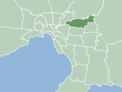
The City of Manningham is a local government area in Victoria, Australia in the north-eastern suburbs of Melbourne and is divided into 12 suburbs, with the largest being Doncaster and Doncaster East. It comprises an area of 113 square kilometres and had a population of 125,508 in June 2018.

<span class="mw-page-title-main">EastLink (Melbourne)</span> Tollway in Melbourne, Australia

EastLink is a tolled section of the M3 freeway linking a large area through the eastern and south-eastern suburbs of Melbourne, Australia.

<span class="mw-page-title-main">Warrandyte, Victoria</span> Suburb of Melbourne, Victoria, Australia

Warrandyte is a suburb of Melbourne, Victoria, Australia, 24 km north-east of Melbourne's Central Business District, located within the City of Manningham local government area. Warrandyte recorded a population of 5,541 at the 2021 census.

<span class="mw-page-title-main">Templestowe, Victoria</span> Suburb of Melbourne, Victoria, Australia

Templestowe is a suburb of Melbourne, Victoria, Australia, 16 km north-east of Melbourne's Central Business District, located within the City of Manningham local government area. Templestowe recorded a population of 16,966 at the 2021 census.

<span class="mw-page-title-main">Doncaster East, Victoria</span> Suburb of Melbourne, Victoria, Australia

Doncaster East is a suburb of Melbourne, Victoria, Australia, 20 km east of Melbourne's Central Business District, located within the City of Manningham local government area. Doncaster East recorded a population of 30,926 at the 2021 census.

<span class="mw-page-title-main">Division of Menzies</span> Australian federal electoral division

The Division of Menzies is an Australian Electoral Division in the state of Victoria.

<span class="mw-page-title-main">Koonung Creek</span> River in Victoria, Australia

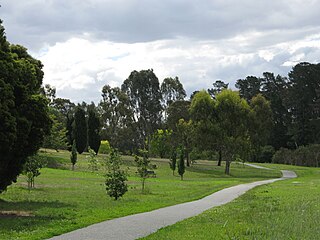
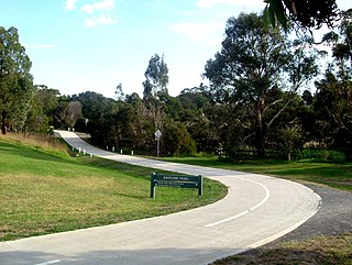
Koonung Creek is a small tributary of the Yarra River in Melbourne's east. The creek originates in Nunawading near Springvale Road, and flows to join the Yarra at the border between Ivanhoe East, Bulleen and Balwyn North. The place the two waterways meet forms the borders between these suburbs. Bushy Creek is a tributary to the creek, joining near Elgar Park in Mont Albert North. A shared use path follows the course of the creek, known as the Koonung Creek Trail.

<span class="mw-page-title-main">Gardiners Creek</span> River in Victoria, Australia

Gardiners Creek, originally known as Kooyongkoot Creek, is an urban stream in the eastern suburbs of Melbourne, and part of the Yarra River catchment.

<span class="mw-page-title-main">Mullum Mullum Creek Trail</span>

The Mullum Mullum Creek Trail is a shared use path for cyclists and pedestrians, which follows Mullum Mullum Creek in the outer eastern suburbs in Melbourne, Victoria, Australia.

<span class="mw-page-title-main">Ruffey Lake Park</span> Park in Melbourne, Victoria, Australia

Ruffey Lake Park is a park in the City of Manningham, Melbourne, Victoria, Australia. It is situated around Ruffey Lake in a portion of a valley through which the Ruffey Creek runs, forming the border between Doncaster and Templestowe. It has three main entrances, Victoria St, The Boulevard and King St. Despite being the second-largest park in Manningham, second to Westerfolds Park, it is the biggest urban park managed by the City of Manningham. It is approximately 68 hectares in size. Formerly orchards, the park has a diverse ecology; this includes a riparian strip of native bushland around the creek, areas of pine trees planted by early settlers and pockets of fruit trees remaining from past orchards.

The Ringwood Bypass is a short stretch of road extending from EastLink to Maroondah Highway in Melbourne, Australia. It allows the Maroondah Highway to bypass Eastland Shopping Centre, in the eastern Melbourne suburb of Ringwood.

<span class="mw-page-title-main">Main Yarra Trail</span>

The Main Yarra Trail, also known as the Yarra Trail is a shared-use path for cyclists and pedestrians, which follows the Yarra River through the northeastern suburbs of Melbourne, Victoria, Australia.

<span class="mw-page-title-main">Currawong Bush Park</span> Riparian bushland park in Melbourne, Victoria, Australia

Currawong Bush Park is a nature park located in the outer eastern Melbourne suburbs of Doncaster East, Warrandyte and Donvale, along Mullum Creek. It covers 59 hectares of remnant bushland and contains archaeological sites significant to the Traditional Owners of the area, the Wurundjeri people of the Kulin nation.

<span class="mw-page-title-main">Mullum Mullum Creek Linear Park</span>

The Mullum Mullum Creek Linear Park is located east of Melbourne, Australia in the suburbs of Doncaster East and Donvale. It stretches for roughly 9 km along the western banks of the Mullum Mullum Creek between Heidelberg-Warrandyte Road and The Eastlink Trail. Facilities include sealed pathways, barbecues and shelters. Other features include, bush walking tracks, trails and equestrian trails. Throughout much of the 1990s, extensive regenerative planting was conducted throughout the entire length of the park; this has restored much of the native riparian bushland within the park, most prominently the Mullum Mullum Wetlands.

<span class="mw-page-title-main">Yarran Dheran</span>

Yarran Dheran Nature Reserve forms part of the Mullum Mullum Valley and is bushland park, located in Melbourne on the border of Donvale, on the banks of the Mullum Mullum Creek. The Reserve is 7.2 hectares and hosts a mix of remnant and regenerated bushland, and many native species of wildlife, particularly birds, of which 85 species may be seen. The Mullum Mullum Creek Trail runs through the Reserve and there are many unsealed bush tracks through the native bushland. There is an Information Centre in the Reserve which is open on Sunday afternoons from 2.00 pm – 4.00 pm subject to volunteer availability. The Reserve includes a series of ponds that feed a cascade to the creek during wet spells. There are toilets and mown areas for picnics and seating. Yarran Dheran is a Dogs on Lead Reserve.

<span class="mw-page-title-main">EastLink Trail</span> Suburban trail in Melbourne, Australia

The EastLink Trail is a shared use path for cyclists and pedestrians in the outer eastern/southeastern suburbs of Melbourne, Victoria, Australia. The trail gets its name from the north-south EastLink tollway, along which it follows for most of its length from Ringwood to Dandenong, until it joins the Dandenong Creek Trail near the Dandenong Bypass bridge at the tri-suburban junction between Dandenong, Dandenong South and Keysborough.

<span class="mw-page-title-main">Parklands adjoining the Yarra River</span>

The Yarra River is a river in southern Victoria, Australia that flows through the city of Melbourne. There are many parklands, including state parks and national parks, that adjoin the river along its 250 km length. Every park listed has walking tracks, smaller parks usually have unsealed paths, while bigger parks will have sealed pathways suitable for walking and cycling. The Yarra River Trail runs along much of the length of the river's lower reaches through Melbourne. Most parks listed have parking available, the quality and quantity of which varies according to the size of the park. Dogs are not permitted in parklands adjoining the river unless otherwise stated in special off-lead areas.

<span class="mw-page-title-main">Warrandyte State Park</span>

Warrandyte State Park is a state park, located in Warrandyte, east of Melbourne, Victoria on the banks of the Yarra River and surroundings. The park comprises 586 hectares of remnant bushland in various locations throughout Warrandyte and Wonga Park around Pound Bend, Fourth Hill, Black Flat, Yarra Brae and various other locations in the area. It hosts many significant geographical, environmental, archaeological and historical sites, such as the site of the first gold discovery in Victoria in 1851 and preserves the sites of former gold mines and tunnels. It is a popular destination for school and community groups and is frequented by local bush walkers and hikers.

<span class="mw-page-title-main">Andersons Creek</span> Creek in Victoria, Australia

Andersons Creek is a creek in Warrandyte and Park Orchards, east of Melbourne, Victoria, Australia. It is a tributary of the Yarra River. For tens of thousands of years it was used as a food and tool source sustainably by the Wurundjeri people, Aboriginal Australians of the Kulin nation, who spoke variations of the Woiwurrung language group.

References

  1. 1 2 Friends of the Mullum Mullum Valley
  2. 1 2 3 4 5 Physiography of Victoria E. Sherbon Hills, Whitcombe & Tombs Pty. Ltd., 1960.
  3. 1 2 3 Melway Edition 36, 2006
  4. EPA Victoria