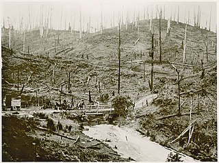
The Latrobe Valley is an inland geographical district and urban area of the Gippsland region in the state of Victoria, Australia. The traditional owners are the Brayakaulung of the Gunai nation. The district lies east of Melbourne and nestled between the Strzelecki Ranges to the south and the Baw Baw Ranges, part of the Great Dividing Range, to the north. Mount St Phillack is the highest peak to the north of the Latrobe Valley, due north of Moe. The highest peak to the south is Mt Tassie, south of Traralgon.

Yarragon is a town in the Shire of Baw Baw in the West Gippsland region of Victoria, Australia. The town lies on the Princes Highway and the main Gippsland Railway line approximately halfway between the major towns of Warragul and Moe. Hills of the Strzelecki Ranges rise over 500 metres (1,600 ft) immediately to the south of the town, providing a spectacular backdrop, while the Moe River and the lowlands lie to the north and east. Mount Worth at 515 m (1,690 ft) above sea level is the highest near peak to the south in the Mount Worth State Park 16 kilometres (9.9 mi) SSW of Yarragon. Mount Baw Baw at 1,563 m (5,128 ft) in the Baw Baw Ranges as part of the Great Dividing Range to the north is approximately 85 kilometres (53 mi) NNE of Yarragon. The township sits at approximately 88 metres (289 ft) above sea level. At the 2006 census, Yarragon had a population of 1131.

The Thomson River, a perennial river of the West Gippsland catchment, is located in the Gippsland region of the Australian state of Victoria.

The Latrobe River is a perennial river of the West Gippsland catchment, located in the West Gippsland region of the Australian state of Victoria. The Latrobe River and its associated sub-catchment is an important source for the Gippsland Lakes, draining the south eastern slopes of the Great Dividing Range.

The Darby River, a perennial river of the West Gippsland catchment, is located in the South Gippsland region of the Australian state of Victoria.
The Albert River is a perennial river of the West Gippsland catchment, located in the South Gippsland region of the Australian state of Victoria.

The Macalister River, a perennial river of the West Gippsland catchment, is located in the Alpine and Gippsland regions of the Australian state of Victoria.
The Perry River is a perennial river of the West Gippsland catchment, located in the Gippsland region of the Australian state of Victoria.

The Morwell River is a perennial river of the West Gippsland catchment, located in the West Gippsland and South Gippsland regions of the Australian state of Victoria.
The Ada River is a perennial river of the West Gippsland catchment, located in the West Gippsland region of the Australian state of Victoria.
The Turton River is a perennial river of the West Gippsland catchment, located in the Gippsland region of the Australian state of Victoria.

The Aberfeldy River is a perennial river of the West Gippsland catchment, located in the Alpine region of the Australian state of Victoria.
The Caledonia River is a perennial river of the West Gippsland catchment, located in the Alpine region of the Australian state of Victoria.
The Toorongo River is a perennial river of the West Gippsland catchment, located in the West Gippsland region of the Australian state of Victoria.
The Loch River is a perennial river of the West Gippsland catchment, located in the West Gippsland region of the Australian state of Victoria.
The Tanjil River is a perennial river of the West Gippsland catchment, located in the West Gippsland region of the Australian state of Victoria.
The Tyers River is a perennial river of the West Gippsland catchment, located in the West Gippsland region of the Australian state of Victoria.
The Wellington River is a perennial river of the West Gippsland catchment, located in the Alpine region of the Australian state of Victoria.
The Carey River is a perennial river of the West Gippsland catchment, located in the Alpine region of the Australian state of Victoria.
The Dolodrook River is a perennial river of the West Gippsland catchment, located in the Alpine region of the Australian state of Victoria.


