Ovens River

Last updated

Ovens
WangarattaOvensRiver.JPG
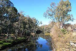
Ovens River at Wangaratta
Map of the Ovens River.svg
Course of the Ovens River in Victoria
EtymologyIn honour of Major Ovens, the Secretary to Governor Thomas Brisbane [1]
Native name
Location
Country Australia
State Victoria
Region Australian Alps (IBRA), Victorian Alps, Hume
Local government areas Alpine Shire, Wangaratta City, Moira Shire
Towns and cities Harrietville, Bright, Porepunkah, Myrtleford, Wangaratta
Physical characteristics
Source Great Dividing Range
Source confluenceEast and West Branches of the Ovens River
  location Harrietville
  coordinates 36°53′15″S147°3′45″E / 36.88750°S 147.06250°E / -36.88750; 147.06250
  elevation529 m (1,736 ft)
Mouth confluence with the Murray River
  location
near Bundalong
  coordinates
36°2′15″S146°10′38″E / 36.03750°S 146.17722°E / -36.03750; 146.17722
  elevation
125 m (410 ft)
Length191 km (119 mi)
Basin size7,778 km2 (3,003 sq mi)
Discharge 
  average46 m3/s (1,600 cu ft/s)
Basin features
River system North-East Murray catchment, Murray-Darling basin
Tributaries 
  left Morses Creek, Buckland River (Victoria), Buffalo River (Victoria), King River (Victoria)
National parks Alpine NP, Mount Buffalo NP
[4]

The Ovens River, a perennial river of the north-east Murray catchment, part of the Murray-Darling basin, is located in the Alpine and Hume regions of the Australian state of Victoria.

Contents

Location and features

Formed by the confluence of the East and West Branches of the river, the Ovens River rises in the Victorian Alps, at the settlement of Harrietville, sourced by runoff from high slopes located within the Alpine National Park and the Mount Buffalo National Park. The river flows generally north by west and is joined by eighteen tributaries including Morses Creek at Bright, the Buckland River at Porepunkah, the Buffalo River and then the King River at Wangaratta. The river descends 405 metres (1,329 ft) over its 191-kilometre (119 mi) course. [4] The Great Alpine Road follows much of the course of the river in its upper reaches. [4]

Ovens Valley

The river flows through the Ovens Valley, which is a popular tourist destination servicing the ski fields of Mount Hotham, Mount Buffalo and Falls Creek, the Alpine National Park and the Mount Buffalo National Park. Air sports such as gliding and paragliding are also practised here, and there is a hedge maze at Wandiligong. A disused railway line has been converted to the Murray to the Mountains Rail Trail, a cycle trail which stretches from Wangaratta and Beechworth to Bright.

There are several wineries in the area, and many hops farms. The wineries are a popular stop for cyclists on their touring rides.

Tobacco was a major industry in the valley until 2006; that year saw the British American Tobacco and Philip Morris companies decide to no longer buy Australian tobacco, and the Federal Government began implementing a plan to transition growers out of this industry. [5] Reminders of the valley's long and prosperous tobacco history continue to dot the valley, such as the many tobacco kilns.

Etymology

Hamilton Hume and William Hovell explored the area in 1824, naming the Ovens River in honour of Major John Ovens, the Secretary to Thomas Brisbane, the Colonial Governor of New South Wales. [1]

In the Aboriginal Waywurru language, the river has two names: Burwang, with no clearly defined meaning; [2] and Djerrang, meaning "leaf". [2]

List of towns

See also

Related Research Articles

<span class="mw-page-title-main">Mount Buffalo National Park</span> Protected area in Victoria, Australia

The Mount Buffalo National Park is a national park in the alpine region of Victoria, Australia. The 31,000-hectare (77,000-acre) national park is located approximately 350 kilometres (220 mi) northeast of Melbourne in the Australian Alps. Within the national park is Mount Buffalo, a moderately high mountain plateau, with an elevation of 1,723 metres (5,653 ft) above sea level.

<span class="mw-page-title-main">Wangaratta</span> City in Victoria, Australia

Wangaratta is a city in the northeast of Victoria, Australia, 236 km (147 mi) from Melbourne along the Hume Highway. The city had a population of 29,808 per the 2021 Australian Census.

<span class="mw-page-title-main">Victorian Alps</span>

The Victorian Alps, also known locally as the High Country, is a large mountain system in the southeastern Australian state of Victoria. Occupying the majority of eastern Victoria, it is the southwestern half of the Australian Alps, the tallest portion of the Great Dividing Range. The Yarra and Dandenong Ranges, both sources of rivers and drinking waters for Melbourne, are branches of the Victorian Alps.

<span class="mw-page-title-main">Bright, Victoria</span> Town in Victoria, Australia

Bright is a town in northeastern Victoria, Australia, 319 metres above sea level at the southeastern end of the Ovens Valley. At the 2021 census, Bright had a population of 2,620. It is located in the Alpine Shire local government area.

<span class="mw-page-title-main">Beechworth</span> Town in Victoria, Australia

Beechworth is a well-preserved historical town located in the north-east of Victoria, Australia, famous for its major growth during the gold rush days of the mid-1850s. At the 2021 census, Beechworth had a population of 3,290.

<span class="mw-page-title-main">Chiltern, Victoria</span> Town in Victoria, Australia

Chiltern is a town in Victoria, Australia, in the northeast of the state between Wangaratta and Wodonga, in the Shire of Indigo. At the 2021 census, Chiltern had a population of 1,580. It was the birthplace of Prime Minister John McEwan. The town is close to the Chiltern-Mount Pilot National Park. Chiltern was once on the main road between Melbourne and Sydney but is now bypassed by the Hume Freeway running one kilometre to the south.

<span class="mw-page-title-main">Great Alpine Road</span> Highway in Victoria, Australia

The Great Alpine Road (B500) is a country tourist road in Victoria, Australia, running from Wangaratta in the north to Bairnsdale in the east, and passing through the Victorian Alps. The road was given its current name because it was considered the mountain equivalent to Victoria's world-famous Great Ocean Road in the south-west of the state. The road usually remains open during winter; however, vehicles travelling between Harrietville and Omeo are required to carry diamond-pattern snow chains during the declared snow season.

<span class="mw-page-title-main">Whitfield, Victoria</span> Town in Victoria, Australia

Whitfield is an agricultural township in the King Valley in north-eastern Victoria.

<span class="mw-page-title-main">King River (Victoria)</span> River in Victoria (Australia)

The King River, a perennial river of the North-East Murray catchment of the Murray-Darling basin, is located in the Alpine and Hume regions of Victoria, Australia. It flows from the northwestern slopes of the Alpine National Park in the Australian Alps, through the King Valley, and joining with the Ovens River at the rural city of Wangaratta.

<span class="mw-page-title-main">Tambo River (Victoria)</span> River in Victoria, Australia

The Tambo River or Berrawan is a perennial river of the Mitchell River catchment, located in the East Gippsland region of the Australian state of Victoria. With a total length in excess of 186 kilometres (116 mi), the Tambo River is one of the longest rivers in the East Gippsland drainage basin, extending from the steep forested southern slopes of the Victorian Alps through forest and farmland to the Gippsland Lakes.

The Morses Creek, is a perennial stream of the North-East Murray catchment of the Murray-Darling basin, is located in the Alpine region of Victoria, Australia. It flows from the northern slopes of the Mount Buffalo National Park in the Australian Alps, joining with the Ovens River at Bright.

<span class="mw-page-title-main">County of Bogong</span> Cadastral in Victoria, Australia

The County of Bogong is one of the 37 counties of Victoria which are part of the cadastral divisions of Australia, used for land titles. It is located south of the Murray River, east of the Ovens River, and west of the Mitta Mitta River. Mount Bogong is located there, the highest mountain in Victoria. The county was proclaimed in 1871.

<span class="mw-page-title-main">Myrtleford Alpine Saints Football Netball Club</span>

The Myrtleford Alpine Saints Football Netball Club, is an Australian rules football and netball club based in the town of Myrtleford, in north east Victoria on the Ovens River. The football and netball squads play in the Ovens & Murray Football League (OMFL).

<span class="mw-page-title-main">Porepunkah</span> Town in Victoria, Australia

Porepunkah is a town in northeast Victoria, Australia on the Great Alpine Road, at the foot of Mount Buffalo 320 kilometres (199 mi) northeast of the state capital, Melbourne and 5 kilometres (3 mi) northwest of Bright. It is part of Alpine Shire local government area and on the banks of the Ovens River, near the Buckland River junction. At the 2016 census, Porepunkah had a population of 941.

The Murray to Mountains Rail Trail is a cycling and walking rail trail in northern Victoria, Australia. It extends from Wangaratta to Bright, with a side branch to Beechworth, following the route of the former Bright railway line. This side branch trail is planned to be extended from Beechworth to Yackandandah. AU$12m was budgeted by the Victoria State Government for this extension in May 2017. Unusually for a rail trail, it is sealed for virtually the entire distance of approximately 95 kilometres.

The Alpine Classic is an Australian bicycle event run every Australia Day weekend in Bright, Victoria. The event is currently managed by O2 Events, having previously been organised by Audax Australia volunteers. Arguably the most difficult single day cycle event in Australia with the 200 km version covering four steep climbs. All distances start at Howitt Park in Bright and are on open roads.

<span class="mw-page-title-main">Bright railway line</span>

The Bright railway line was a railway line in Victoria, Australia constructed by the Victorian Railways as a branch from the previously constructed Yackandandah line to Beechworth, with the Bright line branching at Everton. The line followed the Ovens Valley opening as far as Myrtleford on 17 December 1883 being extended to Bright on 17 October 1890.

<span class="mw-page-title-main">Buckland River (Victoria)</span> River in Victoria, Australia

The Buckland River, a perennial river of the North-East Murray catchment of the Murray-Darling basin, is located in the Alpine region of Victoria, Australia. It flows from the eastern slopes of the Buffalo Range in the Australian Alps, joining with the Ovens River at Porepunkah.

<span class="mw-page-title-main">Hume (region)</span> Region in Victoria, Australia

The Hume is an economic rural region located in the north-eastern part of Victoria, Australia. Comprising an area in excess of 40,000 square kilometres (15,000 sq mi) with a population that ranges from 263,000 to 300,000, the Hume region includes the local government areas of Alpine Shire, Rural City of Benalla, City of Wodonga, City of Greater Shepparton, Shire of Indigo, Shire of Mansfield, Shire of Strathbogie, Shire of Towong and the Rural City of Wangaratta, and also includes five unincorporated areas encompassing the alpine ski resorts in the region.

The Buffalo River, a perennial river of the North-East Murray catchment of the Murray-Darling basin, is located in the Alpine region of Victoria, Australia. It flows from the eastern slopes of the Buffalo Range in the Australian Alps, joining with the Ovens River west of Myrtleford.

References

  1. 1 2 "Ovens River: 23093: Historical Information". Vicnames. 17 June 2011. Archived from the original on 22 June 2014. Retrieved 22 June 2014.
  2. 1 2 3 "Ovens River: 23093: Historical Information: Burwang". Vicnames. 12 August 2011. Retrieved 22 June 2014.
  3. "Ovens River: 23093: Historical Information: Djerrang". Vicnames. 12 August 2011. Retrieved 22 June 2014.
  4. 1 2 3 "Map of Ovens River". Bonzle Digital Atlas of Australia. Retrieved 22 June 2014.
  5. Lee, Tim (10 June 2007). "Tobacco industry up in smoke" (transcript). Landline . Australia: ABC TV . Retrieved 28 December 2018.

Commons-logo.svg Media related to Ovens River at Wikimedia Commons