
The Great Otway National Park is a national park located in the Barwon South West region of Victoria, Australia. The 103,185-hectare (254,980-acre) national park is situated approximately 162 kilometres (101 mi) southwest of Melbourne, in the Otway Ranges, a low coastal mountain range. It contains a diverse range of landscapes and vegetation types.

The Shire of Colac Otway is a local government area in the Barwon South West region of Victoria, Australia, located in the south-western part of the state. It covers an area of 3,438 square kilometres (1,327 sq mi) and in June 2018 had a population of 21,503. It includes the towns of Apollo Bay, Beeac, Beech Forest, Birregurra, Colac, Cressy, Forrest, Johanna, Kennett River, Lavers Hill, Warrion and Wye River. It came into existence on 23 September 1994 through the amalgamation of the local government areas of City of Colac, Shire of Colac, part of the Shire of Otway and part of the Shire of Heytesbury.
Lorne is a seaside town on Louttit Bay in Victoria, Australia. It is situated about the Erskine River and is a popular destination on the Great Ocean Road tourist route. Lorne is in the Surf Coast Shire and at the 2016 census had a population of 1,114 but this figure grows during the holiday season.

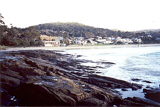
Wye River is a small town in Victoria, Australia. It is also the name given to the waterway which flows through the town and into the sea. Situated 155 km to the west of Melbourne, on the Otway Coast, part of the scenic Great Ocean Road, the Wye River township is located about 15 km west of the resort town Lorne, Victoria. It became more feasible for Melburnians to holiday there after the section of the Great Ocean Road from Lorne to Apollo Bay was opened in 1932. At the 2016 census, Wye River had a permanent population of 66, although its holiday population is ten times that.

Johanna is a small locality on the coast of Victoria, Australia located west of Cape Otway in the Colac Otway Shire. It is named after the schooner Joanna that was wrecked at the mouth of the Johanna River on 22 September 1843.
Beech Forest is a town in Victoria, Australia. The area of Beech Forest is largely used for potato farming.
The Kennet River, now commonly spelt Kennett River, is a perennial river of the Corangamite catchment, located in the Otways region of the Australian state of Victoria.

The Parker River is a perennial river of the Corangamite catchment, located in the Otways region of the Australian state of Victoria.
The Gellibrand River is a perennial river of the Corangamite catchment, located in the Otways region of the Australian state of Victoria.
The Johanna River is a perennial river of the Corangamite catchment, located in the Otways region of the Australian state of Victoria.

The Aire River is a perennial river of the Corangamite catchment, located in the Otways region of the Australian state of Victoria.
The Calder River is a perennial river of the Corangamite catchment, located in the Otways region of the Australian state of Victoria.
The Elliott River is a perennial river of the Corangamite catchment, located in the Otways region of the Australian state of Victoria.

The Barham River is a perennial river of the Corangamite catchment, located in the Otways region of the Australian state of Victoria.
The Grey River is a perennial river of the Corangamite catchment, located in the Otways region of the Australian state of Victoria.
The Wye River is a perennial river of the Corangamite catchment, located in the Otways region of the Australian state of Victoria.

The Cumberland River is a perennial river of the Corangamite catchment, located in the Otways region of the Australian state of Victoria.

The St George River, or sometimes incorrectly Saint George River, is a perennial river of the Corangamite catchment, located in the Otways region of the Australian state of Victoria.

The Anglesea River is a perennial river of the Corangamite catchment, located in the Otways region of the Australian state of Victoria.
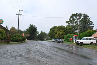
Benwerrin is a rural locality in the Surf Coast Shire, Victoria, Australia.

