
The Avon River is a perennial river of the West Gippsland catchment, located in the West Gippsland region, of the Australian state of Victoria. The Avon, forms an important part of the Latrobe sub-catchment, draining the south eastern slopes of the Great Dividing Range, to form the Gippsland Lakes.
The Timbarra River is a perennial river of the Mitchell River catchment, located in the East Gippsland region of the Australian state of Victoria.
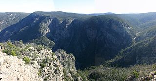
The Dargo River is a perennial river of the Mitchell River catchment, located in the Alpine and East Gippsland regions of the Australian state of Victoria.
The Little River is a perennial river of the Snowy River catchment, located in the Alpine region of the Australian state of Victoria. It is one of two rivers of the same name that are tributaries of the Snowy River, the other being the Little River.
The Deddick River is a perennial river of the Snowy River catchment, located in the Alpine region of the Australian state of Victoria.

The Bonang River is a perennial river of the Snowy River catchment, located in the Alpine region of the Australian state of Victoria.
The Little Yalmy River is a perennial river of the Snowy River catchment, located in the Alpine region of the Australian state of Victoria.
The Back River is a perennial river of the Mitchell River catchment, located in the Alpine region of the Australian state of Victoria.
The Little River is a perennial river of the Mitchell River catchment, located in the East Gippsland region of the Australian state of Victoria.
The Wonnangatta River is a perennial river of the Mitchell River catchment, located in the Alpine and East Gippsland regions of the Australian state of Victoria.
Swamp Creek is a perennial stream of the Mitchell River catchment, located in the Alpine and East Gippsland regions of the Australian state of Victoria.
The Little Dargo River is a perennial river of the Mitchell River catchment, located in the Alpine region of the Australian state of Victoria.
The Dry River is a perennial river of the Mitchell River catchment, located in the Alpine region of the Australian state of Victoria.
The Little River is a perennial river of the Mitchell River catchment, located in the Alpine region of the Australian state of Victoria.
The Humffray River is a perennial river of the Mitchell River catchment, located in the Alpine region of the Australian state of Victoria.
The Wongungarra River is a perennial river of the Mitchell River catchment, located in the Alpine region of the Australian state of Victoria.
The Crooked River is a perennial river of the Mitchell River catchment, located in the Alpine region of the Australian state of Victoria.
The Turton River is a perennial river of the West Gippsland catchment, located in the Gippsland region of the Australian state of Victoria.
The Wellington River is a perennial river of the West Gippsland catchment, located in the Alpine region of the Australian state of Victoria.
The Little River is a perennial river of the West Gippsland catchment, located in the alpine region of the Australian state of Victoria.

