Lake Corangamite, a hypersaline endorheic lake, is located near Colac in the Lakes and Craters region of the Victorian Volcanic Plains of south-west Victoria, Australia. The lake's salinity levels have increased dramatically as the lake level has dropped in recent decades. It is Australia's largest permanent saline lake, covering approximately 230 square kilometres (89 sq mi) with a circumference of 150 kilometres (93 mi). It forms part of the Ramsar-listed Western District Lakes wetland site. The Aboriginal name of the lake is recorded as Kronimite.
The Kennet River, now commonly spelt Kennett River, is a perennial river of the Corangamite catchment, located in the Otways region of the Australian state of Victoria.

The Woady Yaloak River is a perennial river of the Corangamite catchment, located in the Western District Lakes region of the Australian state of Victoria.

The Parker River is a perennial river of the Corangamite catchment, located in the Otways region of the Australian state of Victoria.
The Gellibrand River is a perennial river of the Corangamite catchment, located in the Otways region of the Australian state of Victoria.
The Johanna River is a perennial river of the Corangamite catchment, located in the Otways region of the Australian state of Victoria.

The Aire River is a perennial river of the Corangamite catchment, located in the Otways region of the Australian state of Victoria.
The Ford River is a perennial river of the Corangamite catchment, located in the Otways region of the Australian state of Victoria.
The Calder River is a perennial river of the Corangamite catchment, located in the Otways region of the Australian state of Victoria.
The Geary River is a perennial river of the Corangamite catchment, located in the Otways region of the Australian state of Victoria.
The Elliott River is a perennial river of the Corangamite catchment, located in the Otways region of the Australian state of Victoria.

The Barham River is a perennial river of the Corangamite catchment, located in the Otways region of the Australian state of Victoria.
The Grey River is a perennial river of the Corangamite catchment, located in the Otways region of the Australian state of Victoria.

The Wye River is a perennial river of the Corangamite catchment, located in the Otways region of the Australian state of Victoria.

The Cumberland River is a perennial river of the Corangamite catchment, located in the Otways region of the Australian state of Victoria.

The Erskine River is a river in southwestern Victoria, Australia. It arises in the Otway Ranges and enters Bass Strait to the east of Cape Otway through the town of Lorne. The Erskine River above the falls is known for its high diversity of native fish species and low occurrence of introduced species.

The Anglesea River is a perennial river of the Corangamite catchment, located in the Otways region of the Australian state of Victoria.
The Carlisle River is a perennial river of the Corangamite catchment, located in the Otways region of the Australian state of Victoria.
The Curdies River is a perennial river of the Corangamite catchment, located in the Otways region of the Australian state of Victoria.
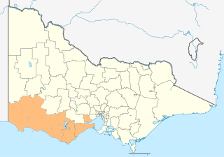
The Barwon South West is an economic rural region located in the southwestern part of Victoria, Australia. The Barwon South West region stretches from the tip of the Queenscliff Heads to the border of South Australia. It is home to Victoria’s largest provincial centre, Geelong and the major centres of Aireys Inlet, Apollo Bay, Camperdown, Colac, Hamilton, Lorne, Port Campbell, Port Fairy, Portland, Torquay and Warrnambool. It draws its name from the Barwon River and the geographic location of the region in the state of Victoria.

