Big River (Mitta Mitta River, Victoria)

Last updated

Big
Big River downstream at Bundara Campground near Anglers Rest, Vic, jjron, 6.06.2009.jpg
Looking south over the Big River at the Bundara Campground, near Anglers Rest
Australia Victoria relief location map.jpg
Red pog.svg
Location of the Big River mouth in Victoria
Location
Country Australia
State Victoria
Region Victorian Alps (IBRA), East Gippsland
Local government area East Gippsland Shire
Physical characteristics
SourceSpion Kopje, Victorian Alps
  locationnear Falls Creek
  coordinates 36°49′S147°19′E / 36.817°S 147.317°E / -36.817; 147.317
  elevation1,850 m (6,070 ft)
Mouth confluence with the Cobungra River to form the Mitta Mitta River
  location
Anglers Rest
  coordinates
36°59′23″S147°30′40″E / 36.98972°S 147.51111°E / -36.98972; 147.51111 Coordinates: 36°59′23″S147°30′40″E / 36.98972°S 147.51111°E / -36.98972; 147.51111
  elevation
645 m (2,116 ft)
Length52 km (32 mi)
Basin features
River system North-East Murray catchment,
Murray-Darling basin
Tributaries 
  leftGlen Wills Creek
  rightHollonds Creek, Middle Creek (Victoria), Bundara River
National park Alpine National Park
[1]

The Big River, a perennial river of the North-East Murray catchment of the Murray-Darling basin, is located in the East Gippsland and Alpine regions of Victoria, Australia. It flows from the northern slopes of Falls Creek in the Australian Alps, joining with the Cobungra River near Anglers Rest to form the Mitta Mitta River. [2]

Contents

Course

The Big River rises below the ski resort at Falls Creek in the Alpine National Park, on the northern slopes of Spion Kopje at an elevation of 1,837 metres (6,027 ft) above sea level. The river flows north off Spion Kopje, then east in the valley between Spion Kopje and Victoria's highest peak, Mount Bogong, separating Mount Bogong itself from the Bogong High Plains. The river then flows south-southeast, forming the eastern edge of the national park, before turning southward near the Omeo Highway crossing around Glen Valley, 16 kilometres (9.9 mi) north of Anglers Rest. [2]

The Omeo Highway then closely follows the course of the Big River until the point where the Bundara River enters it, about 2 kilometres (1.2 mi) north of Anglers Rest. Shortly downstream from this, near Anglers Rest, the Big River forms its confluence with the Cobungra River, with the two rivers becoming the Mitta Mitta River, itself a tributary of the Murray River. [2] The river descends 1,210 metres (3,970 ft) over its 52-kilometre (32 mi) course. [1]

Tributaries

Key tributaries of the Big River include Cairn Creek, Beckraith Creek, Camp Creek, Hollonds Creek, Dead Horse Creek, Middle Creek, Glen Wills Creek, Wallaby Creek, Burnside Creek, and the Bundara River. [2] The main tributaries flow off the northern slopes of Spion Kopje, the southern slopes of Mount Bogong, the north, east, and west slopes of Mount Nelse and Mount Nelse North, the eastern slopes of Mount Cope, and the western slopes of Mount Wills and The Knocker. [2]

River health

Devastated bushland alongside the Big River near Anglers Rest resulting from the 2003 Eastern Victorian alpine bushfires 2003 Bushfires aftermath, Big River near Anglers Rest.jpg
Devastated bushland alongside the Big River near Anglers Rest resulting from the 2003 Eastern Victorian alpine bushfires

Most of the waterways in the Mitta Mitta sub-catchment basin are recognised as being in good to excellent condition. Extensive forest covers much of the catchment area. Despite some land clearing and livestock damage to river banks, the aquatic habitat is generally very good. [3] The upper Big River above the Glen Valley is classified as a "Representative River of East Victorian dissected uplands". [3]

In early 2003, large areas of forest around the Big River and its catchments were severely impacted by the Eastern Victorian alpine bushfires. These fires burnt through approximately 13,000 square kilometres (5,000 sq mi) of the area's bushland for close to two months. [4] [5] The damage resulting from the fires impacted river health for some time[ quantify ] after the fires.

See also

Related Research Articles

<span class="mw-page-title-main">Alpine National Park</span> Protected area in Victoria, Australia

The Alpine National Park is a national park located in the Central Highlands and Alpine regions of Victoria, Australia. The 646,000-hectare (1,600,000-acre) national park is located northeast of Melbourne. It is the largest National Park in Victoria, and covers much of the higher areas of the Great Dividing Range in Victoria, including Victoria's highest point, Mount Bogong at 1,986 metres (6,516 ft) and the associated subalpine woodland and grassland of the Bogong High Plains. The park's north-eastern boundary is along the border with New South Wales, where it abuts the Kosciuszko National Park. On 7 November 2008 the Alpine National Park was added to the Australian National Heritage List as one of eleven areas constituting the Australian Alps National Parks and Reserves.

<span class="mw-page-title-main">Mitta Mitta River</span> River in Victoria, Australia

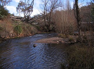
Mitta Mitta River, a perennial river and a direct tributary of the Murray River within the Murray–Darling basin, is located in the Alpine district of Victoria, Australia.

<span class="mw-page-title-main">Australian Alps</span> Bioregion in Australia

The Australian Alps is a mountain range in southeast Australia. It comprises an interim Australian bioregion, and is the highest mountain range in Australia. The range straddles the borders of eastern Victoria, southeastern New South Wales, and the Australian Capital Territory. It contains Australia's only peaks exceeding 2,000 m (6,600 ft) in elevation, and is the only bioregion on the Australian mainland in which deep snow falls annually. The range comprises an area of 1,232,981 ha.

<span class="mw-page-title-main">Kiewa River</span> River in Victoria, Australia

Kiewa River, a perennial river that is part of the Murray catchment within the Murray-Darling basin, is located in the Alpine bioregion, in the Australian state of Victoria.

<span class="mw-page-title-main">Mount Bogong</span> Mountain in Victoria, Australia

Mount Bogong,, located in the Alpine National Park and part of the Victorian Alps of the Great Dividing Range, is the highest mountain in Victoria, Australia, at 1,986 metres (6,516 ft) above sea level.

<span class="mw-page-title-main">Omeo</span> Town in Victoria, Australia

Omeo is a town in Victoria, Australia on the Great Alpine Road, east of Mount Hotham, in the Shire of East Gippsland. At the 2016 census, Omeo had a population of 406. The name is derived from an Aboriginal word for 'mountains' or 'hills'. Omeo is affectionately known as the City of the Alps with many historic buildings remaining in the town. The town is still the commercial hub for the Omeo Region and is a service centre for outlying communities such as Benambra, Cobungra, Cassilis, Swifts Creek, and Ensay.

The Gudgenby River, a perennial river that is part of the Murrumbidgee catchment within the Murray–Darling basin, is located in the Australian Capital Territory, Australia.

<span class="mw-page-title-main">Bogong High Plains</span> Mountains in Australia

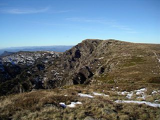
The Bogong High Plains, part of the Victorian Alps of the Great Dividing Range, are a section of plains located in the Alpine National Park in the Australian state of Victoria and are situated south of Mount Bogong.

<span class="mw-page-title-main">King River (Victoria)</span> River in Victoria (Australia)

The King River, a perennial river of the North-East Murray catchment of the Murray-Darling basin, is located in the Alpine and Hume regions of Victoria, Australia. It flows from the northwestern slopes of the Alpine National Park in the Australian Alps, through the King Valley, and joining with the Ovens River at the rural city of Wangaratta.

<span class="mw-page-title-main">Tambo River (Victoria)</span> River in Victoria, Australia

The Tambo River or Berrawan is a perennial river of the Mitchell River catchment, located in the East Gippsland region of the Australian state of Victoria. With a total length in excess of 186 kilometres (116 mi), the Tambo River is one of the longest rivers in the East Gippsland drainage basin, extending from the steep forested southern slopes of the Victorian Alps through forest and farmland to the Gippsland Lakes.

<span class="mw-page-title-main">County of Bogong</span> Cadastral in Victoria, Australia

The County of Bogong is one of the 37 counties of Victoria which are part of the cadastral divisions of Australia, used for land titles. It is located south of the Murray River, east of the Ovens River, and west of the Mitta Mitta River. Mount Bogong is located there, the highest mountain in Victoria. The county was proclaimed in 1871.

<span class="mw-page-title-main">2003 Eastern Victorian alpine bushfires</span>

The Eastern Victorian alpine bushfires were a series of bushfires in 2003 that burnt in the Alpine National Park and Mount Buffalo National Park in north-eastern Victoria, Australia. The bushfire started with eighty-seven fires that were started by lightning in the north east of Victoria on 8 January 2003. Eight of these fires were unable to be contained and joined to form the largest fire in Victoria since the 1939 "Black Friday" bushfires.

<span class="mw-page-title-main">Buckland River (Victoria)</span> River in Victoria, Australia

The Buckland River, a perennial river of the North-East Murray catchment of the Murray-Darling basin, is located in the Alpine region of Victoria, Australia. It flows from the eastern slopes of the Buffalo Range in the Australian Alps, joining with the Ovens River at Porepunkah.

<span class="mw-page-title-main">Cobungra River</span> River in Victoria, Australia

The Cobungra River, a perennial river of the North-East Murray catchment of the Murray-Darling basin, is located in the East Gippsland and Alpine regions of Victoria, Australia.

<span class="mw-page-title-main">Anglers Rest, Victoria</span> Town in Victoria, Australia

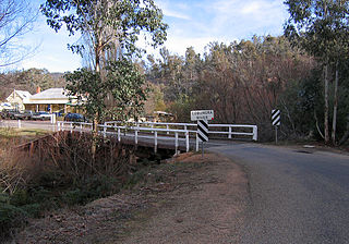
Anglers Rest is a locality in Victoria, Australia. It is on the Omeo Highway, 28.5 kilometres (17.7 mi) north of Omeo in the Shire of East Gippsland, almost totally surrounded by the Alpine National Park.

<span class="mw-page-title-main">Bundara River</span> River in Victoria, Australia

The Bundara River, a perennial river of the North-East Murray catchment of the Murray-Darling basin, is located in the East Gippsland and Alpine regions of Victoria, Australia.

The Victoria River, a perennial river of the North-East Murray catchment of the Murray-Darling basin, is located in the East Gippsland and Alpine regions of Victoria, Australia.

The Dart River, a perennial river of the North-East Murray catchment of the Murray-Darling basin, is located in the Alpine region of Victoria, Australia. It flows from the northwestern slopes of the Alpine National Park in the Australian Alps, south and joins with the Mitta Mitta River within Lake Dartmouth.

The Gibbo River, a perennial river of the North-East Murray catchment of the Murray-Darling basin, is located in the Alpine and East Gippsland regions of Victoria, Australia. It flows from the northwestern slopes of the Australian Alps, south and joins with Morass Creek southeast of Lake Dartmouth.

The Taponga River, an inland perennial river of the Goulburn Broken catchment, part of the Murray-Darling basin, is located in the lower South Eastern Highlands bioregion, Alpine and Northern Country/North Central regions of the Australian state of Victoria. It flows from the northwestern slopes of the Australian Alps, north and joins with the Big River.

References

The Big River beside the Omeo Hwy at the Bogong High Plains Rd turnoff, Shannonvale Omeo Hwy & Big River at Bogong High Plains Rd turnoff, Shannonvale, Vic, jjron, 07.11.2009.jpg
The Big River beside the Omeo Hwy at the Bogong High Plains Rd turnoff, Shannonvale
  1. 1 2 "Map of Big River, VIC". Bonzle Digital Atlas of Australia. Retrieved 22 June 2014.
  2. 1 2 3 4 5 Vicroads Country Street Directory of Victoria (4 ed.). Noble Park, Victoria: Royal Automobile Club of Victoria. 2000. ISSN   1329-5284.
  3. 1 2 "A guide to inland angling waters of Victoria: Mitta Mitta basin". Department of Primary Industries website. State Government of Victoria. 11 January 2011. Archived from the original on 17 March 2011. Retrieved 11 April 2011.
  4. "No end in sight for Victorian bushfires". The Age . 27 January 2003. Retrieved 29 December 2010.
  5. Noble, Tom (2 February 2003). "Razing Heaven". The Age . Retrieved 29 December 2010.