
The Murray River is a river in Southeastern Australia. It is Australia's longest river at 2,508 km (1,558 mi) extent. Its tributaries include five of the next six longest rivers of Australia. Together with that of the Murray, the catchments of these rivers form the Murray–Darling basin, which covers about one-seventh the area of Australia. It is widely considered Australia's most important irrigated region.

Dartmouth Dam is a large rock-fill embankment dam with an uncontrolled chute spillway across the Mitta Mitta, Gibbo, and Dart rivers, the Morass Creek and a number of small tributaries. The dam is located near Mount Bogong in the north-east of the Australian state of Victoria. The dam's purpose includes irrigation, the generation of hydro-electric power, water supply and conservation. The impounded reservoir is called Dartmouth Reservoir, sometimes called Lake Dartmouth. The Dartmouth Power Station, a hydro-electric power station that generates power to the national grid, is located near the dam wall.

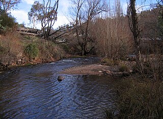
Mitta Mitta River, a perennial river and a direct tributary of the Murray River within the Murray–Darling basin, is located in the Alpine district of Victoria, Australia.

Hume Dam, formerly the Hume Weir, is a major dam across the Murray River downstream of its junction with the Mitta River in the Riverina region of New South Wales, Australia. The dam's purpose includes flood mitigation, hydro-power, irrigation, water supply and conservation. The impounded reservoir is called Lake Hume, formerly the Hume Reservoir. It is a gated concrete gravity dam with four earth embankments and twenty-nine vertical undershot gated concrete overflow spillways.

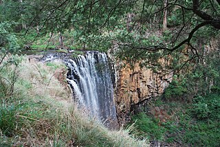
The Goulburn River, a major inland perennial river of the Goulburn Broken catchment, part of the Murray-Darling basin, is located in the Alpine, Northern Country/North Central, and Southern Riverina regions of the Australian state of Victoria. The headwaters of the Goulburn River rise in the western end of the Victorian Alps, below the peak of Corn Hill before descending to flow into the Murray River near Echuca, making it the longest river in Victoria at 654 kilometres (406 mi). The river is impounded by the Eildon Dam to create Lake Eildon, the Eildon Pondage, the Goulburn Weir and Waranga Basin.

The Avoca River, an inland intermittent river of the north–central catchment, part of the Murray-Darling basin, is located in the lower Riverina bioregion and Central Highlands and Wimmera regions of the Australian state of Victoria. The headwaters of the Avoca River rise on the northern slopes of the Pyrenees Range and descend to flow into the ephemeral Kerang Lakes.

Kiewa River, a perennial river that is part of the Murray catchment within the Murray-Darling basin, is located in the Alpine bioregion, in the Australian state of Victoria.

The Tambo River or Berrawan is a perennial river of the Mitchell River catchment, located in the East Gippsland region of the Australian state of Victoria. With a total length in excess of 186 kilometres (116 mi), the Tambo River is one of the longest rivers in the East Gippsland drainage basin, extending from the steep forested southern slopes of the Victorian Alps through forest and farmland to the Gippsland Lakes.
The Coliban River, an inland perennial river of the north–central catchment, part of the Murray-Darling basin, is located in the lower Riverina bioregion and Central Highlands region of the Australian state of Victoria. The headwaters of the Coliban River rise on the northern slopes of the Great Dividing Range and descend to flow north into the Campaspe River with the impounded Lake Eppalock.
Lake Burrumbeet is a large but shallow eutrophic lake in central western Victoria, Australia. Located 20 kilometres (12 mi) west of Ballarat and 140 kilometres (87 mi) west of Melbourne, the lake has been progressively emptying since 1997 and was declared completely dry in 2004. It has however in recent years refilled because of good rainfalls, making water sports in the lake once again possible, with recreational jet skiing and boating taking place in the winter of 2010. The lake is a major wetland for the region because of its size and is utilised as a recreational area for boating, fishing and camping.

The Mount Emu Creek, a perennial creek of the Glenelg Hopkins catchment, is located in the Western District of Victoria, Australia.

The Buckland River, a perennial river of the North-East Murray catchment of the Murray-Darling basin, is located in the Alpine region of Victoria, Australia. It flows from the eastern slopes of the Buffalo Range in the Australian Alps, joining with the Ovens River at Porepunkah.

The Howqua River, a minor inland perennial river of the Goulburn Broken catchment, part of the Murray-Darling basin, is located in the Alpine region of the Australian state of Victoria. The headwaters of the Howqua River rise below Mount Howitt in the western slopes of the Victorian Alps, and descend to flow into the Goulburn River within Lake Eildon.
The Cobungra River, a perennial river of the North-East Murray catchment of the Murray-Darling basin, is located in the East Gippsland and Alpine regions of Victoria, Australia.

The Big River, a perennial river of the North-East Murray catchment of the Murray-Darling basin, is located in the East Gippsland and Alpine regions of Victoria, Australia. It flows from the northern slopes of Falls Creek in the Australian Alps, joining with the Cobungra River near Anglers Rest to form the Mitta Mitta River.

The Bundara River, a perennial river of the North-East Murray catchment of the Murray-Darling basin, is located in the East Gippsland and Alpine regions of Victoria, Australia.

The Dandongadale River, a perennial river of the North-East Murray catchment of the Murray-Darling basin, is located in the Alpine region of Victoria, Australia. It flows from the northern slopes of the Alpine National Park in the Australian Alps, joining with the Buffalo River in remote national park territory.
The Gibbo River, a perennial river of the North-East Murray catchment of the Murray-Darling basin, is located in the Alpine and East Gippsland regions of Victoria, Australia. It flows from the northwestern slopes of the Australian Alps, south and joins with Morass Creek southeast of Lake Dartmouth.
The Taponga River, an inland perennial river of the Goulburn Broken catchment, part of the Murray-Darling basin, is located in the lower South Eastern Highlands bioregion, Alpine and Northern Country/North Central regions of the Australian state of Victoria. It flows from the northwestern slopes of the Australian Alps, north and joins with the Big River.
The Royston River, an inland perennial river of the Goulburn Broken catchment, part of the Murray-Darling basin, is located in the lower South Eastern Highlands bioregion and Northern Country/North Central regions of the Australian state of Victoria. The headwaters of the Royston River rise on the western slopes of the Victorian Alps and descend to flow into the Rubicon River.
