Goulburn River

Last updated

Goulburn
Golburn-at-Seymour.jpg
Middle reaches of the Goulburn, near Seymour
Map of the Goulburn River.svg
Course of the Goulburn River
and the major irrigation channel diverted from the river in Victoria
EtymologyIn honour of Major Frederick Goulburn, the Colonial Secretary of New South Wales [1]
Native name
Location
Country Australia
State Victoria
Region Alpine and Riverine bioregions (IBRA), Victorian Alps, Northern Country/North Central, Southern Riverina
Local government areas Mansfield, Murrindindi, Mitchell, Strathbogie, Greater Shepparton, Campaspe
Towns and cities Alexandra, Seymour, Nagambie, Murchison, SheppartonMooroopna, Echuca
Physical characteristics
SourceCorn Hill, Victorian Alps, Great Dividing Range
  locationnear Woods Point
  coordinates 37°32′13″S146°11′22″E / 37.53694°S 146.18944°E / -37.53694; 146.18944
  elevation1,210 m (3,970 ft)
Mouth confluence with the Murray River
  location
near Echuca
  coordinates
36°6′11″S144°49′47″E / 36.10306°S 144.82972°E / -36.10306; 144.82972 Coordinates: 36°6′11″S144°49′47″E / 36.10306°S 144.82972°E / -36.10306; 144.82972
  elevation
100 m (330 ft)
Length654 km (406 mi)
Basin size23,916 km2 (9,234 sq mi)
Discharge 
  average84 m3/s (3,000 cu ft/s)
Basin features
River system Goulburn Broken catchment,
Murray-Darling basin
Tributaries 
  left Big River, Rubicon River, Acheron River, Yea River, Sunday Creek (Victoria)
  right Jamieson River, Howqua River, Delatite River, Seven Creeks, Broken River
National parks Lower Goulburn National Park
[8]

The Goulburn River, a major inland perennial river of the Goulburn Broken catchment, part of the Murray-Darling basin, is located in the Alpine, Northern Country/North Central, and Southern Riverina regions of the Australian state of Victoria. The headwaters of the Goulburn River rise in the western end of the Victorian Alps, below the peak of Corn Hill before descending to flow into the Murray River near Echuca, making it the longest river in Victoria at 654 kilometres (406 mi). [9] The river is impounded by the Eildon Dam to create Lake Eildon, the Eildon Pondage, the Goulburn Weir and Waranga Basin.

Contents

Location and features

Goulburn River near its source at Woods Point, 2012 Woods Point Goulburn River 001.JPG
Goulburn River near its source at Woods Point, 2012

The river rises below Corn Hill on the southwestern slopes of the Victorian Alps, south of Eildon near the town of Woods Point in the Shire of Mansfield. The river flows generally north, then west, then north, then west passing through or adjacent to the regional cities and towns of Alexandra, Seymour, Nagambie, Murchison, Arcadia Downs, Shepparton Mooroopna before reaching its confluence with the Murray River near Echuca. The Goulburn has 41 tributaries including the Black, Jamieson, Howqua, Delatite, Big, Rubicon, Acheron, Yea, and Broken rivers and the Seven Creeks. The river descends 1,100 metres (3,600 ft) over its 654-kilometre (406 mi) course. [8]

In addition to being the longest river in Victoria, the Goulburn also has the highest discharge and the highest annual flow of any river in Victoria. The area surrounding the river is very productive as a result of irrigated agriculture. [10] The Goulburn (Along with the Upper Murray and Murrumbidgee rivers) accounts for 45% of the Murray-Darling Basin's total runoff. By contrast, the Darling basin contributes just 31.7% of the basin's total runoff. [11]

River quality

Much of the flow is extracted, and the river is very heavily regulated, which has strongly affected the river's ecosystem. With recent years[ when? ] being some of the driest on record in the basin, there has been even further stress on the river's ecosystem. Because of all this[ clarification needed ] there has been much controversy over the construction of the North–South Pipeline, which will pipe 70 gigalitres (15×10^9 imp gal; 18×10^9 US gal) of water annually to Melbourne's water supply. There are arguments[ which? ] that all the water piped to Melbourne will be saved water, by the upgrade of the irrigation infrastructure in the Goulburn river basin all a part of a food bowl modernisation project.[ citation needed ] In June 2008 the Murray-Darling Basin Commission released a report on the condition of the Murray-Darling basin, with the Goulburn and Murrumbidgee rivers both rated in a very poor condition in the Murray-Darling basin with fish stocks in both rivers were also rated as extremely poor. [12]

Recreation

The lower course of the Goulburn River at Murchison, 2009 MurchisonGoulburnRiver.JPG
The lower course of the Goulburn River at Murchison, 2009

The Goulburn Heritage River was declared in 1992 in recognition of its unique natural, recreational, scenic and cultural values. In June 2010, the Victorian Government created the Lower Goulburn National Park to protect and enhance the River Red Gum forests in Victoria. Red River Gum forests line the Goulburn River for most of its length, reaching up to 45 metres (148 ft) in height and live more than 500 years. The trees need periods of flooding and can survive inundation for months. Their seeds are washed onto higher ground during a flood and germinate and grow before the next flood reaches them. Hollows and broken branches provide nesting for galahs, cockatoos, cockatiels and various parrots, while fallen branches provide habitat for other animals. [13]

Additional activities on the river include canoeing, sightseeing and picnicking, swimming, and fishing, with Murray Cod, Golden Perch and Spiny freshwater crayfish found in the lower reaches of the river. [13] In the upper reaches, there are extensive forests of very tall mountain ash and mixed species and may be described as typical trout streams. [14]

Etymology

In the Aboriginal Taungurung language, the river has several names: Warring, meaning "big or large water"; [2] Bayyango, where Thomas Mitchell noted that this word appeared to be a generic word for river, [7] and (also in the Ngurai-illam Wurrung dialect/language) Omio with no clearly defined meaning. [6] In the Yorta Yorta language, the river has several names: Koninner, meaning "the country at the junction of the Murray and Goulburn rivers; [3] Gungupna, with gupna meaning "deep waterholes"; [4] and Gaiyila, meaning "father of waters". [5]

Hamilton Hume and William Hovell explored the area in 1824, naming the Goulburn River in honour of Major Frederick Goulburn, the first Colonial Secretary of New South Wales. [1]

See also

Related Research Articles

<span class="mw-page-title-main">Murray River</span> Longest river in Australia

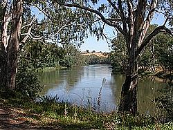
The Murray River is a river in Southeastern Australia. It is Australia's longest river at 2,508 km (1,558 mi) extent. Its tributaries include five of the next six longest rivers of Australia. Together with that of the Murray, the catchments of these rivers form the Murray–Darling basin, which covers about one-seventh the area of Australia. It is widely considered Australia's most important irrigated region.

<span class="mw-page-title-main">Echuca</span> Town in Victoria, Australia

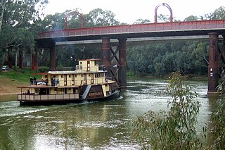
Echuca is a town on the banks of the Murray River and Campaspe River in Victoria, Australia. The border town of Moama is adjacent on the northern side of the Murray River in New South Wales. Echuca is the administrative centre and largest settlement in the Shire of Campaspe. As of the 2021 census, Echuca had a population of 15,056, and the population of the combined Echuca and Moama townships was 22,568.

<span class="mw-page-title-main">Murrumbidgee River</span> Major river in southeastern Australia

The Murrumbidgee River is a major tributary of the Murray River within the Murray–Darling basin and the second longest river in Australia. It flows through the Australian state of New South Wales and the Australian Capital Territory, descending 1,500 metres (4,900 ft) over 1,485 kilometres (923 mi), generally in a west-northwesterly direction from the foot of Peppercorn Hill in the Fiery Range of the Snowy Mountains towards its confluence with the Murray River near Boundary Bend.

<span class="mw-page-title-main">Murray–Darling basin</span> Largest Australian river catchment

The Murray–Darling basin is a large geographical area in the interior of southeastern Australia, encompassing the drainage basin of the tributaries of the Murray River, Australia's longest river, and the Darling River, a right tributary of the Murray and Australia's third-longest river. The basin, which includes six of Australia's seven longest rivers and covers around one-seventh of the Australian landmass, is one of the country's most significant agricultural areas providing one-third of Australia's food supply. Located west of the Great Dividing Range, it drains southwestly into the Great Australian Bight and spans most of the states of New South Wales and Victoria, the Australian Capital Territory, and parts of the states of Queensland and South Australia.

<span class="mw-page-title-main">Eildon Dam</span> Dam in Victorian Alps, Victoria

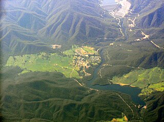
The Eildon Dam is a rock and earth-fill embankment dam with a controlled spillway across the Goulburn River, is located between the regional towns of Mansfield and Eildon within Lake Eildon National Park, in the Alpine region of Victoria, Australia. The dam's purpose is for the supply of potable water, irrigation, and the generation of hydroelectricity. The impounded reservoir is called Lake Eildon.

<span class="mw-page-title-main">Avoca River</span> River in Victoria, Australia

The Avoca River, an inland intermittent river of the north–central catchment, part of the Murray-Darling basin, is located in the lower Riverina bioregion and Central Highlands and Wimmera regions of the Australian state of Victoria. The headwaters of the Avoca River rise on the northern slopes of the Pyrenees Range and descend to flow into the ephemeral Kerang Lakes.

The Waranga Dam is a major earthfill embankment dam with an uncontrolled spillway located approximately 150 kilometres (93 mi) north of Melbourne in the North Central region of the Australian state of Victoria. The impounded off-stream reservoir is Waranga Basin and forms part of the Goulburn River irrigation system, irrigating an area of 626 square kilometres (242 sq mi). The dam and reservoir are located in Shire of Campaspe near the City of Greater Shepparton and is located 8 kilometres (5.0 mi) northeast of Rushworth, 12 kilometres (7.5 mi) southwest of Tatura, and near Murchison. When full, the reservoir covers an area of 58.5 square kilometres (22.6 sq mi).

<span class="mw-page-title-main">Goulburn Valley</span>

The Goulburn Valley is a sub-region, part of the Hume region of the Australian state of Victoria. The sub-region consists of those areas in the catchment of the Goulburn River and other nearby streams, and is part of the Murray-Darling Basin. The Goulburn Valley is bordered on the south by the Great Dividing Range and to the north by the Murray River, the state border with New South Wales. The sub-region is one of Australia's most productive and intensively farmed areas and is predominantly irrigated.

<span class="mw-page-title-main">Broken River (Victoria)</span> River in Victoria, Australia

The Broken River, a minor inland perennial river of the Goulburn Broken catchment, part of the Murray–Darling basin, is located in the Alpine and Northern Country/North Central regions of the Australian state of Victoria. The headwaters of the Broken River rise in the western slopes of the Victorian Alps, near Bald Hill and descend to flow into the Goulburn River near Shepparton. The river is impounded by the Nillahcootie Dam to create Lake Nillahcootie and Benalla Dam to create Lake Benalla.

<span class="mw-page-title-main">King River (Victoria)</span> River in Victoria (Australia)

The King River, a perennial river of the North-East Murray catchment of the Murray-Darling basin, is located in the Alpine and Hume regions of Victoria, Australia. It flows from the northwestern slopes of the Alpine National Park in the Australian Alps, through the King Valley, and joining with the Ovens River at the rural city of Wangaratta.

<span class="mw-page-title-main">Delatite River</span> River in Victoria, Australia

The Delatite River, an inland perennial river of the Goulburn Broken catchment, part of the Murray-Darling basin, is located in the lower South Eastern Highlands bioregion and Northern Country/North Central regions of the Australian state of Victoria. The headwaters of the Delatite River rise on the western slopes of the Victorian Alps and descend to flow into the Goulburn River within Lake Eildon.

<span class="mw-page-title-main">Yorta Yorta</span> Aboriginal Australian people of north-eastern Victoria and southern New South Wales

The Yorta Yorta, also known as Jotijota, are an Aboriginal Australian people who have traditionally inhabited the area surrounding the junction of the Goulburn and Murray Rivers in present-day north-eastern Victoria and southern New South Wales.

<span class="mw-page-title-main">Irrigation in Australia</span>

Irrigation is a widespread practice required in many areas of Australia, the driest inhabited continent, to supplement low rainfall with water from other sources to assist in growing crops and pasture. Overuse or poor management of irrigation is held responsible by some for environmental problems such as soil salinity and loss of habitat for native flora and fauna.

The Murray–Darling Basin Authority (MDBA) is the principal government agency in charge of managing the Murray–Darling basin in an integrated and sustainable manner. The MDBA is an independent statutory agency that manages, in conjunction with the Basin states, the Murray–Darling basin's water resources in the national interest. The MDBA reports to the Australian Government Minister for the Environment and Water, held since June 2022 by the Hon Tanya Plibersek.

<span class="mw-page-title-main">North–South Pipeline</span> Australian water pipeline near Melbourne

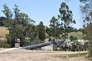
The North–South Pipeline, also known as the Sugarloaf Pipeline, is a water pipeline in Central Victoria, Australia, northeast of Melbourne that is part of Victoria's water system, acting as a link between Melbourne's water grid and the Murray-Goulburn water grid, supplying water via a series of existing and proposed pipelines. The 70-kilometre pipeline was connected to Melbourne in February 2010 to carry water from the Goulburn River to Melbourne's Sugarloaf Reservoir. It is the government's policy that it only be used in times of critical human need: when Melbourne's total water storages are less than 30% full on 30 November of any year. The pipeline can transfer a portion of Lake Eildon's water that is set aside for Melbourne, called the critical water reserve. This was 38,400 megalitres at 2 June 2014, and any changes are based on Goulburn-Murray Water's advice.

<span class="mw-page-title-main">Barmah National Park</span> Protected area in Victoria, Australia

The Barmah National Park, formerly Barmah State Park, is a national park located in the Hume region of the Australian state of Victoria. The park is located adjacent to the Murray River near the town of Barmah, approximately 225 kilometres (140 mi) north of Melbourne. The park consists of river red gum floodplain forest, interspersed with treeless freshwater marshes. The area is subject to seasonal flooding from natural and irrigation water flows.

<span class="mw-page-title-main">Howqua River</span> River in Victoria, Australia

The Howqua River, a minor inland perennial river of the Goulburn Broken catchment, part of the Murray-Darling basin, is located in the Alpine region of the Australian state of Victoria. The headwaters of the Howqua River rise below Mount Howitt in the western slopes of the Victorian Alps, and descend to flow into the Goulburn River within Lake Eildon.

The Taponga River, an inland perennial river of the Goulburn Broken catchment, part of the Murray-Darling basin, is located in the lower South Eastern Highlands bioregion, Alpine and Northern Country/North Central regions of the Australian state of Victoria. It flows from the northwestern slopes of the Australian Alps, north and joins with the Big River.

<span class="mw-page-title-main">Murrindindi River</span> River in Victoria, Australia

The Murrindindi River, an inland perennial river of the Goulburn Broken catchment, part of the Murray-Darling basin, is located in the lower South Eastern Highlands bioregion and Northern Country/North Central regions of the Australian state of Victoria. The headwaters of the Murrindindi River rise on the western slopes of the Victorian Alps and descend to flow into the Yea River.

<span class="mw-page-title-main">Campaspe River</span> River in Victoria, Australia

The Campaspe River, an inland intermittent river of the north–central catchment, part of the Murray-Darling basin, is located in the lower Riverina bioregion and Central Highlands and Wimmera regions of the Australian state of Victoria. The headwaters of the Campaspe River rise on the northern slopes of the Great Dividing Range and descend to flow north into the Murray River, Australia's longest river, near Echuca.

References

  1. 1 2 "Goulburn River: 2003: Historical Information". Vicnames. 12 August 2011. Archived from the original on 14 July 2014. Retrieved 13 July 2014.
  2. 1 2 "Goulburn River: 3776: Historical Information: Warring". 12 August 2011. Archived from the original on 14 July 2014. Retrieved 13 July 2014.
  3. 1 2 "Goulburn River: 3771: Historical Information: Koninner". 12 August 2011. Archived from the original on 14 July 2014. Retrieved 13 July 2014.
  4. 1 2 "Goulburn River: 3774: Historical Information: Gungupna". 12 August 2011. Archived from the original on 14 July 2014. Retrieved 13 July 2014.
  5. 1 2 "Goulburn River: 3773: Historical Information: Gaiyila". 12 August 2011. Archived from the original on 14 July 2014. Retrieved 13 July 2014.
  6. 1 2 "Goulburn River: 3775: Historical Information: Omio". 12 August 2011. Archived from the original on 14 July 2014. Retrieved 13 July 2014.
  7. 1 2 "Goulburn River: 3772: Historical Information: Bayyango". 12 August 2011. Archived from the original on 14 July 2014. Retrieved 13 July 2014.
  8. 1 2 "Map of Goulburn River". Bonzle Digital Atlas of Australia. Retrieved 22 June 2014.
  9. "Goulburn River". Environment Victoria. Victorian Government . Retrieved 13 July 2014.
  10. "Food Production in the Goulburn Murray Irrigation District". Archived from the original on 3 September 2011. Retrieved 28 September 2011.
  11. "Surface water in the Basin | Murray-Darling Basin Authority". Archived from the original on 11 February 2015. Retrieved 11 February 2015.
  12. Sustainable Rivers Audit (PDF). Murray-Darling Basin Commission. June 2008. pp. 14, 30. Archived from the original (PDF) on 19 July 2008. Retrieved 21 June 2008.
  13. 1 2 "Lower Goulburn National Park: Visitor notes" (PDF). Parks Victoria (PDF). Victorian Government. June 2013. Retrieved 13 July 2014.
  14. "Fishing guides: Goulburn". Department of Environment and Primary Industries . Victorian Government. 28 January 2014. Archived from the original on 19 June 2014. Retrieved 13 July 2014.