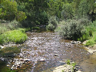
The Suggan Buggan River is a perennial river of the Snowy River catchment, located in the Alpine region of the Australian state of Victoria.
The Bendoc River is a perennial river of the Snowy River catchment, located in the Alpine regions of the states of Victoria and New South Wales, Australia.
The Delegate River is a perennial river of the Snowy River catchment, located in the Alpine regions of the states of Victoria and New South Wales, Australia.
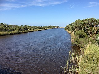
Genoa River is a perennial river located in the Monaro region of New South Wales and flows into the East Gippsland region of Victoria in Australia. It used to be known as Bondi Creek or Yard Creek. The river's name derives from the First People "jinoor" ("footpath").

The Wallagaraugh River is a perennial river of the Genoa River catchment, with its headwaters located in the South Coast region of New South Wales and its lower reaches located in the East Gippsland region of Victoria, Australia.
The Brodribb River is a perennial river of the Snowy River catchment, located in the East Gippsland region of the Australian state of Victoria.
The Little River is a perennial river of the Snowy River catchment, located in the Alpine region of the Australian state of Victoria. It is one of two rivers of the same name that are tributaries of the Snowy River, the other being the Little River.

The Moroka River is a perennial river of the Mitchell River catchment, located in the Alpine region of the Australian state of Victoria.
The Queensborough River is a perennial river of the Snowy River catchment, located in the Alpine regions of the Australian states of Victoria and New South Wales.
The Deddick River is a perennial river of the Snowy River catchment, located in the Alpine region of the Australian state of Victoria.

The Bonang River is a perennial river of the Snowy River catchment, located in the Alpine region of the Australian state of Victoria.

The Buchan River is a perennial river of the Snowy River catchment, located in the Alpine region of the Australian state of Victoria.
The Rodger River is a perennial river of the Snowy River catchment, located in the Alpine region of the Australian state of Victoria.
The Yalmy River is a perennial river of the Snowy River catchment, located in the Alpine region of the Australian state of Victoria.
The Little Yalmy River is a perennial river of the Snowy River catchment, located in the Alpine region of the Australian state of Victoria.
The Big River is a perennial river of the Snowy River catchment, located in the East Gippsland region of the Australian state of Victoria.
The Saint Patricks River is a perennial river of the Snowy River catchment, located in the East Gippsland region of the Australian state of Victoria.
The Rich River is a perennial river of the Snowy River catchment, located in the East Gippsland region of the Australian state of Victoria.

The Berrima River, also called the Berrima Creek, is a perennial river of the Snowy River catchment, located in the Alpine region of the Australian states of New South Wales and Victoria.
The Murrindal River is a perennial river of the Snowy River catchment, located in the East Gippsland region of the Australian state of Victoria.

