
The Mitchell River is a perennial river of the East Gippsland catchment, located in the Australian state of Victoria. The unregulated river provides a unique example of riparian ecology, flowing generally south with the catchment area drawing from the steep mountains of the Victorian Alps to enter Lake King, one of the Gippsland Lakes, and then empty into the Bass Strait.
Deen Maar Indigenous Protected Area is an Indigenous Protected Area (IPA) located in south-west Victoria, Australia on land bounded by the Eumeralla River and Bass Strait. The IPA has an area of 4.53 square kilometres. The country consists of limestone ridges, wetlands, lakes and sand dunes. It is the traditional home of the Peek Whurrong speakers of the Dhauwurdwurung (Gunditjmara) Nation. The IPA takes its name from Deen Maar Island, which lies a short distance off the coast. It is classified as an IUCN Category VI protected area. It is within the boundaries of the Yambuk Important Bird Area, identified as such by BirdLife International because of its importance for the conservation of threatened species such as the orange-bellied parrot and hooded plover.

Discovery Bay is an open oceanic embayment lying along the coast of eastern South Australia and western Victoria in south-eastern Australia.

The Hopkins River, a perennial river of the Glenelg Hopkins catchment, is located in the Western District of Victoria, Australia.

The Glenelg River, a perennial river of the Glenelg Hopkins catchment, is located in the Australian states of Victoria and South Australia.
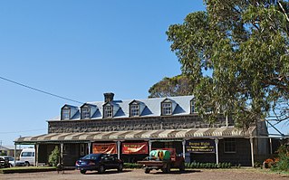
Yambuk is a town in Victoria, Australia.

The Wannon River, a perennial river of the Glenelg Hopkins catchment, is located in the Western District of Victoria, Australia.
The Fitzroy River, a perennial river of the Glenelg Hopkins catchment, is located in the Western District of Victoria, Australia.
The Merri River, a perennial river of the Glenelg Hopkins catchment, is located in the Western District of Victoria, Australia.
The Surry River, sometimes incorrectly spelled as the Surrey River, a perennial river of the Glenelg Hopkins catchment, is located in the Western District of Victoria, Australia.
The Eumeralla River is a perennial river of the Glenelg Hopkins catchment, located in the Western District of Victoria, Australia.
The Calder River is a perennial river of the Corangamite catchment, located in The Otways region of the Australian state of Victoria.
The Perry River is a perennial river of the West Gippsland catchment, located in the Gippsland region of the Australian state of Victoria.

The Yambuk Important Bird Area comprises a 10 km2 tract of coastal land fronting Bass Strait in south-western Victoria, south-eastern Australia. It lies some 20 km west of the town of Port Fairy and encompasses the lower reaches of the Eumeralla River and Lake Yambuk.
The Crawford River or Smoky River, a perennial river of the Glenelg Hopkins catchment, is located in the Western District of Victoria, Australia.
The Wando River, a perennial river of the Glenelg Hopkins catchment, is located in the Western District of Victoria, Australia.
The Chetwynd River, a perennial river of the Glenelg Hopkins catchment, is located in the Western District of Victoria, Australia.
The Stokes River, a perennial river of the Glenelg Hopkins catchment, is located in the Western District of Victoria, Australia.
The Eumeralla Wars were the violent encounters over the possession of land between British colonists and Gunditjmara Aboriginal people in what is now called the Western District area of south west Victoria.
The Eastern Maar people are a group of Aboriginal Australian peoples whose traditional lands are in the south-western part of state of Victoria, Australia. It is a name adopted by a number of Aboriginal Victorian groups who identify as Maar, including Eastern Gunditjmara, Tjap Wurrung, Peek Whurrong, Kirrae Whurrung, Kuurn Kopan Noot and/or Yarro waetch people.The word "Maar" means "the people".
