
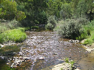
The Avon River is a perennial river of the West Gippsland catchment, located in the West Gippsland region, of the Australian state of Victoria. The Avon, forms an important part of the Latrobe sub-catchment, draining the south eastern slopes of the Great Dividing Range, to form the Gippsland Lakes.

The Bemm River is a perennial river, located in the East Gippsland region of the Australian state of Victoria.
The Cann River is a perennial river located in the East Gippsland region of the Australian state of Victoria.
The Suggan Buggan River is a perennial river of the Snowy River catchment, located in the Alpine region of the Australian state of Victoria.
The Timbarra River is a perennial river of the Mitchell River catchment, located in the East Gippsland region of the Australian state of Victoria.
The Delegate River is a perennial river of the Snowy River catchment, located in the Alpine regions of the states of Victoria and New South Wales, Australia.
Genoa River is a perennial river located in the Monaro region of New South Wales and flows into the East Gippsland region of Victoria in Australia. It used to be known as Bondi Creek or Yard Creek. The river's name derives from the First People "jinoor" ("footpath").

The Ingeegoodbee River is a perennial river of the Snowy River catchment, located in the Alpine regions of the states of New South Wales and Victoria, Australia.
The Hartland River is a perennial river of the East Gippsland catchment, located in the Australian state of Victoria.
The Yeerung River is a perennial river located in the East Gippsland region of the Australian state of Victoria.
The Little River is a perennial river of the Bemm River catchment, located in the East Gippsland region of the Australian state of Victoria.
The Mueller River is a perennial river with no defined major catchment, located in the East Gippsland region of the Australian state of Victoria.
The Red River is a perennial river with no defined major catchment, located in the East Gippsland region of the Australian state of Victoria.

The Betka River is a perennial river with no defined major catchment, located in the East Gippsland region of the Australian state of Victoria.
The Wentworth River is a perennial river of the Mitchell River catchment, located in the East Gippsland region of the Australian state of Victoria.
The Little River is a perennial river of the Snowy River catchment, located in the Alpine region of the Australian state of Victoria. It is one of two rivers of the same name that are tributaries of the Snowy River, the other being the Little River.

Seaspray is a small coastal town in Victoria, Australia, in the Gippsland region of the state. The town is located alongside the Ninety Mile Beach about 10 kilometres (6.2 mi) off the South Gippsland Highway in the Shire of Wellington, 242 kilometres (150 mi) east of the state capital, Melbourne.
The Teal Creek, formerly known as Little River, is a perennial stream of the Genoa River catchment, located in the East Gippsland region of the Australian state of Victoria.
The Jack River is a perennial river of the Snowy River catchment, located in the East Gippsland region of the Australian state of Victoria.
Swamp Creek is a perennial stream of the Mitchell River catchment, located in the Alpine and East Gippsland regions of the Australian state of Victoria.

