
The Avoca River, an inland intermittent river of the north–central catchment, part of the Murray-Darling basin, is located in the lower Riverina bioregion and Central Highlands and Wimmera regions of the Australian state of Victoria. The headwaters of the Avoca River rise on the northern slopes of the Pyrenees Range and descend to flow into the ephemeral Kerang Lakes.
Hamilton Highway is a rural highway in western Victoria, Australia, linking Geelong and the town of Hamilton, through the localities of Inverleigh, Cressy, Lismore, Derrinallum, Darlington, Mortlake, and Penshurst. Glenelg Highway links Hamilton across the South Australian border to Mount Gambier, making Hamilton Highway a popular alternative Melbourne-Mount Gambier route.
Lake Corangamite, a hypersaline endorheic lake, is located near Colac in the Lakes and Craters region of the Victorian Volcanic Plains of south-west Victoria, Australia. The lake's salinity levels have increased dramatically as the lake level has dropped in recent decades. It is Australia's largest permanent saline lake, covering approximately 230 square kilometres (89 sq mi) with a circumference of 150 kilometres (93 mi). It forms part of the Ramsar-listed Western District Lakes wetland site. The indigenous name of the lake is recorded as Kronimite.

The Lang Lang River is a perennial river of the Western Port catchment, located in the West Gippsland region of the Australian state of Victoria.
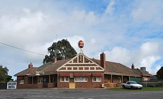
Cape Clear is a small town located in Victoria, Australia. Cape Clear has a hotel and a general store. The town is close to the Woady Yaloak River. The area was once vibrant during the gold rush in the 19th century with the area swamping to 25,000 people during the height of the gold rush with the local population being lower than 1,000. Cape Clear Post Office opened on 17 April 1865. and still ran and owned by the same family. It is now largely dependent on farming.

Cressy is a town in Victoria, Australia, approximately 38 kilometres (24 mi) north of Colac on the Ballarat road. It is divided between Golden Plains Shire, the Shire of Colac Otway, and Corangamite Shire. At the 2016 census, Cressy and the surrounding area had a population of 175.

The County of Grenville is one of the 37 counties of Victoria which are part of the cadastral divisions of Australia, used for land titles. It is located to the north-east of Lake Corangamite and includes Cressy. Ballarat is on its north-eastern edge. The boundary to the east is the Yarrowee River, and to the south part of the Barwon River. Colac is on its southern edge. The county was proclaimed in 1849.

Lake Connewarre, a shallow estuarine 880-hectare (2,200-acre) lake on the Barwon River, is located on the Bellarine Peninsula southeast of Geelong in the Australian state of Victoria.

Rokewood is a small rural township in Victoria, Australia in the Golden Plains Shire, 133 kilometres (83 mi) west of the state capital, Melbourne. At the 2016 census, Rokewood and the surrounding area had a population of 217.

The Parker River is a perennial river of the Corangamite catchment, located in the Otways region of the Australian state of Victoria.
The Ford River is a perennial river of the Corangamite catchment, located in the Otways region of the Australian state of Victoria.
The Calder River is a perennial river of the Corangamite catchment, located in the Otways region of the Australian state of Victoria.
The Geary River is a perennial river of the Corangamite catchment, located in the Otways region of the Australian state of Victoria.

The Barham River is a perennial river of the Corangamite catchment, located in the Otways region of the Australian state of Victoria.

The Wye River is a perennial river of the Corangamite catchment, located in the Otways region of the Australian state of Victoria.

The Anglesea River is a perennial river of the Corangamite catchment, located in the Otways region of the Australian state of Victoria.
Scarsdale is a small town in rural Victoria, Australia, and approximately 25 km south west of Ballarat. It is situated in the north-western part of Golden Plains Shire, on the bank of the Woady Yaloak River and is primarily an agricultural community. Scarsdale township includes a few community facilities including a primary school, a kindergarten, a general store, Town Hall, Post Office, the Scarsdale Community Park and The Scarsdale Hotel. The township is built along the Glenelg Highway, and the highway is the main route to Ballarat.
Thomas Ulick Burke (1826–1867) was a well-known figure in gold-rush Victoria, Australia, famous as the victim of the "Break O' Day" aka "Scarsdale" aka "Piggoreet" murder.

The Leigh River is a perennial river of the Corangamite catchment, located in the Central Highlands region of the Australian state of Victoria.
Lake Martin, a shallow 2,200-hectare (5,400-acre) Freshwater lake on the Woady Yaloak River, is located in the Western District Lakes region of southwest Victoria, in Australian. The lake is situated adjacent to, and upstream from, the hypersaline Lake Corangamite. It is a shallow lake with a depth of less than 5 metres.

