
The Latrobe Valley is an inland geographical district and urban area of the Gippsland region in the state of Victoria, Australia. The traditional owners are the Brayakaulung of the Gunai nation. The district lies east of Melbourne and nestled between the Strzelecki Ranges to the south and the Baw Baw Ranges, part of the Great Dividing Range, to the north. Mount St Phillack is the highest peak to the north of the Latrobe Valley, due north of Moe. The highest peak to the south is Mt Tassie, south of Traralgon.
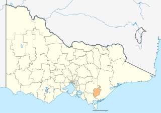
The City of Latrobe is a local government area in the Gippsland region in eastern Victoria, Australia, located in the eastern part of the state. It covers an area of 1,426 square kilometres (551 sq mi) and in June 2018 had a population of 75,211. It is primarily urban with the vast majority of its population living within the four major urban areas of Moe, Morwell, Traralgon, and Churchill, and other significant settlements in the LGA include Boolarra, Callignee, Glengarry, Jeeralang, Newborough, Toongabbie, Tyers, Yallourn North and Yinnar. It was formed in 1994 from the amalgamation of the City of Moe, City of Morwell, City of Traralgon, Shire of Traralgon, and parts of the Shire of Narracan and Shire of Rosedale. The Yallourn Works Area was added in 1996. When formed, the municipality was called the Shire of La Trobe, but on 6 April 2000, it adopted its current name.

The Yallourn Power Station, now owned by EnergyAustralia a wholly owned subsidiary of the Hong-Kong-based CLP Group, is located in the Latrobe Valley of Victoria, Australia, beside the Latrobe River, with the company town of Yallourn located to the south west. Yallourn PS was a complex of six brown coal–fired thermal power stations built progressively from the 1920s to the 1960s; all except one have now been decommissioned. Today, only the 1,450 megawatts (1,940,000 hp) Yallourn W plant remains. It is the second largest power station in Victoria, supplying 22% of Victoria's electricity and 8% of the National Electricity Market. The adjacent open cut brown coal mine is the largest open cut coal mine in Australia, with reserves sufficient to meet the projected needs of the power station to 2028. On 10 March 2021, EnergyAustralia announced that it will close the Yallourn Power Station in mid-2028, four years ahead of schedule, and instead build a 350 megawatt battery in the Latrobe Valley by the end of 2026. At the time, Yallourn produced about 20% of Victoria's electricity.

The Gippsland line is a railway line serving the Latrobe Valley and Gippsland regions of Victoria, Australia. It runs east from the state capital Melbourne through the cities of Moe, Morwell, Traralgon, Sale and terminating at Bairnsdale.

The Thomson River, a perennial river of the West Gippsland catchment, is located in the Gippsland region of the Australian state of Victoria.

The Latrobe River is a perennial river of the West Gippsland catchment, located in the West Gippsland region of the Australian state of Victoria. The Latrobe River and its associated sub-catchment is an important source for the Gippsland Lakes, draining the south eastern slopes of the Great Dividing Range.

Yallourn North is a town in the City of Latrobe, Victoria, Australia. It is approximately eight kilometres north-east of Moe, and 146 kilometres south-east of Melbourne. Prior to 1947 Yallourn North was known as "Brown Coal Mine".

The Yallourn 900 mm railway was a 900 mm narrow gauge railway operated by the State Electricity Commission of Victoria in the Latrobe Valley of Victoria, Australia. The railway was built for the haulage of brown coal and overburden between the Yallourn open cut mine, briquette works, and power station. The Morwell Interconnecting Railway (ICR) was later constructed, linking the Yallourn mine complex with the Hazelwood open cut, briquette works, and power station.
Two different railway lines serviced Yallourn during its existence. Both were broad gauge branches from the main Gippsland line in Victoria, Australia. The first was a line branching from a junction at Hernes Oak, situated between Moe and Morwell, which was in service from 1922 to 1955. The second Yallourn railway line junctioned at Moe, and was used between 1953 and 1986.
The Perry River is a perennial river of the West Gippsland catchment, located in the Gippsland region of the Australian state of Victoria.
The Jordan River, a perennial river of the West Gippsland catchment, is located in the Alpine region of the Australian state of Victoria.
The Ada River is a perennial river of the West Gippsland catchment, located in the West Gippsland region of the Australian state of Victoria.
The Turton River is a perennial river of the West Gippsland catchment, located in the Gippsland region of the Australian state of Victoria.

The Aberfeldy River is a perennial river of the West Gippsland catchment, located in the Alpine region of the Australian state of Victoria.
The Caledonia River is a perennial river of the West Gippsland catchment, located in the Alpine region of the Australian state of Victoria.
The Toorongo River is a perennial river of the West Gippsland catchment, located in the West Gippsland region of the Australian state of Victoria.
The Loch River is a perennial river of the West Gippsland catchment, located in the West Gippsland region of the Australian state of Victoria.
The Tanjil River is a perennial river of the West Gippsland catchment, located in the West Gippsland region of the Australian state of Victoria.
The Tyers River is a perennial river of the West Gippsland catchment, located in the West Gippsland region of the Australian state of Victoria.
The Barkly River, a perennial river of the West Gippsland catchment, is located in the Alpine region of the Australian state of Victoria.

