Related Research Articles

Banksia serrata, commonly known as the saw banksia, the old man banksia, the saw-tooth banksia or the red honeysuckle and as wiriyagan by the Cadigal people, is a species of woody shrub or tree of the genus Banksia, in the family Proteaceae. Native to the east coast of Australia, it is found from Queensland to Victoria with outlying populations on Tasmania and Flinders Island. Commonly growing as a gnarled tree up to 16 m (50 ft) in height, it can be much smaller in more exposed areas. This Banksia species has wrinkled grey bark, shiny dark green serrated leaves and large yellow or greyish-yellow flower spikes appearing over summer. The flower spikes, or inflorescences, turn grey as they age and pollinated flowers develop into large, grey, woody seed pods called follicles.

Banksia attenuata, commonly known as the candlestick banksia, slender banksia, or biara to the Noongar people, is a species of plant in the family Proteaceae. Commonly a tree, it reaches 10 m (33 ft) high, but it is often a shrub in drier areas 0.4 to 2 m high. It has long, narrow, serrated leaves and bright yellow inflorescences, or flower spikes, held above the foliage, which appear in spring and summer. The flower spikes age to grey and swell with the development of the woody follicles. The candlestick banksia is found across much of the southwest of Western Australia, from north of Kalbarri National Park down to Cape Leeuwin and across to Fitzgerald River National Park.

Banksia menziesii, commonly known as firewood banksia, is a species of flowering plant in the genus Banksia. It is a gnarled tree up to 10 m (33 ft) tall, or a lower spreading 1–3 m (3.3–9.8 ft) shrub in the more northern parts of its range. The serrated leaves are dull green with new growth a paler grey green. The prominent autumn and winter inflorescences are often two-coloured red or pink and yellow, and their colour has given rise to more unusual common names such as port wine banksia and strawberry banksia. Yellow blooms are rarely seen.

Banksia littoralis, commonly known as the swamp banksia, swamp oak, river banksia or seaside banksia and the western swamp banksia, is a species of tree that is endemic to the south-west of Western Australia. The Noongar peoples know the plant as pungura, boongura or gwangia. It has rough, crumbly bark, linear, more or less serrated leaves arranged in whorls, yellow flowers and up to two hundred follicles in each head.

Banksia marginata, commonly known as the silver banksia, is a species of tree or woody shrub in the plant genus Banksia found throughout much of southeastern Australia. It ranges from the Eyre Peninsula in South Australia to north of Armidale, New South Wales, and across Tasmania and the islands of Bass Strait. It grows in various habitats, including Eucalyptus forest, scrub, heathland and moorland. Banksia marginata varies widely in habit, ranging from a 20-centimetre (7.9 in) shrub to a 12-metre (40 ft) tree. The narrow leaves are linear and the yellow inflorescences occur from late summer to early winter. The flower spikes fade to brown and then grey and develop woody follicles bearing the winged seeds. Originally described by Antonio José Cavanilles in 1800, further collections of B. marginata were designated as several separate species by Robert Brown in 1810. However, all were reclassified as a single species by George Bentham in 1870. No distinct subspecies have been recognised by Banksia expert Alex George, who nonetheless concedes that further work is needed.
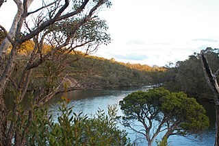
Banksia Creek is a watercourse in South East Queensland. It is located on the mainland in the area of Miriam Vale. The name refers to the plant genus Banksia, which grows in the area.

Banksia Beach is a town and suburb on Bribie Island in the Moreton Bay Region, Queensland, Australia. In the 2016 census the suburb of Banksia Beach had a population of 5,995 people.
The Kalgan River is a river in the Great Southern region of Western Australia.

The Culcairn – Corowa railway line is a closed railway branch line in southern New South Wales, Australia. It branched off of the Main Southern railway line at Culcairn and headed south-west to the town of Corowa on the Murray River. The southern terminus was near the Victorian Railways Springhurst – Wahgunyah railway, but no bridge was ever provided over the river.

Devils Tower comprises two small and rugged granite islands, with a combined area of 4.77 hectares, in south-eastern Australia. It is part of Tasmania’s Curtis Group, lying in northern Bass Strait between the Furneaux Group and Wilsons Promontory in Victoria. It is a nature reserve.

The Tirari Desert is a 15,250 square kilometres (5,888 sq mi) desert in the eastern part of the Far North region of South Australia. It stretches 212 km from north to south and 153 km from east to west.
Doljani is a village situated in Novi Pazar municipality in Serbia.
White Rock River, a perennial river of the Genoa River catchment, is located just south of the Monaro region of New South Wales, Australia.

Nome is a rural locality in the City of Townsville, Queensland, Australia. In the 2016 census, Nome had a population of 1,016 people.
The Elsinore Trough is a graben rift valley in Riverside County, southern California. It is created by the Elsinore Fault Zone.
Burns Creek, a watercourse of the Manning River catchment, is located in the Northern Tablelands region of New South Wales, Australia.

A triple divide or triple watershed is a point on the Earth's surface where three drainage basins meet. A triple divide results from the intersection of two drainage divides. Triple divides range from prominent mountain peaks to minor side peaks, down to simple slope changes on a ridge which are otherwise unremarkable. The elevation of a triple divide can be thousands of meters to barely above sea level. Triple divides are a common hydrographic feature of any terrain that has rivers, streams and/or lakes.
Laglan is a rural locality in the Isaac Region, Queensland, Australia. In the 2016 census Laglan had a population of 3 people, but its boundaries have subsequently changed.
Köksalköy is a village in the Çermik District of Diyarbakır Province in Turkey.
References
- "Banksia Creek". Gazetteer of Australia online. Geoscience Australia, Australian Government.
Rivers of the West Gippsland catchment, Victoria, Australia | |||||||
|---|---|---|---|---|---|---|---|
| Latrobe Basin |
| ||||||
| South Gippsland Basin |
| ||||||
| Thomson Basin |
| ||||||
| No defined basin |
| ||||||
| | This article about a location in Gippsland (region) is a stub. You can help Wikipedia by expanding it. |