Bemm River

Last updated

Bemm
DarkSunset2.jpg
Mouth of the Bemm River at Sydenham Inlet, 2006.
Australia Victoria relief location map.jpg
Red pog.svg
Mouth of the Bemm River in Victoria
Etymology Aboriginal (Gunai): binn or birn meaning "fish hawk" [1]
Native nameBinn (Kurnai)
Location
Country Australia
State Victoria
Region South East Corner (IBRA), East Gippsland
Local government area Shire of East Gippsland
Town Bemm River
Physical characteristics
Source confluence Errinundra River and Combienbar River
  locationBoulder Flat
  coordinates 37°28′34″S148°55′39″E / 37.47611°S 148.92750°E / -37.47611; 148.92750
  elevation165 m (541 ft)
Mouth Sydenham Inlet, Bass Strait
  location
Cape Conran Coastal Park
  coordinates
37°45′52″S148°58′37″E / 37.76444°S 148.97694°E / -37.76444; 148.97694 Coordinates: 37°45′52″S148°58′37″E / 37.76444°S 148.97694°E / -37.76444; 148.97694
  elevation
0 m (0 ft)
Length58 km (36 mi)
Basin features
River system East Gippsland catchment
Tributaries 
  leftPyramid Creek, Dinah Creek, Jungle Creek, Summer Creek
  rightNixon Creek, Goolengook River, Crabhole Creek, McKenzie River (Victoria), Bellbird Creek
National park Cape Conran CP
[1] [2]

The Bemm River is a perennial river, located in the East Gippsland region of the Australian state of Victoria.

Contents

Course and features

Formed by the confluence of the Errinundra and Combienbar rivers, the Bemm River rises below near Boulder Flat, northwest of the town of Cann River. The river flows generally south then south by east, through the Bemm River Scenic Reserve and the Cape Conran Coastal Park, joined by the Goolengook and McKenzie rivers and six minor tributaries, before reaching its mouth with Bass Strait via Sydenham Inlet in the Shire of East Gippsland, near the settlement of Bemm River. The river descends 165 metres (541 ft) over its 58 kilometres (36 mi) course. [2]

The catchment area comprises mainly public land, including Errinundra National Park and the Lind National Park. These areas have a broad range of ecosystems including cool and warm temperate rainforest, ancient wet eucalypt forest, coastal heathland and banksia woodland. The Bemm River catchment area is managed by the East Gippsland Catchment Management Authority.

Etymology

The name of the river is derived from the Aboriginal words binn or birn of the Gunai people, meaning "fish hawk". [1]

See also

Related Research Articles

<span class="mw-page-title-main">East Gippsland</span> Region of Victoria, Australia

East Gippsland is the eastern region of Gippsland, Victoria, Australia covering 31,740 square kilometres (14%) of Victoria. It has a population of 80,114.

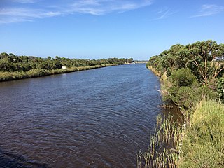
The Cann River is a perennial river located in the East Gippsland region of the Australian state of Victoria.

The Bendoc River is a perennial river of the Snowy River catchment, located in the Alpine regions of the states of Victoria and New South Wales, Australia.

The Delegate River is a perennial river of the Snowy River catchment, located in the Alpine regions of the states of Victoria and New South Wales, Australia.

The Yeerung River is a perennial river located in the East Gippsland region of the Australian state of Victoria.

The Little River is a perennial river of the Bemm River catchment, located in the East Gippsland region of the Australian state of Victoria.

<span class="mw-page-title-main">Brodribb River</span> River in Victoria, Australia

The Brodribb River is a perennial river of the Snowy River catchment, located in the East Gippsland region of the Australian state of Victoria.

The Queensborough River is a perennial river of the Snowy River catchment, located in the Alpine regions of the Australian states of Victoria and New South Wales.

<span class="mw-page-title-main">Bonang River</span> River in Victoria, Australia

The Bonang River is a perennial river of the Snowy River catchment, located in the Alpine region of the Australian state of Victoria.

The Errinundra River is a perennial river of the Bemm River catchment, located in the East Gippsland region of the Australian state of Victoria.

The Combienbar River is a perennial river of the Bemm River catchment, located in the East Gippsland region of the Australian state of Victoria.

The Ada River is a perennial river of the Bemm River catchment, located in the East Gippsland region of the Australian state of Victoria.

The Goolengook River is a perennial river of the Bemm River catchment, located in the East Gippsland region of the Australian state of Victoria.

The Little Goolengook River is a perennial river of the Bemm River catchment, located in the East Gippsland region of the Australian state of Victoria.

<span class="mw-page-title-main">Arte River</span> River in Victoria, Australia

The Arte River is a perennial river of the Bemm River catchment, located in the East Gippsland region of the Australian state of Victoria.

The Little Arte River is a perennial river of the Bemm River catchment, located in the East Gippsland region of the Australian state of Victoria.

The McKenzie River is a perennial river of the Bemm River catchment, located in the East Gippsland region of the Australian state of Victoria.

The Big River is a perennial river of the Snowy River catchment, located in the East Gippsland region of the Australian state of Victoria.

The Saint Patricks River is a perennial river of the Snowy River catchment, located in the East Gippsland region of the Australian state of Victoria.

The Rich River is a perennial river of the Snowy River catchment, located in the East Gippsland region of the Australian state of Victoria.

References

  1. 1 2 3 "Bemm River: 10400". Vicnames. Government of Victoria. 2 May 1966. Archived from the original on 11 January 2014. Retrieved 11 January 2014.
  2. 1 2 "Map of Bemm River, VIC". Bonzle Digital Atlas of Australia. Retrieved 11 January 2014.