Warrnambool is a city on the south-western coast of Victoria, Australia. At the 2021 census, Warrnambool had a population of 35,743. Situated on the Princes Highway, Warrnambool (Allansford) marks the western end of the Great Ocean Road and the southern end of the Hopkins Highway.
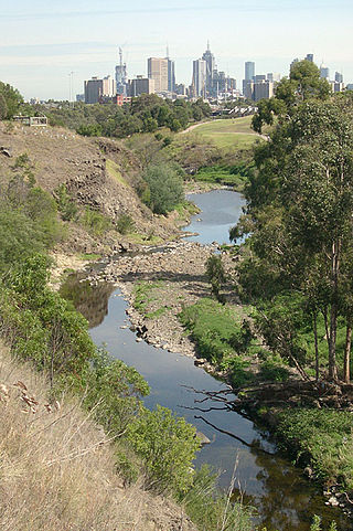
The Merri Creek is a waterway in southern parts of Victoria, Australia, which flows through the northern suburbs of Northcote. It begins near Wallan north of Melbourne and flows south for 70 km until it joins the Yarra River at Dights Falls. The area where the creek meets the river was traditionally the location for large gatherings of the Wurundjeri people and is suspected to have been the location for one of the earliest land treaties in Australia between Indigenous Australians and European settlers.

The Moyne River, a perennial river of the Glenelg Hopkins catchment, is located in the Western District of Victoria, Australia.

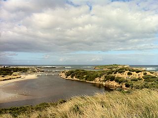
The Hopkins River, a perennial river of the Glenelg Hopkins catchment, is located in the Western District of Victoria, Australia.

The Glenelg River, a perennial river of the Glenelg Hopkins catchment, is located in the Australian states of Victoria and South Australia.
The 1909 Western Victorian floods consisted of widespread flooding on rivers of the western half of the State of Victoria during the middle of August that year.

The Wannon River, a perennial river of the Glenelg Hopkins catchment, is located in the Western District of Victoria, Australia.
The Fitzroy River, a perennial river of the Glenelg Hopkins catchment, is located in the Western District of Victoria, Australia.

The Mount Emu Creek, a perennial creek of the Glenelg Hopkins catchment, is located in the Western District of Victoria, Australia.

Dennington is a town in the Western District of Victoria, Australia. The town is located in the City of Warrnambool local government area, 270 kilometres (170 mi) south west of the state capital, Melbourne and 5 kilometres (3.1 mi) north west of the regional centre of Warrnambool. At the 2016 census, Dennington had a population of 1,907.
The Shaw River, a perennial river of the Glenelg Hopkins catchment, is located in the Western District of Victoria, Australia.
The Surry River, sometimes incorrectly spelled as the Surrey River, a perennial river of the Glenelg Hopkins catchment, is located in the Western District of Victoria, Australia.
The Eumeralla River is a perennial river of the Glenelg Hopkins catchment, located in the Western District of Victoria, Australia.
Warrnambool College is a government high school in the regional town of Warrnambool in south-west Victoria, Australia.
The Crawford River or Smoky River, a perennial river of the Glenelg Hopkins catchment, is located in the Western District of Victoria, Australia.
The Wando River, a perennial river of the Glenelg Hopkins catchment, is located in the Western District of Victoria, Australia.
The Dundas River, a perennial river of the Glenelg Hopkins catchment, is located in the Western District of Victoria, Australia.
The Chetwynd River, a perennial river of the Glenelg Hopkins catchment, is located in the Western District of Victoria, Australia.
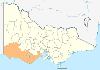
The Barwon South West is an economic rural region located in the southwestern part of Victoria, Australia. The Barwon South West region stretches from the tip of the Queenscliff Heads to the border of South Australia. It is home to Victoria’s largest provincial centre, Geelong and the major centres of Aireys Inlet, Apollo Bay, Camperdown, Colac, Hamilton, Lorne, Port Campbell, Port Fairy, Portland, Torquay and Warrnambool. It draws its name from the Barwon River and the geographic location of the region in the state of Victoria.
