Penshurst, Victoria

Last updated

Penshurst
Victoria
PenshurstParkSpring.jpg
Spring at the Penshurst botanical gardens
Australia Victoria Southern Grampians Shire location map.svg
Red pog.svg
Penshurst
Coordinates 37°53′S142°17′E / 37.883°S 142.283°E / -37.883; 142.283 Coordinates: 37°53′S142°17′E / 37.883°S 142.283°E / -37.883; 142.283
Population461 (2006 census) [1]
Postcode(s) 3289
Location
LGA(s) Shire of Southern Grampians
State electorate(s) Lowan
Federal division(s) Wannon

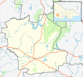
Penshurst is a town in Victoria, Australia. It is in the Shire of Southern Grampians local government area and is located at the foot of Mount Rouse, an extinct volcano. At the 2006 census, Penshurst had a population of 461. [1] Basic facilities include a hospital with an aged care residency and doctor's surgery, a pub, a hall and two schools – one a State school, the other a Catholic school – the State school has 10 students(2020), [2] the Catholic school 26. [3]

Contents

History

Kolorer gunditj people

Before British colonisation, the area around Mount Rouse was the country of the Kolorer gunditj clan of Aboriginal people. Their title is derived from their name for Mount Rouse which was Kolor. [4] The permanent spring that is now located within the Penshurst Botanic Gardens was a traditional meeting place for Aborigines in the region. [5]

Arrival of the British

Major Thomas Mitchell travelled through the area in 1836, naming Mount Rouse. In late 1839 John Cox, who was a grandson of New South Wales Corps officer William Cox, arrived in the region and established a sheep station which he called Mount Rouse station. [6] Conflict with the Aboriginal population soon followed and in May 1840 a manager at the property named Patrick Codd who had a significant history of violence against Aborigines, was killed. Revenge killings by the colonists resulted in up to twenty Aborigines being shot. A local Indigenous man named Figara Alkapurata (or Roger) was later arrested for Codd's murder and executed in Melbourne. [7]

Mount Rouse Aboriginal Protectorate

In early 1842, the colonial government decided to create a reserve for Aboriginal people at Mount Rouse. John Cox was ordered off the land, moving to the neighbouring Weerangourt property. In February 1842, around 210 Aborigines from various tribal groups in the region arrived at Mount Rouse accompanied by Assistant Protector Charles Sievwright. The main buildings of the Protectorate were located at what is now the corner of Cox and Martin streets in Penshurst. [5] [7] In his role Sievwright attempted to safeguard the Aborigines assigned to him by reporting the massacres conducted by nearby settlers and by providing rations and shelter. However, these actions infuriated the local colonists who demanded the government replace him, and in September 1842 Dr John Watton was appointed to manage the protectorate. [7]

During this time, the Native Police were forcibly rounding up Aboriginal people throughout the Western District and ordering them to go to Mount Rouse or be shot. The reserve however was consistently underfunded and could not provide for the needs of hundreds of people. Therefore, few Aboriginal people remained for any great length of time at Mount Rouse. The reserve was also blamed for providing shelter to Aboriginal people who took livestock and speared shepherds at the surrounding sheep stations. These issues chronically interfered with the operation of the protectorate, and in 1849 Dr Watton resigned from his position. A year later the Aboriginal Protectorate was officially closed down and divided up into two grazing properties with a reserve for a township which became the settlement of Penshurst. [7] [8]

Township of Penshurst

The town of Penshurst was gazetted in the 1850s, the Post Office opening on 1 September 1857. [9] In 1852 German Lutherans led by Johann Friedrich Krummnow founded a community named Herrnhut located near Mount Rouse about 8 km from Penshurst – the group adhered to the principles of shared property and fervent prayer. Krummnow died there in 1880 and the community had disbanded by 1890. [10]

The Penshurst Magistrates' Court closed on 1 November 1981, not having been visited by a Magistrate since 1971. [11]

The Penshurst Volcanoes Discovery Centre [12] is an interpretive centre and tourist information centre located in Martin Street in the old Shire of Mount Rouse offices. It contains an audio/visual display of volcanoes in general, and the eruptions and lava flows of the district in particular.

Geography

Penshurst is located in an area littered with basalt stones up 2m long from the Mount Rouse volcano. These are known locally as the stony rises, the technical name being "breached barriers", having been formed from collapsed lava tubes. Features similar to the stony rises may be observed in other areas of south-west Victoria where there is a history of volcanic activity.

Mount Rouse rises 100m above the surrounding plain (367m above sea level) and is composed of both basaltic lava and scoria. It has several craters, the lower of which is a crater lake. The north east side of Mount Rouse is used as a quarry and crushed for road making scoria.

There were instances in the 1970s where bushfires triggered peat fires beneath the stony rises which burnt for a number on months. [ citation needed ] A fire watch building is located at the top of Mount Rouse.

Penshurst is serviced by a fresh water spring located in the town.

Sport

The town has an Australian Rules football team named the Penshurst Bombers, competing in the Mininera & District Football League. [13]

Penshurst has a horse racing club, the Penshurst & District Racing Club, which schedules one race meeting a year, the Penshurst Cup meeting on Boxing Day (26 December). [14] The racecourse is located about 1 km north of Bell Street (the Main Street).

Golfers used to play at the course of the Penshurst Golf Club on Racecourse Road. The club disbanded in 2002, just two years short of its centenary. The golf course no longer exists.

Related Research Articles

<span class="mw-page-title-main">George Augustus Robinson</span> Chief Protector of Aborigines in Port Phillip District, now Victoria, Australia

George Augustus Robinson was a British-born colonial official and self-trained preacher in colonial Australia. In 1824, Robinson travelled to Hobart, Van Diemen’s Land, where he attempted to negotiate a peace between European settlers and Aboriginal Tasmanians prior to the outbreak of the Black War. He was appointed Chief Protector of Aborigines by the Aboriginal Protection Board in Port Phillip District, New South Wales in 1839, a position he held until 1849.

<span class="mw-page-title-main">Western District (Victoria)</span> Region in Victoria, Australia

The Western District comprises western regions of the Australian state of Victoria. It is said to be an ill–defined district, sometimes incorrectly referred to as an economic region,. The district is located within parts of the Barwon South West and the Grampians regions; extending from the south-west corner of the state to Ballarat in the east and as far north as Ararat. The district is bounded by the Wimmera district in the north, by the Goldfields district in the east, by Bass Strait and the Southern Ocean in the south, and by the South Australian border in the west. The district is well known for the production of wool. The most populated city in the Western District is the Ballarat region, with 96,940 inhabitants.

<span class="mw-page-title-main">Foster Fyans</span> Australian politician

Foster Fyans was an Irish military officer, penal colony administrator and public servant. He was acting commandant of the second convict settlement at Norfolk Island, the commandant of the Moreton Bay penal settlement at Brisbane, the first police magistrate at Geelong, and commissioner of crown lands for the Portland Bay pastoral district in the Port Phillip District of New South Wales. He is the great-great-grandfather of actor Sam Neill.

<span class="mw-page-title-main">Derrinallum</span> Town in Victoria, Australia

Derrinallum is a town in Victoria, Australia, located on the Hamilton Highway, in the Corangamite Shire. The town is the centre for the surrounding farming community and lies at the foot of Mount Elephant. Mount Elephant is a 380 m-high conical breached scoria cone formed by an dormant volcano.

<span class="mw-page-title-main">Johann Friedrich Krummnow</span> German-born religious settler in Australia

Johann Friedrich Krummnow was a German-born settler in Australia. He arrived in South Australia in 1839 and in 1852 he founded a community named Herrnhut located near Penshurst in western Victoria. This was Australia's first intentional community based on the principles of shared property and fervent prayer. Krummnow died at Herrnhut in October 1880.

<span class="mw-page-title-main">Mount Napier</span> Mountain in Victoria, Australia

Mount Napier in Victoria, Australia, is one of the youngest volcanoes in Australia. It erupted about 32,000 years ago. It was named by Major Thomas Mitchell after the three Napier brothers, who he had served alongside during the Peninsular War. Mitchell named it in August 1836, during his third expedition across south-eastern Australia. The local Aboriginal name for the mount is Tapoc. Mount Napier State Park is located 270 kilometres west of Melbourne and 17 km south of Hamilton.

<span class="mw-page-title-main">Mount Elephant</span> Mountain in Victoria, Australia

Mount Elephant is a 380-metre-high (1,250 ft) conical breached scoria cone formed by a dormant volcano, located 1 km from the town of Derrinallum in southwestern Victoria, Australia. It is a prominent landmark that forms the eastern gateway to the Kanawinka Geopark from the Hamilton Highway at Derrinallum.

<span class="mw-page-title-main">Newer Volcanics Province</span>

The Newer Volcanics Province is a geological area which is a volcanic field, formed by the East Australia hotspot across south-eastern Australia. It covers an area of 15,000 square kilometres (5,800 sq mi), with over 400 small shield volcanoes and volcanic vents. The area contains the youngest volcanoes in Australia.

<span class="mw-page-title-main">Hawkesdale, Victoria</span> Town in Victoria, Australia

Hawkesdale is a town in the Western District of Victoria, Australia on the Penshurst-Warrnambool Road. It is in the Shire of Moyne local government area and the federal Division of Wannon. At the 2016 census, Hawkesdale and the surrounding area had a population of 322.

The Djab Wurrung, also spelt Djabwurrung, Tjapwurrung, Tjap Wurrung, or Djapwarrung, people are Aboriginal Australians whose country is the volcanic plains of central Victoria from the Mount William Range of Gariwerd in the west to the Pyrenees range in the east encompassing the Wimmera River flowing north and the headwaters of the Hopkins River flowing south. The towns of Ararat, Stawell and Hamilton are within their territory. The Djab Wurrung Heritage Protection Embassy is located on a proposed highway duplication on the Western Highway south of Ararat. There were 41 Djab Wurrung clans who formed an alliance with the neighbouring Jardwadjali people through intermarriage, shared culture, trade and moiety system before colonisation. Their lands were conquered but never ceded.

Mount Leura is a 313-metre scoria cone surrounding a dry crater 100 m deep and is the central and most obvious component of a larger volcanic complex southeast of the town of Camperdown located in western Victoria, Australia, 194 kilometres (121 mi) south west of the state capital, Melbourne. The inactive volcano is thought to have last erupted between 5,000 and 20,000 years ago. The name means "big nose" in local aboriginal dialect.

Mount Porndon is a 278-metre-high (912 ft) volcano located 13 kilometres southeast of Camperdown in western Victoria, Australia.

Murdering Gully, formerly known as Puuroyup to the Djargurd Wurrung people, is the site of an 1839 massacre of 35–40 people of the Tarnbeere Gundidj clan of the Djargurd Wurrung in the Camperdown district of Victoria, Australia. It is a gully on Mount Emu Creek, where a small stream adjoins from Merida Station.

<span class="mw-page-title-main">Edward Stone Parker</span> Australian politician

Edward Stone Parker (1802–1865) was a Methodist preacher and assistant Protector of Aborigines in the Aboriginal Protectorate established in the Port Phillip District of colonial New South Wales under George Augustus Robinson in 1838. He established and administered the Franklinford Aboriginal Protectorate Station in the territory of the Dja Dja Wurrung people from January 1841 to the end of 1848.

Budj Bim, also known as Mount Eccles, is a dormant volcano near Macarthur in southwestern Victoria, Australia. It lies within the geologically-defined area known as the Newer Volcanics Province, which is the youngest volcanic area in Australia and stretches from western Victoria to south-eastern South Australia.

<span class="mw-page-title-main">Mount Franklin (Victoria)</span> Mountain in Victoria, Australia

Mount Franklin is an extinct volcano about 10 km north of Daylesford and 4.6 km south east of Franklinford in Victoria, Australia. A road spirals round the outside slopes covered with pine trees, into a flat 50 acre caldera, now used as a camping ground, and onto the rim which hosts a fire lookout, parking area and picnic ground.

An Aboriginal reserve, also called simply reserve, was a government-sanctioned settlement for Aboriginal Australians, created under various state and federal legislation. Along with missions and other institutions, they were used from the 19th century to the 1960s to keep Aboriginal people separate from the white Australian population, for various reasons perceived by the government of the day. The Aboriginal reserve laws gave governments much power over all aspects of Aboriginal people’s lives.

<span class="mw-page-title-main">Griffiths Island</span> Island in Victoria, Australia

Griffiths Island, sometimes incorrectly spelled as Griffith Island or Griffitts Island, lies at the mouth of the Moyne River next to, and within the bounds of, the town of Port Fairy, in the Western District of the state of Victoria in Australia. Griffiths now has no permanent inhabitants, but is connected to the mainland by a causeway and is accessible on foot. It forms part of the Port Fairy and Belfast Coastline Protection Reserve and, as well as being a tourist attraction, is an important site in the context of the history of European settlement of western Victoria. It is managed by the Moyne Shire Council.

The Eumeralla Wars were the violent encounters over the possession of land between British colonists and Gunditjmara Aboriginal people in what is now called the Western District area of south west Victoria.

<span class="mw-page-title-main">Charles Sievwright</span> British army officer and Aboriginal Protector

Charles Wightman Sievwright was a British army officer before being appointed Assistant Protector of Aborigines in part of the Port Phillip District of the colony of New South Wales, now Victoria, Australia.

References

  1. 1 2 Australian Bureau of Statistics (25 October 2007). "Penshurst (L) (Urban Centre/Locality)". 2006 Census QuickStats. Retrieved 27 June 2010.
  2. "My School provides information that helps parents and the community in understanding the performance of schools over time".
  3. "My School provides information that helps parents and the community in understanding the performance of schools over time".
  4. Robinson, George Augustus; Clark, Ian D (2014). Travels of George Augustus Robinson, Chief Protector, Port Phillip Aboriginal Protectorate.
  5. 1 2 "Heritage place: Mount Rouse Aboriginal Protectorate" (PDF). Government of Victoria. Retrieved 15 July 2021.
  6. Clark, Ian (1995). Scars in the Landscape. Canberra: AIATSIS.
  7. 1 2 3 4 Critchett, Jan (1990). A Distant Field of Murder. Carlton: Melbourne University Press. ISBN   0-522-84527-4.
  8. Cannon, Michael (1993). Black Land, White Land. Port Melbourne: Minerva. ISBN   1-86330-315-4.
  9. Phoenix Auctions History, Post Office List , retrieved 6 March 2021
  10. "Herrnhut Ruins – Statement of Significance". Victorian Heritage Database, Heritage Victoria. Retrieved 30 October 2012.
  11. "Special Report No. 4 – Court Closures in Victoria" (PDF). Auditor-General of Victoria. 1986. p. 78. Retrieved 12 April 2020.
  12. Penshurst Volcanoes Discovery Centre website
  13. Full Points Footy, Mininera & District Football League , retrieved 25 July 2008
  14. Country Racing Victoria, Penshurst & District Racing Club, archived from the original on 24 October 2007, retrieved 7 May 2009

Commons-logo.svg Media related to Penshurst, Victoria at Wikimedia Commons