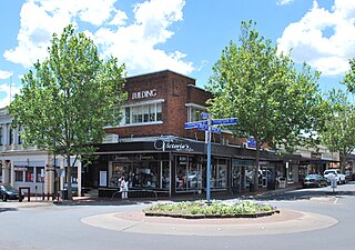
Terang is a town in the Western District of Victoria, Australia. The town is in the Shire of Corangamite and on the Princes Highway 212 kilometres (132 mi) south west of the state's capital, Melbourne. At the 2006 census, Terang had a population of 1,824. At the 2001 census, Terang had a population of 1,859. The population of Terang has since risen according to the 2011 Census; the population is now 2,348, of which 1,155 are male and 1,193 are female, with the median age being 44.
Hamilton is a large town in south-western Victoria, Australia, at the intersection of the Glenelg Highway and the Henty Highway. The Hamilton Highway connects it to Geelong.

Natimuk is a town in Western Victoria, Australia. It is located about 300 kilometres (190 mi) northwest of Melbourne. A further 10 km (6.2 mi) west of Natimuk is one of Australia's best climbing areas, Mount Arapiles. At the 2016 census, Natimuk had a population of 514, up from 449 in 2006.
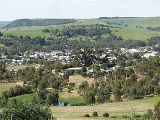
Coleraine is a town in Victoria, Australia on the Glenelg Highway, 334 kilometres (208 mi) west of the state capital, Melbourne and 34 kilometres (21 mi) north-west of Hamilton in the Shire of Southern Grampians local government area. It was named after the town in County Londonderry, Northern Ireland. At the 2006 census, the urban area of Coleraine had a population of 991.

Bright is a town in northeastern Victoria, Australia, 319 metres above sea level at the southeastern end of the Ovens Valley. At the 2021 census, Bright had a population of 2,620. It is located in the Alpine Shire local government area.
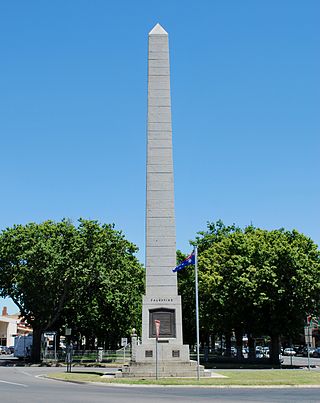
Mortlake is a town in the Western District of Victoria, Australia on the Hamilton Highway, 50 kilometres (31 mi) north-east of Warrnambool. It is in the Shire of Moyne local government area and the federal Division of Wannon. At the 2001 census, Mortlake had a population of 941, rising to 996 in 2006, and to 1,073 in 2011.

Nyah West is a town in Victoria (Australia) near the Murray River, the border with New South Wales. It is near the Murray Valley Highway, 371 kilometres (231 mi) north-west of Melbourne and 27 kilometres (17 mi) north-west of Swan Hill.

Strathmerton is a town in Victoria, Australia.

Lang Lang is a town in Victoria, Australia, 73 km south-east of Melbourne's Central Business District, located within the Shires of Bass Coast, Cardinia and South Gippsland local government areas. Lang Lang recorded a population of 2,556 at the 2021 census.
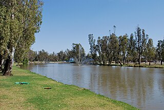
Cohuna is a town situated 274 kilometres (170 mi) north of Melbourne, on the Murray Valley Highway, in northern Victoria, Australia. At the 2016 census, Cohuna had a population of 2,428.

Manangatang is a town in north-west Victoria, Australia. At the 2016 census, Manangatang had a population of 309. It is sometimes noted for its unusual name, from an Aboriginal term - "manang" meaning land and "kaaiti" meaning water.

Gembrook is a town in Victoria, Australia, 54 kilometres (34 mi) south-east of Melbourne's Central Business District, located within the Shire of Cardinia local government area. Gembrook recorded a population of 2,559 at the 2021 census.

Wycheproof is a small town in the centre of the Shire of Buloke, in north western Victoria, Australia. As of the 2021 census, it had a population of 610.

Porepunkah is a town in northeast Victoria, Australia on the Great Alpine Road, at the foot of Mount Buffalo 320 kilometres (199 mi) northeast of the state capital, Melbourne and 5 kilometres (3 mi) northwest of Bright. It is part of Alpine Shire local government area and on the banks of the Ovens River, near the Buckland River junction. At the 2016 census, Porepunkah had a population of 941.

Timboon is a town in the Western District of Victoria, Australia. The town is in the Shire of Corangamite local government area, and is approximately 213 kilometres (132 mi) south-west of the state capital, Melbourne. At the 2001 census, Timboon had a population of 787. At the 2006 census, Timboon had a population of 871. During the 2016 census Timboon had a population of 1,202.

The Wannon River, a perennial river of the Glenelg Hopkins catchment, is located in the Western District of Victoria, Australia.

Balmoral is a township in the Shire of Southern Grampians in the Western District of Victoria, Australia. At the 2016 census, Balmoral and the surrounding area had a population of 294.

Macarthur originally known as Eumeralla, is a town in the Western District of Victoria, Australia on the Hamilton-Port Fairy Road. It is in the Shire of Moyne local government area and the federal Division of Wannon. At the 2016 census, Macarthur and the surrounding area had a population of 522.
Caramut is a town in the Western District of Victoria, Australia on the Hamilton Highway. It is in the Shire of Moyne local government area and the federal Division of Wannon.
Sandford is a bounded rural locality of the Shire of Glenelg local government area, Victoria, Australia south of Casterton. At the 2021 census, Sandford had a population of 130.


