Balmoral | |||||||||||||
|---|---|---|---|---|---|---|---|---|---|---|---|---|---|
 Balmoral post office | |||||||||||||
 Balmoral | |||||||||||||
| Coordinates: 37°15′S141°51′E / 37.250°S 141.850°E | |||||||||||||
| Country | Australia | ||||||||||||
| State | Victoria | ||||||||||||
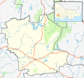
| LGA | |||||||||||||
| Location | |||||||||||||
| Government | |||||||||||||
| • State electorate | |||||||||||||
| • Federal division | |||||||||||||
| Population | |||||||||||||
| • Total | 294 (2016 census) [1] | ||||||||||||
| Postcode | 3407 | ||||||||||||
| |||||||||||||
Balmoral is a town in the Shire of Southern Grampians in the Western District of Victoria, Australia. At the 2016 census, Balmoral and the surrounding area had a population of 294. [1]
The township was settled in the early 1850s, the Post Office opening on 31 October 1855. [2]
A railway line, built in a number of sections, once connected Horsham and Hamilton, running via Cavendish, Balmoral and East Natimuk. [3] The railway closed 1 July 1979 with the majority of the railway track being removed, though several rail bridges remain in place.
The Balmoral Magistrates' Court closed on 1 November 1981, not having been visited by a Magistrate since 1971. [4]
The town in conjunction with neighbouring township Harrow has an Australian Rules football and netball club competing in the Horsham & District Football League. [5]
Golfers play at the Balmoral Golf Club on Rocklands Road. [6]
The Douglas Mine owned by Iluka Resources, which operated from 2006 to 2012 is located nearby.
The Australian Broadcasting Corporation (ABC) released a series of its investigative program Background Briefing titled Hometown Boys, which examined the case of Shaun Bloomfield and Luke Merryfull from Balmoral who were convicted and sentenced on rape charges. [7] [8] The program reported that some members of the local community expressed support for the men and their families following the court proceedings. [8]