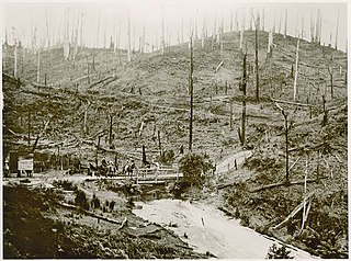
The Avon River is a perennial river of the West Gippsland catchment, located in the West Gippsland region, of the Australian state of Victoria. The Avon, forms an important part of the Latrobe sub-catchment, draining the south eastern slopes of the Great Dividing Range, to form the Gippsland Lakes.

The Thomson River, a perennial river of the West Gippsland catchment, is located in the Gippsland region of the Australian state of Victoria.

The Latrobe River is a perennial river of the West Gippsland catchment, located in the West Gippsland region of the Australian state of Victoria. The Latrobe River and its associated sub-catchment is an important source for the Gippsland Lakes, draining the south eastern slopes of the Great Dividing Range.

The Darby River, a perennial river of the West Gippsland catchment, is located in the South Gippsland region of the Australian state of Victoria.
The Albert River is a perennial river of the West Gippsland catchment, located in the South Gippsland region of the Australian state of Victoria.

The Macalister River, a perennial river of the West Gippsland catchment, is located in the Alpine and Gippsland regions of the Australian state of Victoria.
The Perry River is a perennial river of the West Gippsland catchment, located in the Gippsland region of the Australian state of Victoria.
The Tarwin River is a perennial river of the West Gippsland catchment, located in the South Gippsland region of the Australian state of Victoria. The Tarwin River is the primary river system within South Gippsland Shire and has a catchment area of approximately 1,500 square kilometres (580 sq mi), predominantly rural with small pockets of residential land use. It flows south from the Strzlecki Ranges and discharges in the eastern reaches of Anderson Inlet, a shallow estuary connected to Bass Strait.

The Morwell River is a perennial river of the West Gippsland catchment, located in the West Gippsland and South Gippsland regions of the Australian state of Victoria.
The Ada River is a perennial river of the West Gippsland catchment, located in the West Gippsland region of the Australian state of Victoria.
The Turton River is a perennial river of the West Gippsland catchment, located in the Gippsland region of the Australian state of Victoria.

The Aberfeldy River is a perennial river of the West Gippsland catchment, located in the Alpine region of the Australian state of Victoria.
The Caledonia River is a perennial river of the West Gippsland catchment, located in the Alpine region of the Australian state of Victoria.
The Loch River is a perennial river of the West Gippsland catchment, located in the West Gippsland region of the Australian state of Victoria.
The Tanjil River is a perennial river of the West Gippsland catchment, located in the West Gippsland region of the Australian state of Victoria.
The Tyers River is a perennial river of the West Gippsland catchment, located in the West Gippsland region of the Australian state of Victoria.
The Barkly River, a perennial river of the West Gippsland catchment, is located in the Alpine region of the Australian state of Victoria.
The Carey River is a perennial river of the West Gippsland catchment, located in the Alpine region of the Australian state of Victoria.
The Dolodrook River is a perennial river of the West Gippsland catchment, located in the Alpine region of the Australian state of Victoria.
The Moe River is a perennial river of the West Gippsland catchment, located in the West Gippsland region of the Australian state of Victoria.


