
Kiewa River, a perennial river that is part of the Murray catchment within the Murray-Darling basin, is located in the Alpine bioregion, in the Australian state of Victoria.

The Ovens River, a perennial river of the north-east Murray catchment, part of the Murray-Darling basin, is located in the Alpine and Hume regions of the Australian state of Victoria.
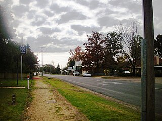
Whitfield is an agricultural township in the King Valley in north-eastern Victoria.

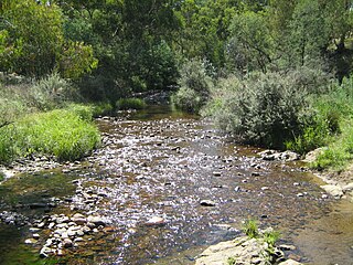
The King River, a perennial river of the North-East Murray catchment of the Murray-Darling basin, is located in the Alpine and Hume regions of Victoria, Australia. It flows from the northwestern slopes of the Alpine National Park in the Australian Alps, through the King Valley, and joining with the Ovens River at the rural city of Wangaratta.
The Morses Creek, is a perennial stream of the North-East Murray catchment of the Murray-Darling basin, is located in the Alpine region of Victoria, Australia. It flows from the northern slopes of the Mount Buffalo National Park in the Australian Alps, joining with the Ovens River at Bright.
The Suggan Buggan River is a perennial river of the Snowy River catchment, located in the Alpine region of the Australian state of Victoria.

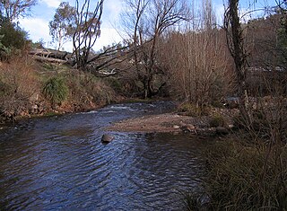
The Buckland River, a perennial river of the North-East Murray catchment of the Murray-Darling basin, is located in the Alpine region of Victoria, Australia. It flows from the eastern slopes of the Buffalo Range in the Australian Alps, joining with the Ovens River at Porepunkah.
The Cobungra River, a perennial river of the North-East Murray catchment of the Murray-Darling basin, is located in the East Gippsland and Alpine regions of Victoria, Australia.

The Big River, a perennial river of the North-East Murray catchment of the Murray-Darling basin, is located in the East Gippsland and Alpine regions of Victoria, Australia. It flows from the northern slopes of Falls Creek in the Australian Alps, joining with the Cobungra River near Anglers Rest to form the Mitta Mitta River.

The Bundara River, a perennial river of the North-East Murray catchment of the Murray-Darling basin, is located in the East Gippsland and Alpine regions of Victoria, Australia.
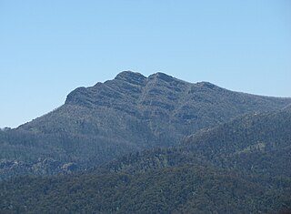
Mount Cobbler is a mountain located in the Alpine National Park to the east of Mansfield in north-eastern Victoria, Australia. Its summit rises to 1,628 metres (5,341 ft) above sea level. The peak and surrounding Cobbler land system are composed of sedimentary rocks, dating to the Lower Carboniferous period, some 359 to 318 million years ago.

The Moroka River is a perennial river of the Mitchell River catchment, located in the Alpine region of the Australian state of Victoria.
The Deddick River is a perennial river of the Snowy River catchment, located in the Alpine region of the Australian state of Victoria.

The Arte River is a perennial river of the Bemm River catchment, located in the East Gippsland region of the Australian state of Victoria.
The Little Arte River is a perennial river of the Bemm River catchment, located in the East Gippsland region of the Australian state of Victoria.
The Buffalo River, a perennial river of the North-East Murray catchment of the Murray-Darling basin, is located in the Alpine region of Victoria, Australia. It flows from the eastern slopes of the Buffalo Range in the Australian Alps, joining with the Ovens River west of Myrtleford.

The Catherine River, a perennial river of the North-East Murray catchment of the Murray-Darling basin, is located in the Alpine region of Victoria, Australia. It flows Northwards in the Alpine National Park in the Australian Alps, joining with the Buffalo River in remote national park territory.

The Dandongadale River, a perennial river of the North-East Murray catchment of the Murray-Darling basin, is located in the Alpine region of Victoria, Australia. It flows from the northern slopes of the Alpine National Park in the Australian Alps, joining with the Buffalo River in remote national park territory.
The Dart River, a perennial river of the North-East Murray catchment of the Murray-Darling basin, is located in the Alpine region of Victoria, Australia. It flows from the northwestern slopes of the Alpine National Park in the Australian Alps, south and joins with the Mitta Mitta River within Lake Dartmouth.
The Black River, an inland perennial river of the Goulburn Broken catchment, part of the Murray-Darling basin, is located in the lower South Eastern Highlands bioregion and Northern Country/North Central regions of the Australian state of Victoria. The headwaters of the Black River rise on the northern slopes of the Yarra Ranges and descend to flow into the Goulburn River within the Yarra Ranges National Park.
