Namoi River

Last updated • 3 min readFrom Wikipedia, The Free Encyclopedia

Namoi River
Namoi manilla rivers manilla.jpg
The confluence of the Namoi and Manilla rivers, at Manilla
Etymology Aboriginal: 1. derived from the name for a species of acacia; 2. derived from ngamu, the Gamilaraay word for "breast" [1]
Location
Country Australia
State New South Wales
Region IBRA: New England Tablelands
District Northern Tablelands, North West Slopes
Municipalities Narrabri, Walgett, Gunnedah
Physical characteristics
Source Moonbi Range, Great Dividing Range
  locationNear Niangala
  elevation708 m (2,323 ft)
2nd source Macdonald River
Source confluence Boundary Creek
Mouth Confluence with the Barwon River
  location
Near Walgett
  elevation
130 m (430 ft)
Length708 km (440 mi)
Basin size43,000 km2 (17,000 sq mi)
Discharge 
  average25 m3/s (880 cu ft/s)
Basin features
River system Barwon River, Murray–Darling basin
Reservoirs Lake Keepit, Baraneal Lagoon
[2] [3]

The Namoi River, a major perennial river that is part of the Barwon catchment of the Murray–Darling basin, is located in the Northern Tablelands and North West Slopes districts of New South Wales, Australia.

Contents

The Namoi River rises on the western slopes of the Moonbi Range and Great Dividing Range, near Niangala, at the convergence of the Macdonald River and Boundary Creek, and flows generally west, joined by twenty-seven tributaries, including the Peel, Manilla and Mooki rivers, before reaching its confluence with the Barwon River, near Walgett.

The Namoi River descends 578 metres (1,896 ft) over its 708 kilometres (440 mi) course; passing near the towns of Gunnedah, Boggabri, Narrabri, Wee Waa and Walgett. The flow of the river is impounded by Lake Keepit and Baraneal Lagoon. [2]

Course

A sand bar and the banks of the Namoi River near Cuttabri. Namoi-River-sand-bank.jpg
A sand bar and the banks of the Namoi River near Cuttabri.
Bridge over the Namoi River, Manilla. Namoi Bridge.JPG
Bridge over the Namoi River, Manilla.

The headwaters of the Namoi, including the Macdonald River, the Peel River, the Cockburn River and the Manilla River, rise on the western slopes of the Great Dividing Range on the Northern Tablelands. Other smaller tributaries include Cobrabald River, Coxs Creek, Maules Creek, Mooki River and Bundock Creek. It rises east of Niangala and flows generally north west after its confluence with its major tributary, the Cobrabald River, then passes through the villages of Woolbrook and Bendemeer. It continues to flow westward to where it changes name to the Namoi River at Boundary Creek just east of where the river enters Warrabah National Park.

The Namoi flows past Manilla, where it is joined by the Manilla River. After passing into Keepit Dam it is joined by the Peel River before passing by Carroll, then joined by the Mooki River near Gunnedah on the Liverpool Plains. From here it flows north-westwards past Boggabri, Narrabri, Wee Waa and Burren Junction and eventually joins the Barwon River, near the town of Walgett. [2]

Keepit Dam near Gunnedah is an important dam for flood control and irrigation. The floodplains of the lower Namoi around Wee Waa are an important area for growing cotton which is irrigated using water from the dam.

History

The traditional custodians of the land surrounding the Namoi River are the Aboriginal people of the Kamilaroi nation. The word namoi or nammoy is believed to be the native name for a species of acacia; and ngamu is a Gamilaraay word for "breast". [1] Alternative meanings of the name include Aboriginal words for "forked stick" and "meeting of the waters".[ citation needed ]

Allan Cunningham, a botanist-explorer, in 1827 became the first European to explore the Namoi River. Cunningham named this river "Mitchell" in honour of James Mitchell, the chief surgeon of Sydney Hospital, out of gratitude for his assistance with barometrical observations.

The Namoi River Road Bridge, which was built at Manilla in 1886, has been placed on the Register of the National Estate. This bridge has eleven metal lattice truss spans and is one of the longest six or seven metal truss bridges completed in Australia by that time.

Fauna

The Namoi supports a wide range of fish and crustaceans, which include Murray cod, yellowbelly, silver perch, catfish ( Tandanus tandanus ) as well as yabbies ( Cherax destructor ). "Crawbob" is a regional name and may be called a "yabby" elsewhere in the state.[ citation needed ]

Murray cod in the Namoi grow to a very large size, with fish of forty kilograms or larger being not uncommon. European carp and extensive irrigation practices have had adverse impact on the native fish population over the last forty years, and restocking programs have been undertaken, mainly by volunteers, to ensure the survival of the native fish population.

The Namoi River snapping turtle or Bell's turtle (Elseya belli) is a species of turtle found only in the upper reaches of the Namoi River, Gwydir and Macdonald rivers on the North West Slopes. [4]

The platypus (Ornithorhynchus anatinus) is found in this river and can often be seen around Warrabah National Park, east of Manilla.

See also

Related Research Articles

<span class="mw-page-title-main">New England (New South Wales)</span> Region in New South Wales, Australia

New England is a vaguely defined region in the north of the state of New South Wales, Australia, about 60 km inland from the Tasman Sea. The area includes the Northern Tablelands and the North West Slopes regions. As of 2006, New England had a population of 202,160, with over a quarter of the people living in the area of Tamworth Regional Council.

<span class="mw-page-title-main">Gwydir River</span> River in New South Wales, Australia

Gwydir River, a major inland perennial river of the Barwon catchment within the Murray–Darling basin, is located in the Northern Tablelands, North West Slopes, and Orana districts of New South Wales, Australia.

<span class="mw-page-title-main">Gunnedah</span> Town in New South Wales, Australia

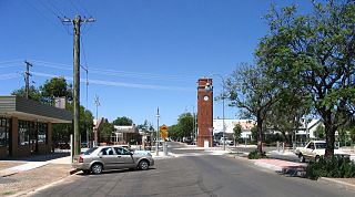
Gunnedah is a town in north-eastern New South Wales, Australia and is the seat of the Gunnedah Shire local government area. In the 2016 census the town recorded a population of 9,726. Gunnedah is situated within the Liverpool Plains, a fertile agricultural region, with 80% of the surrounding shire area devoted to farming. The Namoi River flows west then north-west through the town providing water beneficial to agricultural operations in the area.

<span class="mw-page-title-main">Keepit Dam</span> Dam in North West Slopes, New South Wales

Keepit Dam is a major gated mass concrete gravity dam with an earth fill abutment and a central gated concrete overflow crest and six radial gate spillways across the Namoi River upstream of its junction with the Peel River in the North West Slopes region of New South Wales, Australia. The dam's purpose includes flood mitigation, hydro-power, irrigation, water supply and conservation. The impounded reservoir is called Lake Keepit.

<span class="mw-page-title-main">Peel River (New South Wales)</span> River in New South Wales, Australia

Peel River, a watercourse that is part of the Namoi catchment within the Murray–Darling basin, is located in the North West Slopes and Plains district of New South Wales, Australia.

<span class="mw-page-title-main">Macdonald River (Bendemeer)</span> River in New South Wales, Australia

Macdonald River, a perennial river that is part of the Namoi catchment within the Murray–Darling basin, is located in the Northern Tablelands district of New South Wales, Australia.

<span class="mw-page-title-main">Barwon River (New South Wales)</span> River in New South Wales, Australia

Barwon River, a perennial river that is part of the Murray–Darling basin, is located in the north-west slopes and Orana regions of New South Wales, Australia.

<span class="mw-page-title-main">Walgett, New South Wales</span> Town in New South Wales, Australia

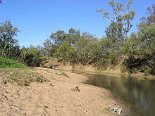
Walgett is a town in northern New South Wales, Australia, and the seat of Walgett Shire. It is near the junctions of the Barwon and Namoi Rivers and the Kamilaroi and Castlereagh Highways. In 2016, Walgett had a population of 2,145.

<span class="mw-page-title-main">Kamilaroi Highway</span>

Kamilaroi Highway is a 605-kilometre (376 mi) state highway located in the north-western region of New South Wales, Australia, and links Bourke via Walgett and Narrabri to Willow Tree. The highway is named after the Kamilaroi Indigenous Australian people who live in the area.

<span class="mw-page-title-main">Boggabri</span> Town in New South Wales, Australia

Boggabri is a small town in north-eastern New South Wales, Australia. It is part of Narrabri Shire and lies between Gunnedah and Narrabri on the Kamilaroi Highway. At the 2016 census, the town had a population of 856 people.

<span class="mw-page-title-main">Wee Waa</span> Town in New South Wales, Australia

Wee Waa is a town located on the north-western slopes of the New England region in New South Wales, Australia. The town is within the Narrabri Shire local government area and is on the Namoi River. Wee Waa is 41 kilometres (25 mi) north-west of Narrabri and 571 kilometres (355 mi) northwest of Sydney on the Kamilaroi Highway. At the 2016 census, Wee Waa had a population of 2,080.

Group 4 is a rugby league competition in the New England and north west area of New South Wales, run under the auspices of the Country Rugby League.

<span class="mw-page-title-main">Narrabri Shire</span> Local government area in New South Wales, Australia

Narrabri Shire is a local government area in the North West Slopes region of New South Wales, Australia. The Shire is located adjacent to the Namoi River and the Newell and Kamilaroi Highways.

The North West Slopes region of New South Wales, Australia, refers generally to the area west of the Northern Tablelands, to the north of the Central West region and to the east of the Far West region. Despite its name, the region is in north-central New South Wales, corresponding generally to the Australian Bureau of Meteorology's forecast area of North West Slopes and Plains. The administrative areas of the region include the city of Tamworth, Gunnedah, Moree, Narrabri and Inverell.

<span class="mw-page-title-main">Split Rock Dam</span> Dam in North West Slopes, New South Wales

Split Rock Dam is a minor ungated concrete faced rock fill embankment dam with concrete chute spillway across the Manilla River upstream of Manilla in the north-western slopes region of New South Wales, Australia. The dam's purpose includes flood mitigation, irrigation, water supply and conservation. The impounded reservoir is called Split Rock Reservoir.

<span class="mw-page-title-main">Nandewar Range</span>

The Nandewar Range, a mountain range that is part of the Great Dividing Range, is located in the North West Slopes region of New South Wales, Australia. The range is situated approximately 30 km (19 mi) east of the township of Narrabri.

<span class="mw-page-title-main">Manilla River</span> River in New South Wales, Australia

Manilla River, a perennial stream that is part of the Namoi catchment within the Murray–Darling basin, is located in the Northern Tablelands district of New South Wales, Australia.

<span class="mw-page-title-main">Mooki River</span> River in New South Wales, Australia

Mooki River, a perennial stream that is part of the Namoi catchment within the Murray–Darling basin, is located in the Northern Tablelands district of New South Wales, Australia.

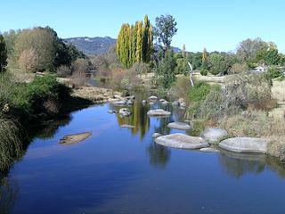
Somerton is a village between Tamworth and Gunnedah on the Oxley Highway in northern New South Wales Australia. In the 2016 census, there were 277 people in Somerton. Somerton Village adjoins the plentiful Peel River.

<span class="mw-page-title-main">Cobrabald River</span> River in New South Wales, Australia

Cobrabald River, a mostly perennial river that is part of the Namoi catchment within the Murray–Darling basin, is located in the Northern Tablelands district of New South Wales, Australia.

References

  1. 1 2 "Namoi River". Geographical Names Register (GNR) of NSW. Geographical Names Board of New South Wales . Retrieved 10 February 2013. OOjs UI icon edit-ltr-progressive.svg
  2. 1 2 3 "Map of Namoi River". Bonzle.com. Retrieved 10 February 2013.
  3. "Namoi River Catchment Overview". Archived from the original on 4 September 2007. Retrieved 22 January 2008.
  4. Threatened Species of the New England Tablelands & NW Slopes of NSW. NSW National Parks & Wildlife Service. 2003. ISBN   0-7313-6673-5.

Coordinates: 30°00′S148°07′E / 30.000°S 148.117°E / -30.000; 148.117