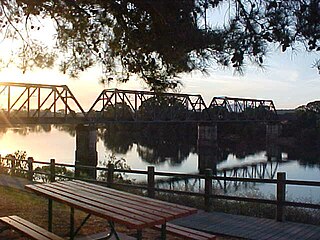
| Pappinbarra River Pappinbarra Creek, Left Arm of Pappinbarra Creek [1] | |
|---|---|
| Location | |
| Country | Australia |
| State | New South Wales |
| IBRA | NSW North Coast |
| District | Mid North Coast |
| local government area | Port Macquarie-Hastings |
| Physical characteristics | |
| Source | Mount Boss, Gibraltar Range |
| • location | northwest of the hamlet of Pappinbarra Junction |
| • elevation | 392 m (1,286 ft) |
| Mouth | confluence with the Hastings River |
• location | near Beechwood |
• elevation | 16 m (52 ft) |
| Length | 62 km (39 mi) |
| Basin features | |
| River system | Hastings River catchment |
| National Park | Werrikimbe NP |
| [2] | |
Pappinbarra River, a perennial stream of the Hastings River catchment, is located in the Mid North Coast region of New South Wales, Australia.
Pappinbarra River rises below Mount Boss on the slopes of the Gibraltar Range within the Werrikimbe National Park, northwest of the hamlet of Pappinbarra Junction, and flows generally southeast before reaching its confluence with the Hastings River, near Beechwood. The river descends 376 metres (1,234 ft) over its 58 kilometres (36 mi) course. [2]

Hastings River, an open and trained intermediate wave dominated barrier estuary, is located in the Northern Tablelands and Mid North Coast districts of New South Wales, Australia.
Dawson River, a perennial river of the Manning River catchment, is located in the Mid North Coast district of New South Wales, Australia.

Belubula River, a perennial river that is part of the Lachlan catchment within the Murray–Darling basin, is located in the central west region of New South Wales, Australia.
Doyles River, a perennial river of the Hastings River catchment, is located in the Mid North Coast region of New South Wales, Australia.

Ellenborough River, a perennial river of the Hastings River catchment, is located in the Mid North Coast region of New South Wales, Australia.

Nowendoc River, a perennial river of the Manning River catchment, is located in the Northern Tablelands and Mid North Coast districts of New South Wales, Australia.
Rowleys River, a perennial river of the Manning River catchment, is located in the Northern Tablelands and Mid North Coast districts of New South Wales, Australia.
Stewarts River, a mostly perennial stream of the Mid North Coast region, is located in New South Wales, Australia.
Tobins River, a perennial stream of the Hastings River catchment, is located in the Northern Tablelands and Mid North Coast districts of New South Wales, Australia.

Forbes River, a perennial river of the Hastings River catchment, is located in the Mid North Coast region of New South Wales, Australia.
Maria River, a watercourse of the Hastings River catchment, is located in the Mid North Coast region of New South Wales, Australia.
Kalang River, a perennial river of the Bellinger River catchment, is located in the Mid North Coast region of New South Wales, Australia.
The Beaury Creek, a perennial stream of the Clarence River catchment, is located in the Northern Rivers region of New South Wales, Australia.
The Christmas Creek, a perennial stream that is part of the Macleay River catchment, is located in the Mid North Coast region of New South Wales, Australia.
The Pipers Creek, a watercourse that is part of the Hastings River catchment, is located in the Mid North Coast region of New South Wales, Australia.
The Ralfes Creek, a perennial stream that is part of the Hastings River catchment, is located in the Mid North Coast region of New South Wales, Australia.
Dingo Creek, a perennial stream of the Manning River catchment, is located in the Mid North Coast region of New South Wales, Australia.
Caparra Creek, a perennial stream of the Manning River catchment, is located in the Mid North Coast region of New South Wales, Australia.
Burns Creek, a watercourse of the Manning River catchment, is located in the Northern Tablelands region of New South Wales, Australia.
Moonan Brook, a mostly perennial stream of the Hunter River catchment, is located in the Hunter region of New South Wales, Australia.
Coordinates: 31°21′S152°28′E / 31.350°S 152.467°E
| This New South Wales river or creek related article is a stub. You can help Wikipedia by expanding it. |