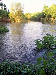
| Wangat River Little River [1] | |
|---|---|
| Location | |
| Country | Australia |
| State | New South Wales |
| Region | NSW North Coast (IBRA), Hunter |
| Local government area | Dungog |
| Physical characteristics | |
| Source | Gloucester Tops |
| • location | near Gloucester Gap, Barrington Tops NP |
| • elevation | 1,070 m (3,510 ft) |
| Mouth | confluence with Chichester River |
• location | southeast of Chichester |
• elevation | 162 m (531 ft) |
| Length | 20 km (12 mi) |
| Basin features | |
| River system | Hunter River catchment |
| [1] [2] | |
Wangat River, a perennial river of the Hunter River catchment, is located in the Hunter region of New South Wales, Australia.
Wangat River rises below Gloucester Tops, west of Gloucester Gap, within Barrington Tops National Park, and flows generally southeast and south before reaching its confluence with the Chichester River, southeast of Chichester within Lake Chichester. The river descends 906 metres (2,972 ft) over its 20 kilometres (12 mi) course. [2]

Paterson River, a perennial river that is part of the Hunter River catchment, is located in the Hunter and Mid North Coast regions of New South Wales, Australia.

Avon River, a perennial stream of the Manning River catchment, is located in the Upper Hunter region of New South Wales, Australia.

Barrington River, a perennial river of the Manning River catchment, is located in the Upper Hunter district of New South Wales, Australia.

Chichester Dam is a minor concrete gravity dam across the Chichester and Wangat rivers, upstream of Dungog, in the Hunter Region of New South Wales, Australia. The dam's main purpose is water supply for the Lower Hunter region. A mini hydro-electric power station operates at times of peak flow and is connected to the national grid. The impounded reservoir is Lake Chichester.

Karuah River, an open semi-mature tide dominated drowned valley estuary is located in the Mid North Coast and Hunter regions of New South Wales, Australia.

Barnard River, a perennial river of the Manning River catchment, is located in the Northern Tablelands and Mid North Coast districts of New South Wales, Australia.
Bow River, a partly perennial stream of the Hunter River catchment, is located in the Hunter district of New South Wales, Australia.
Bowman River, a perennial river of the Gloucester River catchment, is located in the Upper Hunter district of New South Wales, Australia.

The Chichester River, a perennial stream of the Hunter River catchment, is located in the Hunter region of New South Wales, Australia.
Cobark River, a perennial river of the Manning River catchment, is located in the Upper Hunter district of New South Wales, Australia.

Cooplacurripa River, a perennial river of the Manning River catchment, is located in the Northern Tablelands and Mid North Coast districts of New South Wales, Australia.
Curricabark River, a perennial river of the Manning River catchment, is located in the Northern Tablelands region of New South Wales, Australia.

Gloucester River, a perennial river and major tributary of the Manning River catchment, is located in the Mid North Coast hinterland New South Wales, Australia.
Kerripit River, a perennial river of the Manning River catchment, is located in the Upper Hunter district of New South Wales, Australia.
Moppy River, a perennial river of the Manning River catchment, is located in the Upper Hunter district of New South Wales, Australia.

Telegherry River, a perennial river of the Mid-Coast Council system, is located in the Mid North Coast and Upper Hunter regions of New South Wales, Australia.
Wards River, a mostly perennial river of the Mid-Coast Council system, is located in the Mid North Coast and Upper Hunter regions of New South Wales, Australia.

The Williams River is a perennial stream that is a tributary of the Hunter River, in the Hunter Region of New South Wales, Australia.

Congewai Creek, a watercourse of the Hunter River catchment, is located in the Hunter district of New South Wales, Australia.
Pages Creek, a mostly perennial stream of the Hunter River catchment, is located in the Hunter region of New South Wales, Australia.
Coordinates: 32°14′S151°41′E / 32.233°S 151.683°E