
The City of Lake Macquarie is a local government area in Greater Newcastle and part of the Hunter Region in New South Wales, Australia. It was proclaimed a city from 7 September 1984. The area is situated adjacent to the city of Newcastle and is part of the Greater Newcastle Area. The city is approximately 150 km (93 mi) north of Sydney. One of its major tourist attractions is its lake, also named Lake Macquarie.

Dungog is a country town on the Williams River in the Hunter Region of New South Wales, Australia. Located in the middle of dairy and timber country, it is the centre of the Dungog Shire local government area and at the 2016 census it had a population of 2,025 people. The area includes the Fosterton Loop, 22 kilometres (14 mi) of road, used in the annual Pedalfest. A small portion of Dungog lies in the Mid-Coast Council LGA.

Paterson is a small township in the lower Hunter Region of New South Wales, Australia. Located within Dungog Shire, it is situated on the Paterson River. It is in the middle of what was once dairy, timber and citrus country and is now more significantly a feeder town for the nearby mining industry in the Upper Hunter and the city of Newcastle. It was named after one of the first known Europeans in the area was Colonel William Paterson in 1801 surveyed the area beside the river.

Port Stephens Council is a local government area in the Hunter Region of New South Wales, Australia. The area is just north of Newcastle and is adjacent to the Pacific Highway which runs through Raymond Terrace, the largest town and Council seat. The area is named after Port Stephens, which is the major geographical feature of the area. It extends generally from the Hunter River in the south, to near Clarence Town in the north, and from the Tasman Sea in the east, to just south of Paterson in the west. The mayor of Port Stephens Council is Ryan Palmer. Port Stephens is about two and a half hours north of Sydney.

Woodville is a rural suburb in the Hunter Region of New South Wales, Australia that is shared between the Port Stephens and Maitland local government areas (LGA). Most of the suburb lies to the east of the Paterson River in the Port Stephens LGA while a small area of approximately 1.3 square kilometres (0.5 sq mi), to the west of the Paterson, is within the boundaries of the Maitland LGA.

Gloucester Shire was a local government area in the Mid North Coast and Upper Hunter regions of New South Wales, Australia. The Shire was situated adjacent to the Bucketts Way and the North Coast railway line.

The City of Maitland is a local government area in the lower Hunter region of New South Wales, Australia. The area is situated adjacent to the New England Highway and the Hunter railway line.

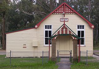
Dungog Shire is a local government area in the Hunter region of New South Wales, Australia. The Shire is situated adjacent to the Barrington Tops and consists predominantly of very rugged to hilly country which becomes less rugged from north to south.
Thornton is a suburb in the City of Maitland, New South Wales, Australia. It is bisected by the New England Highway.
Glen Oak is a small community in the Hunter Region of New South Wales, Australia, shared between the Port Stephens and Dungog local government areas (LGA). Approximately two thirds of the suburb's 45.1 square kilometres (17.4 sq mi) is located within the Port Stephens LGA while the remaining third, which is sparsely populated, is located in Dungog Shire.

East Seaham is a primarily rural suburb of the Port Stephens local government area in the Hunter Region of New South Wales, Australia. It is situated on the east bank of the Williams River, opposite Glen Oak and Seaham. At the 2011 census, the population of East Seaham and the adjacent suburb of Balickera was 359, with the two suburbs having an average population density of 5.5/km2 (14/sq mi).
Heatherbrae is a suburb of the Port Stephens local government area in the Hunter Region of New South Wales, Australia. The suburb lies to the east of the Hunter River and to the south of the town of Raymond Terrace. It is bisected by the Pacific Highway. At the 2016 census it had a population of 512. Most of the population lives to the west of the Pacific Highway in a housing subdivision while some residents live to the east of the highway in a semi-industrial area. Remaining residents live in rural and semi-rural areas adjacent to the highway and throughout the rest of the suburb. The Worimi people are the traditional owners of the Port Stephens area. In 2016 the median age of the population was 54. 80% were born in Australia, 2.6% New Zealand, 2.2% Pakistan, 2.0% England, 1% Germany and 0.8% China. In terms of religion, 26.1% were Anglican, 21.4% No Religion, 19.0% Catholic, 12.0% Not Stated and 4.5% Uniting Church. In terms of languages spoken other than English, 2.2% speak Urdu, 0.8% Tagalog, 0.6% Italian, 0.6% Serbo-Croatian/Yugoslavian and 0.6% Bengali.

Stratford is a rural locality in the Mid-Coast Council local government area in the Hunter Region of New South Wales, Australia. The largest population centre in the area is the town of Stratford, which is approximately 14 kilometres (9 mi) south of Gloucester and 109 km (68 mi) north of Newcastle. Stratford, which is next to the Avon River, is on Bucketts Way, 66 km (41 mi) from the Pacific Highway, the nearest major highway.

Vacy is a locality of the Dungog Shire local government area in the Hunter Region of New South Wales, Australia. Situated between Gresford and Paterson, it includes the village of Vacy, which was founded in the 1820s as a private town by John Cory, the owner of a large land grant. Vacy began to prosper in the 1850s and was a busy town by the 1870s. It remained a private town until it was sold in 1927 by the Cory family. The village is located at the junction of the Paterson and Allyn rivers. At the 2011 census, Vacy had a population of 547.
Martins Creek is a small country town located between Dungog and Maitland in the Hunter Region of Australia.

Largs is a developing township adjacent to Bolwarra Heights and is a suburb in the City of Maitland in the Hunter Region of New South Wales, Australia. It is located on the eastern side of the Hunter River, 8 km north of the Maitland CBD. As of 2018, the Maitland LGA is seeing new development along elevated areas adjacent to the river flood plain. Maitland is an established city. Schools and all normal community facilities are available. The City of Maitland covers an area of 390 square kilometres.
Oakhampton is a suburb in the City of Maitland in the Hunter Region of New South Wales, Australia.
Maitland Vale is a suburb in the City of Maitland in the Hunter Region of New South Wales, Australia.
Melville is a locality in the City of Maitland in the Hunter Region of New South Wales, Australia.
Rosebrook is a locality in the City of Maitland in the Hunter Region of New South Wales, Australia.
