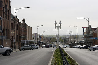
Bathurst is a city in the Central Tablelands of New South Wales, Australia. Bathurst is about 200 kilometres (120 mi) west-northwest of Sydney and is the seat of the Bathurst Regional Council. Bathurst is the oldest inland settlement in Australia and had a population of 37,191 in June 2019.
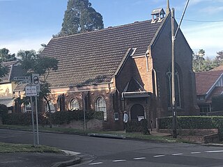
Artarmon is a suburb on the lower North Shore of Sydney, in the state of New South Wales, Australia, 9 kilometres north-west of the Sydney central business district, in the local government area of the City of Willoughby.
Kingswood is a suburb in western Sydney, in the state of New South Wales in Australia. It is 52 kilometres west of the Sydney central business district, in the local government area of the City of Penrith. There are various other locations within the state of New South Wales that are also called Kingswood, and is often confused with the nearby suburb of Kingswood Park.

Werrington is a suburb of Sydney, in the state of New South Wales, Australia. It is 49.3 kilometres (30.6 mi) west of the Sydney central business district, in the local government area of the City of Penrith and is part of the Greater Western Sydney region.

St Marys is a suburb in western Sydney, in the state of New South Wales, Australia. It is 45 kilometres west of the Sydney central business district, in the local government area of the City of Penrith.

Mount Kuring-gai is an outer suburb of Northern Sydney, in the state of New South Wales, Australia. Mount Kuring-gai is located 31 kilometres north-west of the Sydney central business district, in the local government area of Hornsby Shire.
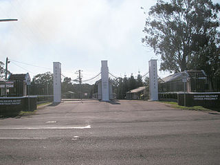
Ingleburn is a suburb of Sydney, in the state of New South Wales, Australia 40 kilometres south-west of the Sydney central business district, in the local government area of City of Campbelltown. It is part of the Macarthur region. Ingleburn is located approximately halfway between the two commercial centres of Liverpool and Campbelltown.
Berowra Heights is an outer suburb of Northern Sydney, in the state of New South Wales, Australia 39 kilometres north of the Sydney central business district, in the local government area of Hornsby Shire. Berowra Heights is north-west of the suburb of Berowra and east of Berowra Waters.

Kelso is a suburb of Bathurst, New South Wales, Australia, in the Bathurst Regional Council area.
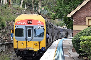
The Blue Mountains Line (BMT) is an inter urban commuter rail service operated by NSW TrainLink serving the Blue Mountains region of New South Wales, Australia. The line travels west from Sydney to the major town of Katoomba and on to Mount Victoria, Lithgow and Bathurst. Mount Victoria is the terminus for most electric services, but some services terminate at Lithgow instead. Two express services per day in each direction, known as the Bathurst Bullet, extend to the regional city of Bathurst, which is supplemented by road coaches connecting Bathurst to Lithgow. Due to electrification limits at Lithgow, the Bathurst Bullet is run using the Endeavour railcars, which operate on diesel. The Blue Mountains Line operates over a mostly duplicated section of the Main Western line. As such, the tracks are also traversed by the Central West XPT, Outback Xplorer and Indian Pacific passenger services and by freight trains.
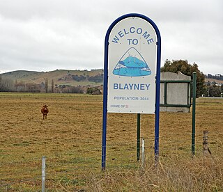
Blayney is a farming town and administrative centre with a population of 3,378 in 2016, in the Central West region of New South Wales, Australia. Situated on the Mid-Western Highway about 240 km (150 mi) west of Sydney, 35 km (22 mi) west of Bathurst and 863 m (944 yd) above sea-level, Blayney is the seat of Blayney Shire Council.

Whitton is a small town located in Leeton Shire in the Australian state of New South Wales and is located 23km west of the Leeton township. Founded in 1850, it is named after John Whitton (1820–98), Engineer-in-Charge of the New South Wales Government Railways. The railway reached Whitton in 1881. At the 2016 census, Whitton had a population of 496.

Ben Lomond is a village on the Northern Tablelands in the New England region of New South Wales, Australia. The village is situated 6 km off the New England Highway between Armidale and Glen Innes. It was located in the Guyra Shire local government area until that council was amalgamated into the Armidale Regional Council on 12 May 2016, with parts of the surrounding district in Glen Innes Severn Shire and Inverell Shire. It is primarily a farming area, with most of the residents involved in sheep, cattle and grain farming.

Stuart Town, formerly known as Ironbark, is a small town on the Central Western Slopes of New South Wales, Australia within Dubbo Regional Council. It is located 317 kilometres (197 mi) north-west of the state capital, Sydney. At the 2011 census, Stuart Town had a population of 487. The area around the town is rich in cattle farming and orchards, so the town serves as a service centre to that area.
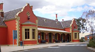
Bathurst railway station is a heritage-listed railway station at Havannah Street, Bathurst, Bathurst Region, New South Wales, Australia. It is situated on the Main Western line and serves the city of Bathurst. It was added to the New South Wales State Heritage Register on 2 April 1999.
Bathurst Regional Council is a local government area in the Central West region of New South Wales, Australia. The area is located adjacent to the Great Western Highway, Mid-Western Highway, Mitchell Highway and the Main Western railway line. At the 2016 census, the Bathurst Region had a population of 41,300.

Tarana railway station is a heritage-listed railway station located on the Main Western line in Tarana, City of Lithgow, New South Wales, Australia. It is also known as the Tarana Railway Station and yard group. The property was added to the New South Wales State Heritage Register on 2 April 1999.
Georges Plains is a locality in the Bathurst Region of New South Wales, Australia. It had a population of 248 people as of the 2016 census.

Raglan railway station is a heritage-listed disused railway station located on the Main Western railway at Raglan in the Bathurst Region local government area of New South Wales, Australia. The former station was added to the New South Wales State Heritage Register on 2 April 1999.
Whittingham is a locality in the Singleton Council region of New South Wales, Australia. It had a population of 364 as of the 2016 census.
