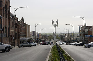
Bathurst is a city in the Central Tablelands of New South Wales, Australia. Bathurst is about 200 kilometres (120 mi) west-northwest of Sydney and is the seat of the Bathurst Regional Council. Founded in 1815, Bathurst is the oldest inland settlement in Australia and had a population of 37,396 in 2021.

Great Western Highway is a 202-kilometre-long (126 mi) state highway in New South Wales, Australia. From east to west, the highway links Sydney with Bathurst, on the state's Central Tablelands. The highway also has local road names between the Sydney city centre and Parramatta, being: Broadway from Haymarket to Chippendale, Parramatta Road from Chippendale to Parramatta, and Church Street through Parramatta.

Kelso is a suburb of Bathurst, New South Wales, Australia, in the Bathurst Regional Council area.

Hill End is a former gold mining town in New South Wales, Australia. The town is located in the Bathurst Regional Council local Government area.
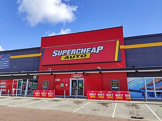
Supercheap Auto is an Australian automotive parts and accessories retailer. It was founded in 1972, operating as a mail-order business and opened its first store in Brisbane in 1974. It now has 300 stores across Australia and New Zealand.

Sofala is a village in New South Wales, Australia, 255 kilometres (158 mi) north-west of Sydney, within Bathurst Regional Council. It is located beside the Turon River. Sofala is just off the Bathurst-Ilford Road, with only local traffic through the town itself. At the 2006 census, Sofala had a population of 208.
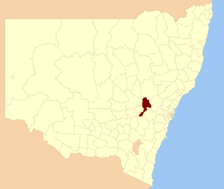
Bathurst Regional Council is a local government area in the Central West region of New South Wales, Australia. The area is located adjacent to the Great Western Highway, Mid-Western Highway, Mitchell Highway and the Main Western railway line. At the 2021 census, the Bathurst Region had a population of 43,567.

The Shire of Mount Magnet is a local government area in the Mid West region of Western Australia, about 570 kilometres (354 mi) north-northeast of the state capital, Perth. The Shire covers an area of 13,692 square kilometres (5,287 sq mi), and its seat of government is the town of Mount Magnet. The Shire of Mount Magnet current president is James (Jim) McGorman.
The Kelso High Campus of Denison College of Secondary Education is a government-funded co-educational comprehensive secondary day school campus, located in Kelso, in the Central West region of New South Wales, Australia.
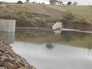
Ben Chifley Dam, or Chifley Dam, is a rock and earth-fill embankment dam across the Campbells River in the central west region of New South Wales, Australia. The main purpose of the dam is to supply potable water to the city of Bathurst.
West Bathurst is a suburb of Bathurst in the Bathurst Region, New South Wales, Australia.
Perthville is a small town in New South Wales, Australia. The town is located on the Central Tablelands, approximately 10 kilometres (6.2 mi) from the regional city of Bathurst. The town has evolved over time due to road improvements to be a satellite suburb of Bathurst.
Eglinton is a northern suburb of Bathurst, New South Wales, Australia, in the Bathurst Region.
Raglan is a locality in the Bathurst Region of New South Wales, Australia. It was named after FitzRoy Somerset, 1st Baron Raglan, commander-in-chief of the Allied forces in the Crimean War from 1850 to 1855. It had a population of 1,199 people as of the 2016 census.
Mount Panorama is a suburb of Bathurst, New South Wales, Australia, in the Bathurst Region. The suburb of Mount Panorama is the site of the Mount Panorama Circuit a street racing track.
South Bathurst is a suburb of Bathurst, New South Wales, Australia, in the Bathurst Region.
Mitchell is a suburb of Bathurst, New South Wales, Australia, in the Bathurst Region.
Robin Hill is a suburb of Bathurst, New South Wales, Australia, in the Bathurst Region.
Forest Grove is a suburb of Bathurst, New South Wales, Australia, in the Bathurst Region.
Windradyne is a suburb of Bathurst, New South Wales, Australia, in the Bathurst Region.

