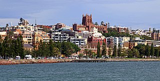
Newcastle, also commonly referred to as Greater Newcastle is a regional metropolitan area and the second-most-populous district of New South Wales, Australia. It includes the cities of Newcastle and Lake Macquarie and it is the hub of the Lower Hunter region, which includes most parts of the cities of Newcastle, Lake Macquarie, Maitland, Cessnock, and Port Stephens Council. Newcastle is also known by its colloquial nickname, Newy.
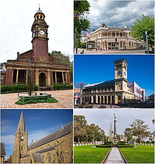
Maitland is a city in the Hunter Valley of New South Wales, Australia and the seat of Maitland City Council, situated on the Hunter River approximately 166 kilometres (103 mi) by road north of Sydney and 35 km (22 mi) north-west of Newcastle. It is on the New England Highway approximately 17 km (11 mi) from its origin at Hexham.

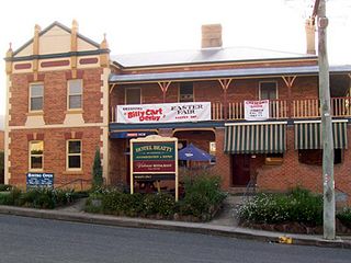
Branxton is a town in the Hunter Region of New South Wales, Australia. Branxton is 171 kilometres (106 mi) north of Sydney via the Sydney–Newcastle Freeway and New England Highway. Branxton is located mostly in the City of Cessnock, but part of it is in Singleton Shire.
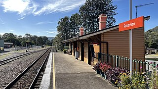
Paterson railway station is located on the North Coast line in New South Wales, Australia. It serves the town of Paterson. It is serviced by NSW TrainLink Hunter line services travelling between Newcastle and Dungog. The station opened on 14 August 1911, and its original wooden station building is still in place.

Dungog is a country town on the Williams River in the Hunter region and a small part of the Mid North Coast region of New South Wales, Australia. Located in the middle of dairy and timber country, it is the centre of the Dungog Shire Local Government Area and at the 2021 Census it had a population of 2,169 people. The area includes the Fosterton Loop, 22 kilometres (14 mi) of road, used in the annual Pedalfest. A small portion of Dungog lies in the Mid-Coast Council Local Government Area.

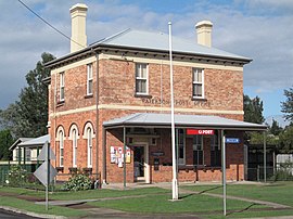
Morpeth is a suburb of the city of Maitland in the Hunter Region of New South Wales, Australia. It is on the southern banks of the Hunter River at the border between the City of Maitland and Port Stephens Council LGAs. The major population centre, where almost all residents of the suburb reside, is the historical town of Morpeth which takes its name from Morpeth, Northumberland, near Newcastle upon Tyne, in England.

Civic railway station was located on the Newcastle line in New South Wales, Australia. It served the Civic part of Newcastle's central business district, opening on 22 December 1935. The station had the smallest signal box in the state to control the Merewether Street level crossing. The signal box closed in July 1992. Civic station closed on 25 December 2014, when the Newcastle line was truncated to terminate at Hamilton for the construction of Newcastle Interchange and the Newcastle Light Rail. Civic light rail stop is located in Hunter Street, immediately adjacent to the old station.

Seaham is a suburb of the Port Stephens local government area in the Hunter Region of New South Wales, Australia. It is located on the Williams River which flows into the Hunter River 14.6 km (9.1 mi) downstream from Seaham village at Raymond Terrace.

Brandy Hill is a suburb of the Port Stephens local government area in the Hunter Region of New South Wales, Australia. It was originally farmland but was subdivided in the 1980s and now supports a population of almost 700 people living on large, primarily residential, blocks. It overlooks working farmland and offers superb views of the greater Morpeth area, with visibility extending to Maitland.

Port Stephens Council is a local government area in the Hunter Region of New South Wales, Australia. The area is just north of Newcastle and is adjacent to the Pacific Highway which runs through Raymond Terrace, the largest town and Council seat. The area is named after Port Stephens, which is the major geographical feature of the area. It extends generally from the Hunter River in the south, to near Clarence Town in the north, and from the Tasman Sea in the east, to just south of Paterson in the west. The mayor of Port Stephens Council is Ryan Palmer. Palmer was caught in a major scandal in 2022 following the purchase of an $86,000 Ford Ranger for mayoral and personal use. Port Stephens is about two and a half hours north of Sydney.

Woodville is a rural suburb in the Hunter Region of New South Wales, Australia that is shared between the Port Stephens and Maitland local government areas (LGA). Most of the suburb lies to the east of the Paterson River in the Port Stephens LGA while a small area of approximately 1.3 square kilometres (0.5 sq mi), to the west of the Paterson, is within the boundaries of the Maitland LGA.
East Gresford is a village in the Hunter Region of New South Wales, Australia in Dungog Shire. The village is located 192 kilometres (119 mi) north of Sydney and the nearest major centres are Singleton some 42 kilometres (26 mi) southwest and Maitland to the south. In the 2006 census, it had a population of 289.

Clarence Town is both a primarily rural locality and a township in the Dungog Shire local government area in the Hunter Region of New South Wales, Australia. It is 193 kilometres (120 mi) north of Sydney, 54 km (34 mi) north-north-west of Newcastle, and 28 km (17 mi) from the Pacific Highway at Raymond Terrace. The locality is bisected by the Williams River. The township sits just to the west of the river about 32 km (20 mi) upstream from where it flows into the Hunter River at Raymond Terrace.
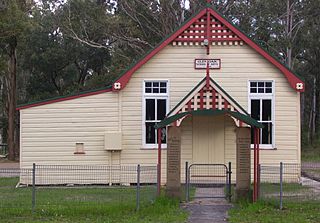
Glen Oak is a small community in the Hunter Region of New South Wales, Australia, shared between the Port Stephens and Dungog local government areas (LGA). Approximately two thirds of the suburb's 45.1 square kilometres (17.4 sq mi) is located within the Port Stephens LGA while the remaining third, which is sparsely populated, is located in Dungog Shire.
Duns Creek is a rural residential suburb in the Hunter Region of New South Wales, Australia, located near the historic village of Paterson in the north-western corner of the Port Stephens Council local government area.
Martins Creek is a small country town located between Dungog and Maitland in the Hunter Region of Australia.

Largs is a developing township adjacent to Bolwarra Heights and is a suburb in the City of Maitland in the Hunter Region of New South Wales, Australia. It is located on the eastern side of the Hunter River, 6 km north of the Maitland CBD. As of 2018, the Maitland LGA is seeing new development along elevated areas adjacent to the river flood plain. Maitland is an established city. Schools and all normal community facilities are available. The City of Maitland covers an area of 390 square kilometres.

Clarence Town Courthouse is a heritage-listed former courthouse and now museum at 49 Grey Street, Clarence Town, Dungog Shire, New South Wales, Australia. It was built from 1868 to 1869. It was added to the New South Wales State Heritage Register on 2 April 1999.

Tocal Homestead is a heritage-listed homestead at Tocal Road, Paterson, Dungog Shire, New South Wales, Australia. The original 1845 homestead was designed by William Moir, while an 1867 barn was designed by Edmund Blacket. The property is owned by the C. B. Alexander Foundation. It was added to the New South Wales State Heritage Register on 2 April 1999. The Tocal College complex, built on the former homestead grounds from the 1960s, is separately heritage-listed.
Oakhampton is a suburb in the City of Maitland in the Hunter Region of New South Wales, Australia.