Colwinston is both a village and a community in the Vale of Glamorgan, Wales, approximately 4 miles (6.4 km) southeast of the centre of Bridgend and 21 miles (34 km) west of the centre of Cardiff. The village is located within 1⁄2 mile (0.80 km) of the A48. The population in 2005 was approximately 400 but with recent building development, the population is now estimated at over 600 people.

Houston, is a village in the council area of Renfrewshire and the larger historic county of the same name in the west central Lowlands of Scotland.
Redmarshall is a village and civil parish in the borough of Stockton-on-Tees and ceremonial county of County Durham, England. The population as of the 2011 census was 287. Redmarshall is situated to the west of Stockton-on-Tees, just north of the A66 road which is one of the main trunk routes through Teesside. It is home to the Church of Saint Cuthbert and a pub called The Ship. It has a green in the centre and roads such as Church Lane, Coniston Crescent and Windermere Avenue, named after waters in the Lake District. Ferguson Way is the newest addition to the village. A small wood is a short way out of the village and down a bank past Ferguson Way. There is a new housing estate called the langtons being built on the old remains of the mains care home.

Landbeach is a small fen-edge English village about three miles (5 km) north of Cambridge. The parish covers an area of 9 km2 (3.5 sq mi).

Bishop's Hull is a village and civil parish in Somerset, England, in the western suburbs of Taunton. It includes the areas of Rumwell, Rumwell Park, Roughmoor and Longaller and is close to the River Tone. The parish, which includes the hamlet of Netherclay, has a population of 2,975 in total.

Brantham is a village and civil parish in the Babergh district of Suffolk, England. It is located close to the River Stour and the border with Essex, around 2 miles (3 km) north of Manningtree, and around 9 miles (14 km) southwest of Ipswich.

Ollerton and Boughton is a civil parish in the Newark and Sherwood district of Nottinghamshire, England. The main settlements are the town of Ollerton and the villages of New Ollerton and Boughton. The civil parish was formed in 1996, when the civil parishes of Ollerton and Boughton were merged. The population of the civil parish at the time of the 2011 census was recorded as 9,840, and this increased to 11,089 residents at the 2021 census.

Doddinghurst is a village and civil parish in the Borough of Brentwood, in south Essex. It is 3 miles (5 km) to the north of Brentwood.

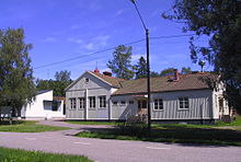
A village hall is a public building in a rural or suburban community which functions as a community centre without a religious affiliation.

Kilburn is a village and civil parish in the English county of Derbyshire, known as Kilbourne until around 100 years ago. The population of the civil parish taken at the 2011 Census was 3,618.

Hinxton is a village in South Cambridgeshire, England.

South Moreton is a village and civil parish in South Oxfordshire, England, about 3 miles (5 km) east of Didcot, 4 miles (6.4 km) west of Wallingford, and 7 miles (11 km) south of Abingdon. It is only separated by the Great Western Railway cutting from its twin village of North Moreton, a quarter of a mile to the north. Mortune took its name in the Domesday Book from the houses on the ridge above the moor of Hakka's Brook, and was part of Berkshire until the 1974 boundary changes. The 2011 Census recorded the parish population as 420.

Mellor is a village situated in the Borough of Ribble Valley in Lancashire, England. The population of the civil parish at the census of 2011 was 2,262.

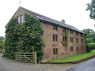
Saltford is a large English village and civil parish in the Bath and North East Somerset unitary authority, Somerset. It lies between the cities of Bristol and Bath, and adjoins Keynsham on the same route. Saltford Manor House claims to be the oldest continuously occupied dwelling in England.
Utkinton is a village and former civil parish, now in the parishes of Utkinton and Cotebrook, in the unitary authority area of Cheshire West and Chester and the ceremonial county of Cheshire, England. It is approximately 2 miles (3.2 km) north of Tarporley, 8 miles (13 km) west of Winsford and 9 miles (14 km) east of Chester. The upper part of Utkinton is known as 'Quarry Bank'. Utkinton is at the heart of the local farming community. The area is also on the Sandstone Trail.

Shimpling is a village and civil parish in south Suffolk, England. About 7 miles (11 km) from Bury St Edmunds, it is part of Babergh district. The village is formed from two halves, the newer Shimpling Street and about 2 miles (3 km) away the old village of Shimpling. The village has a Church of England parish church, where supermodel Claudia Schiffer and film producer Matthew Vaughn were married on 25 May 2002.

East Dean is a village and civil parish in the District of Chichester in West Sussex, England. The village is in a valley in the South Downs, 5+1⁄2 miles (9 km) north-northeast of Chichester on a narrow road between Singleton on the A286 and Upwaltham on the A285 road. The village pond is considered to be the source of the River Lavant.

Lawshall is a village and civil parish in Suffolk, England. Located around a mile off the A134 between Bury St Edmunds and Sudbury, it is part of Babergh district. The parish has nine settlements comprising the three main settlements of The Street, Lambs Lane and Bury Road along with the six small hamlets of Audley End, Hanningfield Green, Harrow Green, Hart's Green, Hibb's Green and Lawshall Green.

Askam and Ireleth is a civil parish close to Barrow-in-Furness in Westmorland and Furness, Cumbria, England. Historically part of Lancashire, it originally consisted of two separate coastal villages with different origins and histories which, in recent times, have merged to become one continuous settlement. In the 2001 census the parish had a population of 3,632, reducing at the 2011 census to 3,462.
St Mary Out Liberty is a community in the southeast of Pembrokeshire, Wales. The community was established in 1974 under changes in local government organisation and has its own community council. It is included, with St Mary In Liberty, in the parish of Tenby. The community includes the villages of New Hedges, Gumfreston plus small parts of Tenby and Saundersfoot.