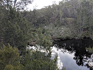
Goulburn River, a perennial river of the Hunter River catchment, is located in the Upper Hunter region of New South Wales, Australia.

The Lachlan River is an intermittent river that is part of the Murrumbidgee catchment within the Murray–Darling basin, located in the Southern Tablelands, Central West, and Riverina regions of New South Wales, Australia.

The Wollondilly River, an Australian perennial river that is part of the Hawkesbury–Nepean catchment, is located in the Southern Tablelands and Southern Highlands regions of New South Wales. The river meanders from its western slopes near Crookwell, flowing south-east through Goulburn, turning north-east to near Bullio, flowing north-west to Barrallier, before finally heading north-easterly into its mouth at Lake Burragorang.

Bylong Valley Way is a New South Wales regional road linking Golden Highway near Sandy Hollow to Castlereagh Highway near Ilford. It is named after the Bylong Valley, through which the road passes.
The Horton River, a perennial stream of the Barwon catchment within the Murray–Darling basin, is located in the Northern Tablelands and North West Slopes districts of New South Wales, Australia.

The Avon River, a perennial river of the Hawkesbury-Nepean catchment, is located in the Southern Highlands and Macarthur districts of New South Wales, Australia.

Barnard River, a perennial river of the Manning River catchment, is located in the Northern Tablelands and Mid North Coast districts of New South Wales, Australia.
Bow River, a partly perennial stream of the Hunter River catchment, is located in the Hunter district of New South Wales, Australia.

Endrick River is a perennial river of the Shoalhaven catchment located in the Southern Tablelands region of New South Wales, Australia.
Growee River, a perennial river of the Hunter River catchment, is located in the Central Tablelands region of New South Wales, Australia.
Krui River, a perennial river of the Hunter River catchment, is located in the Upper Hunter region of New South Wales, Australia.
Lee Creek, a partly perennial river of the Hunter River catchment, is located in the Central Tablelands region of New South Wales, Australia.
Merriwa River, a perennial river of the Hunter River catchment, is located in the Upper Hunter region of New South Wales, Australia.
The Mulwaree River, a perennial river that is part of the Hawkesbury-Nepean catchment, is located in the Southern Tablelands region of New South Wales, Australia.
Munmurra River, a perennial river of the Hunter River catchment, is located in the Upper Hunter region of New South Wales, Australia.

Pages River, a perennial river of the Hunter River catchment, is located in the Hunter region of New South Wales, Australia.
The Tarlo River, a perennial river that is part of the Hawkesbury-Nepean catchment, is located in the Southern Tablelands and Southern Highlands regions of New South Wales, Australia.
Worondi Rivulet, a perennial stream of the Hunter River catchment, is located in the Upper Hunter region of New South Wales, Australia.
Barigan Creek, a watercourse of the Hunter River catchment, is located in the Central Tablelands region of New South Wales, Australia.
Widden Brook, a partly perennial stream of the Hunter River catchment, is located in the Hunter region of New South Wales, Australia.


