Hunter Street, Newcastle

Last updated

Hunter Street

HunterStCivic.jpg
Hunter Street, Newcastle from Civic Railway Station. To the right is the Newcastle Civic Theatre
Hunter Street, Newcastle
Australia New South Wales location map blank.svg
Red pog.svg
Hunter Street
Location of Hunter Street in New South Wales
Coordinates
General information
TypeStreet
Length3.4 km (2.1 mi)
Opened1823
Maintained by Newcastle City Council
Major junctions
East endPacific Street
Newcastle, New South Wales
 
West endSelma Street
Newcastle West, New South Wales
Location(s)
Region Hunter Region
LGA(s) City of Newcastle
Suburb(s)

Hunter Street is a major road in the Newcastle central business district, in New South Wales. The street, formerly three separate thoroughfares, extends from Pacific Street in the city's east, to Selma Street in Newcastle West and since 2008 has been the focus of community-led creative enterprises and projects. [1] Established as the city's main street for commercial and retail activity, Hunter Street entered a period of severe decline after World War II. Since 2008, the eastern end of Hunter Street has emerged as a precinct for niche retail and the night-time economy. In June 2012 it was announced that the pedestrian mall between Perkins and Newcomen Streets will be redeveloped by the public and private sectors to stimulate the city's ongoing revitalisation. [2]

Contents

History

Hunter Street runs in the vicinity of an early nineteenth-century track known as Wellington Street that extended from Watt Street (formerly George Street) in the east to Perkins Street in the west. The strip was renamed Hunter Street by Henry Dangar in 1823 and by the mid nineteenth-century commercial and residential properties had been built on most addresses east of Perkins Street. Recalling the town in 1866, Mr. Thomas Brown described Hunter Street as "unpaved, grass grown and deserted". [3] West of Perkins Street, the Australian Agricultural Company owned a separate track that ran to what is today Bank Corner. From here, in the vicinity of the existing Bellevue Street, another track called Charlton Street continued west to Dairy Farmer's Corner (Tudor Street) and out to the Islington Bridge. By century's end, Blane and Charlton Streets had been renamed Hunter Street West and today these three streets are considered to be one.

Workmen laying concrete paving, Hunter Street, ca. 1921, Sam Hood Paving Hunter Street Newcastle Sam Hood.jpg
Workmen laying concrete paving, Hunter Street, ca. 1921, Sam Hood

By 1900, Hunter Street stretched from its original eastern terminus to Dairy Farmer's Corner. In this year, 26 hotels were operating along the street with the majority of buildings concentrated east of the intersection with Darby Street. Development gained momentum after the introduction of steam trams in 1887 and the first restrictions on vehicular traffic drawn by animals was introduced in 1898. Drainage problems and raw sewerage necessitated the sealing of Hunter Street, first carried out with wooden blocks, concrete and asphalt, and the street was extended east to Telford Street in the early years of last century. [3]

Following the opening of the Newcastle Steelworks during 1915, Newcastle became increasingly suburban and Hunter Street developed as a destination for commerce and retail. The size and extravagance of Newcastle's early twentieth-century department stores demonstrates the popularity of city shopping. Scotts Limited and W. Winn & Co. Pty Ltd erected landmark stores near the original confluence of Hunter and Blane Streets, creating the eastern bookend of a retail strip that by mid-century stretched to the Newcastle & Suburban Co-operative Society (better known as "The Store") near Dairy Farmer's Corner.

As well as department stores, picture palaces also began to punctuate Hunter Street in the years leading up to World War II. Entertainment was concentrated in two precincts, one around the Palais Royale and Theatre Royal (Steel to Bellevue Streets), and the other from Perkins Street to the former Strand Theatre at the intersection with Market Street. The electrification of the city's tram network delivered thousands of people into the city on any given Friday and Saturday nights, creating greater connectivity with suburbs in the city's west and south.

In the decade that followed World War II, the rapid suburbanisation of Newcastle created unprecedented competition for traditional retail areas. The opening of shopping centres in Kotara, Jesmond and Charlestown, triggered a steady migration away from Hunter Street despite the completion of a pedestrian mall between Perkins and Newcomen Streets in the 1970s. Construction in the city centre stagnated during this period of decentralisation, expedited by a destructive earthquake in 1989.

After the earthquake Hunter Street remained inaccessible for two weeks. A recession in the early 1990s, coupled with record youth unemployment, brought the emptying of Hunter Street to a nadir in 2008. In this year, with the vacancy rate at 20% and chronically vacant properties beginning to deteriorate, Marcus Westbury created the Renew Newcastle initiative to activate empty shop fronts in and around the Hunter Street Mall. Since 2008, the Renew model has activated over 100 properties in the city centre and many of these projects have addressed Hunter Street. [4]

In recent years, independent art galleries and niche retail has flourished in Hunter Street. The Newcastle Art School, a campus of Hunter Institute of TAFE established in the 1890s is also located in Hunter Street. East of Auckland Street, near City Hall, independent coffee shops, restaurants and small bars have been appearing along the streetscape since 2009. According to the Newcastle Herald in July 2013, the Hunter Street vacancy rate is less than half that of 2008 and business confidence has improved in precincts east of City Hall. In June 2012, NSW State Government's land and property developer, Landcom, purchased two thirds of The GPT Group 's Newcastle city centre landholdings for $20 million and plan to develop four city blocks into a combination of residential, commercial and retail space. [2]

See also

Australia road sign W5-29.svg Australian Roadsportal

Related Research Articles

<span class="mw-page-title-main">Shopping mall</span> Large indoor shopping center, usually anchored by department stores

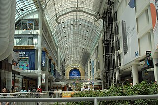
A shopping mall is a large indoor shopping center, usually anchored by department stores. The term mall originally meant a pedestrian promenade with shops along it, but in the late 1960s, it began to be used as a generic term for the large enclosed shopping centers that were becoming increasingly commonplace. In the United Kingdom and other countries, shopping malls may be called shopping centers.

<span class="mw-page-title-main">Shopping center</span> Commercial trading complex

A shopping center, shopping centre, also called a shopping complex, shopping arcade, shopping plaza or galleria, is a group of shops built together, sometimes under one roof.

<span class="mw-page-title-main">High Street</span> Generic primary business street of towns or cities

High Street is a common street name for the primary business street of a city, town, or village, especially in the United Kingdom and Commonwealth. It implies that it is the focal point for business, especially shopping. It is also a metonym for the retail sector.

<span class="mw-page-title-main">Tysons Corner Center</span> Shopping mall in Virginia, United States

Tysons Corner Center is a shopping mall in the unincorporated area of Tysons in Fairfax County, Virginia, United States. It opened to the public in 1968, becoming one of the first fully enclosed, climate-controlled shopping malls in the Washington metropolitan area. The mall's anchor department stores are Macy's, Nordstrom, and Bloomingdale's. The mall also features prominent specialty retailers including Everlane, Fabletics, Untuckit, Oak + Fort, Intimissimi, Aesop, and Warby Parker.

<span class="mw-page-title-main">Strip mall</span> Open-air shopping mall

A strip mall, strip center, strip plaza or simply plaza is a type of shopping center common in North America and Australia where the stores are arranged in a row, with a footpath in front. Strip malls are typically developed as a unit and have large parking lots in front. Many of them face major traffic arterials and tend to be self-contained with few pedestrian connections to surrounding neighborhoods. Smaller strip malls may be called mini-malls, while larger ones may be called power centers or big box centers. In 2013, The New York Times reported that the United States had 65,840 strip malls. In 2020, The Wall Street Journal wrote that in the United States, despite the continuing retail apocalypse starting around 2010, investments and visitor numbers were increasing to strip malls.

<span class="mw-page-title-main">Pitt Street Mall</span> Thoroughfare in New South Wales, Australia

Pitt Street Mall is the pedestrianised section of Pitt Street in the Sydney central business district, in the Australian state of New South Wales. Running for approximately 200 metres between Market Street and King Street, it is one block long and one of Australia's busiest and most cosmopolitan shopping precincts. Floorspace rents are the highest in Australia, in part due to other cities' shopping precincts being longer. In 2015, its rents were the fifth-highest in the world in terms of city streets.

<span class="mw-page-title-main">George Street, Sydney</span> Street in Sydney, Australia

George Street is a street in the central business district of Sydney.

<span class="mw-page-title-main">Australia Fair Shopping Centre</span> Shopping mall in Gold Coast, Queensland

Australia Fair Shopping Centre is a dual-level regional shopping centre covering 59,540 square metres (640,900 sq ft) located in Southport, Gold Coast, Queensland. The centre also incorporates a five-level office tower comprising 5,824 square metres (62,690 sq ft) of office space, housing specialist services and commercial offices.

<span class="mw-page-title-main">Golden Mile, Toronto</span> Commercial district in Ontario, Canada

The Golden Mile is a commercial district in the Scarborough district of Toronto, Ontario, Canada. Situated along Eglinton Avenue East, east of Victoria Park Avenue, it was one of Canada's first model industrial parks. The original Golden Mile of Industry ran along Eglinton from Pharmacy Avenue east to Birchmount Road.

<span class="mw-page-title-main">Sawgrass Mills</span> Shopping mall in Florida, United States

Sawgrass Mills is a shopping mall in Sunrise, Florida, owned by Simon Property Group. With 2,370,610 square feet (220,237 m2) of retail selling space, it is the eleventh largest mall in the United States, the largest single story outlet mall in the U.S., the largest shopping mall in Broward County, the second largest mall in Florida and the Miami metropolitan area after the Aventura Mall, and the third largest shopping mall in the southeastern United States. With over 21 million annual visitors, Sawgrass Mills is one of the most visited attractions in the state of Florida.

<span class="mw-page-title-main">Bankstown Central</span> Shopping mall in New South Wales, Australia

Bankstown Central is a shopping centre in the suburb of Bankstown in South Western Sydney.

<span class="mw-page-title-main">Melbourne Central Shopping Centre</span> Shopping mall in Victoria, Australia

Melbourne Central is a large shopping centre, office, and public transport hub in the central business district of Melbourne, Victoria, Australia. The main tower is 211-metre (692 ft) high, making it one of the tallest buildings in Melbourne at the time it was built in 1991. Other parts of the complex include the Melbourne Central Shopping Centre, the underground Melbourne Central railway station and the heritage-listed Coop's Shot Tower.

Charlestown Square is a large indoor/outdoor shopping centre in the suburb of Charlestown in the City of Lake Macquarie.

<span class="mw-page-title-main">Northland Shopping Centre</span> Shopping mall in Victoria, Australia

Northland Shopping Centre is a major shopping centre in Preston, approximately 11 km north of the Melbourne central business district in Victoria, Australia. It is the largest predominantly single-level shopping centre in Melbourne. It has more than 330 stores on one floor, with the top floor containing just the Hoyts cinemas, Pancake Parlour and indoor golf venue X-Golf.

<span class="mw-page-title-main">Wollongong Central</span> Shopping mall in New South Wales, Australia

Wollongong Central is a large shopping centre in the Wollongong CBD in the llawarra region. It is located along Crown Street which the main road of Wollongong.

Park Central Mall was the first shopping mall in Phoenix, Arizona. It is located in Encanto Village, on Central Avenue and Osborn Road.

<span class="mw-page-title-main">Jesmond, New South Wales</span> Suburb of Newcastle, New South Wales, Australia

Jesmond is a suburb of the City of Newcastle LGA, located about 9.5 km (6 mi) west of the Newcastle CBD in the Hunter Region of New South Wales, Australia. It is both a commercial centre and dormitory suburb of Newcastle. Residents include Australian and international students attending the University of Newcastle in adjacent Callaghan. The suburb also has numerous aged housing facilities. The suburb is very multicultural due to many international university students. According to the 2006 Census there were 2,442 people in 1,144 dwellings.

<span class="mw-page-title-main">Dangar Grid</span> Business district layout in Newcastle, Australia

The Dangar Grid is the layout of the streets in the centre of the central business district of Newcastle, Australia. Named after its designer, Henry Dangar, the Grid was designed in 1823 and implemented sometime thereafter. It covers the area from Brown Street to Pacific Street, and from Church Street to Hunter Street.

The Newcastle and Suburban Co-operative Society, known locally as The Store, was a co-operative based in Newcastle, a city in New South Wales, Australia. The Store was described as "the largest and most successful co-operative society in the southern hemisphere".

Newcomen Street Corporation Baths were public baths in Newcastle, Australia. Opened in 1888, ongoing financial and hygiene problems resulted in the closure of the baths in 1906. The baths provided a place for the public to bathe in sea water while enjoying the health benefits in a safe manner. The building was converted into an arcade in 1934, and parts of the original façade are still visible today.

References

  1. "Creating Creative Enterprise Hubs: A Guide" (PDF). arts.nsw.gov.au. Retrieved 3 December 2013.
  2. 1 2 "Landcom purchases two-thirds of GPT's Newcastle landholdings". GPT Group . 20 June 2012. Archived from the original on 22 May 2013. Retrieved 3 December 2013.
  3. 1 2 Barney, Norm (19 July 2013). "OPINION: Story of a sandhill". Newcastle Herald . Retrieved 3 December 2013.
  4. Page, Donna (19 July 2013). "HUNTER STREET: POLL Turning the corner". Newcastle Herald . Retrieved 3 December 2013.