| Worondi Rivulet Chinamans Gully [1] | |
|---|---|
| Location | |
| Country | Australia |
| State | New South Wales |
| Region | NSW North Coast (IBRA), Upper Hunter |
| Local government area | Upper Hunter |
| Physical characteristics | |
| Source | Great Dividing Range |
| • location | east of Terragong and northeast of Merriwa |
| • elevation | 463 m (1,519 ft) |
| Mouth | confluence with Goulburn River |
• location | west of Sandy Hollow, within Goulburn River National Park |
• elevation | 133 m (436 ft) |
| Length | 45 km (28 mi) |
| Basin features | |
| River system | Hunter River catchment |
| Tributaries | |
| • right | Wappinguy Creek |
| National park | Goulburn River NP |
| [2] | |
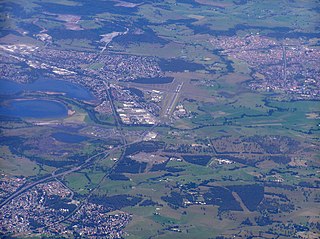
Worondi Rivulet, a perennial stream of the Hunter River catchment, is located in the Upper Hunter region of New South Wales, Australia.
Worondi Rivulet rises on the slopes of the Great Dividing Range, east of Terragong and northeast of Merriwa. The river flows generally south by west and then southeast, joined by one minor tributary before reaching its confluence with the Goulburn River, west of Sandy Hollow within Goulburn River National Park. The river descends 330 metres (1,080 ft) over its 45 kilometres (28 mi) course. [2]

Goulburn River, a perennial river of the Hunter River catchment, is located in the Upper Hunter region of New South Wales, Australia.

Peel River, a watercourse that is part of the Namoi catchment within the Murray–Darling basin, is located in the North West Slopes and Plains district of New South Wales, Australia.
Macquarie Rivulet is a perennial river located in the Southern Highlands and Illawarra regions of New South Wales, Australia.

Barnard River, a perennial river of the Manning River catchment, is located in the Northern Tablelands and Mid North Coast districts of New South Wales, Australia.
Bow River, a partly perennial stream of the Hunter River catchment, is located in the Hunter district of New South Wales, Australia.
Bylong River, a perennial river of the Hunter River catchment, is located in the Central Tablelands and Upper Hunter regions of New South Wales, Australia.
The Goorudee Rivulet, a perennial river of the Murrumbidgee catchment of the Murray–Darling basin, is located in the Snowy Mountains region of New South Wales, Australia.
Krui River, a perennial river of the Hunter River catchment, is located in the Upper Hunter region of New South Wales, Australia.
Lee Creek, a partly perennial river of the Hunter River catchment, is located in the Central Tablelands region of New South Wales, Australia.
Merriwa River, a perennial river of the Hunter River catchment, is located in the Upper Hunter region of New South Wales, Australia.
Munmurra River, a perennial river of the Hunter River catchment, is located in the Upper Hunter region of New South Wales, Australia.

Pages River, a perennial river of the Hunter River catchment, is located in the Hunter region of New South Wales, Australia.

Wallamba River, a watercourse of the Mid-Coast Council system, is located in the Mid North Coast district of New South Wales, Australia.
Wangat River, a perennial river of the Hunter River catchment, is located in the Hunter region of New South Wales, Australia.
Baerami Creek, a partly perennial stream of the Hunter River catchment, is located in the Hunter region of New South Wales, Australia.
Barigan Creek, a watercourse of the Hunter River catchment, is located in the Central Tablelands region of New South Wales, Australia.
Blackwater Creek, a perennial stream of the Hunter River catchment, is located in the Hunter region of New South Wales, Australia.

Congewai Creek, a watercourse of the Hunter River catchment, is located in the Hunter district of New South Wales, Australia.
Rouchel Brook, a perennial stream of the Hunter River catchment, is located in the Hunter region of New South Wales, Australia.
Widden Brook, a partly perennial stream of the Hunter River catchment, is located in the Hunter region of New South Wales, Australia.
River systems and rivers of Hunter-Central Rivers catchment, New South Wales, Australia | |
|---|---|
| Manning River | |
| Great Lakes | |
| Hunter Valley and Hunter River | |
32°22′S150°29′E / 32.367°S 150.483°E