
Myall Lakes, a series of fresh water lakes protected under the Ramsar Convention, are located within the Mid-Coast Council local government area in the Mid North Coast region of New South Wales, Australia.

Port Stephens, an open youthful tide-dominated drowned-valley estuary, is a large natural harbour of approximately 134 square kilometres (52 sq mi) located in the Hunter Region of New South Wales, Australia.
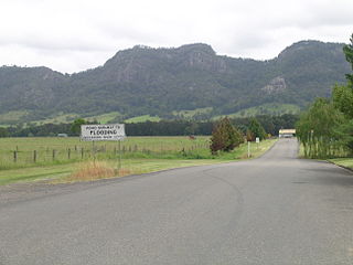
The Bucketts Way is a 151-kilometre (94 mi) rural road that links Gloucester to Taree and Raymond Terrace, in New South Wales, Australia. It was named after the Bucketts Mountains, a prominent mountain range near Gloucester. Between 1928 and 1952 the Bucketts Way served as the alignment of the Pacific Highway between Raymond Terrace and Taree. The entire route is designated as Tourist Drive TD2.

Bulahdelah is a town and locality in the Hunter/Mid North Coast region of New South Wales, Australia in the Mid-Coast Council local government area. At the 2016 census, the locality had a population of 1,424. The main population centre, where 69% of the area's population lived in 2006, is the town of Bulahdelah.

Myall River, an open semi-mature brackish freshwater barrier estuary of the Mid-Coast Council system, is located in the Mid North Coast region of New South Wales, Australia.

Karuah is a locality in both the Port Stephens and Mid-Coast Councils in the Hunter Region of New South Wales, Australia. It is thought that the name means 'native plum tree' in the local Aboriginal dialect..In 1790 five convicts who escaped from Sydney and relocated to the area. In 1795 the Karuah River was first surveyed as part of a wider survey of Port Stephens..In 1811 Governor Lachlan Macquarie decided to name the area the Clyde. By 1816 permits were issued to allow cedar cutting in the area..In 1824 the Australian Agricultural Company purchased a million acres to create the township. In 1907 the name was changed from Sawyers Point to Karuah.

Barrington River, a perennial river of the Manning River catchment, is located in the Upper Hunter district of New South Wales, Australia.
Karuah River, an open semi-mature tide dominated drowned valley estuary is located in the Mid North Coast and Hunter regions of New South Wales, Australia.

Barnard River, a perennial river of the Manning River catchment, is located in the Northern Tablelands and Mid North Coast districts of New South Wales, Australia.
Coolongolook River, a watercourse of the Mid-Coast Council system, is located in the Mid North Coast district of New South Wales, Australia.

Cooplacurripa River, a perennial river of the Manning River catchment, is located in the Northern Tablelands and Mid North Coast districts of New South Wales, Australia.

The Crawford River, a perennial river of the Mid-Coast Council system, is located in the Mid North Coast region of New South Wales, Australia.
Mammy Johnsons River, a mostly perennial river of the Mid-Coast Council system, is located in the Mid North Coast and Upper Hunter regions of New South Wales, Australia.
The Branch River, a watercourse of the Mid-Coast Council system, is located in the Mid North Coast and Upper Hunter regions of New South Wales, Australia.
Wallamba River, a watercourse of the Mid-Coast Council system, is located in the Mid North Coast district of New South Wales, Australia.
Wallingat River, a watercourse of the Mid-Coast Council system, is located in the Mid North Coast district of New South Wales, Australia.
Wang Wauk River, a perennial river of the Great Lakes system, is located in the Mid North Coast region of New South Wales, Australia.
Wards River, a mostly perennial river of the Mid-Coast Council system, is located in the Mid North Coast and Upper Hunter regions of New South Wales, Australia.
Wallis Lake, an open and trained wave dominated barrier estuary, is located within the Mid-Coast Council local government area in the Mid North Coast region of New South Wales, Australia. Wallis Lake is located adjacent to the towns of Forster and Tuncurry, and adjacent to the east coast, about 308 kilometres (191 mi) north of Sydney.
Smiths Lake, an intermittently closed youthful saline coastal lagoon, is located within the Mid-Coast Council local government area in the Mid North Coast region of New South Wales, Australia. Smiths Lake is located adjacent to the village of Smiths Lake, and adjacent to the east coast, about 274 kilometres (170 mi) north of Sydney.
