
Nowendoc National Park is a protected area on the southern end of the Northern Tablelands and west of Nowendoc, New South Wales, Australia. It is located approximately 70 km south of Walcha and about 375 km north of Sydney.

Tapin Tops National Park is an 110 km2 (42 sq mi) national park that is located in the Mid North Coast region of New South Wales, Australia.

The City of Shoalhaven is a local government area in the south-eastern coastal region of New South Wales, Australia. The area is approximately 200 kilometres (120 mi) south of Sydney. The area is located adjacent to the Tasman Sea. The Princes Highway passes through the area and the South Coast railway line traverses the northern section of the area and terminates at Bomaderry. At the 2016 census, the population of the City of Shoalhaven was 99,650.

Walcha is a town at the south-eastern edge of the Northern Tablelands, New South Wales, Australia.

Manning River, an open and trained mature wave dominated barrier estuary, is located in the Northern Tablelands and Mid North Coast districts of New South Wales, Australia.

Thunderbolts Way is a 290-kilometre (180 mi) country road located in the Northern Tablelands region of New South Wales, Australia. The road links Gloucester to Walcha, Uralla, where it very briefly joins the New England Highway and, to Copes Creek, 16 km (10 mi) south of the Gwydir Highway intersection at Inverell. The road is fully sealed and passes through thickly forested mountain areas with many nearby national parks and nature reserves.
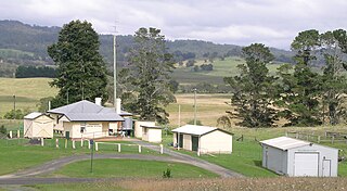
Nowendoc is a parish and village on the Northern Tablelands, New South Wales, Australia. It is 360 km north of the state capital, Sydney, 66 km south of Walcha in the Walcha Shire local government area. A sealed road, Thunderbolts Way, is about three hundred metres to the south of Nowendoc and provides links to the south and north.
The Cordeaux River, a perennial river of the Hawkesbury-Nepean catchment, is located in the Southern Highlands and Macarthur regions of New South Wales, Australia.

Cooplacurripa River, a perennial river of the Manning River catchment, is located in the Northern Tablelands and Mid North Coast districts of New South Wales, Australia.
Mummel River, a watercourse of the Manning River catchment, is located in the Northern Tablelands and Mid North Coast districts of New South Wales, Australia.
Murrah River is an open mature wave dominated barrier estuary or perennial river located in the South Coast region of New South Wales, Australia.

Nowendoc River, a perennial river of the Manning River catchment, is located in the Northern Tablelands and Mid North Coast districts of New South Wales, Australia.
The Nullica River is an intermittently closed semi-mature saline coastal lagoon or perennial river, located in the South Coast region of New South Wales, Australia.
Rowleys River, a perennial river of the Manning River catchment, is located in the Northern Tablelands and Mid North Coast districts of New South Wales, Australia.
The Towamba River is an open mature wave dominated barrier estuary or perennial river, located in the South Coast region of New South Wales, Australia.
Walcrow River, a watercourse of the Manning River catchment, is located in the Northern Tablelands and Mid North Coast districts of New South Wales, Australia.
The Wonboyn River, an open youthful wave dominated barrier estuary or perennial stream, is located in the South Coast region of New South Wales, Australia.

Cooplacurripa Station is a pastoral lease that operates as a cattle station in Cooplacurripa, New South Wales.

The Murray River Council is a local government area in the Riverina region of New South Wales, Australia. This area was formed in 2016 from the merger of Murray Shire with Wakool Shire.
Number One is a small rural locality in the Mid North Coast region, located within the Mid-Coast Council local government area of New South Wales, Australia. It is situated approximately 360 kilometres (220 mi) north of Sydney.
