| Moppy River Morpey Creek [1] | |
|---|---|
| Location | |
| Country | Australia |
| State | New South Wales |
| IBRA | New England Tablelands, NSW North Coast |
| District | Upper Hunter, Mid North Coast |
| Local government area | Mid-Coast Council |
| Physical characteristics | |
| Source | Mount Royal Range, Great Dividing Range |
| • location | near Tunderbolts Lookout, Barrington Tops National Park |
| • elevation | 1,500 m (4,900 ft) |
| Mouth | confluence with the Barrington River |
• location | near Moppy |
• elevation | 356 m (1,168 ft) |
| Length | 22 km (14 mi) |
| Basin features | |
| River system | Manning River catchment |
| National park | Barrington Tops |
| [2] | |
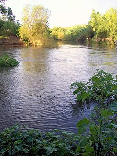
Moppy River, a perennial river of the Manning River catchment, is located in the Upper Hunter district of New South Wales, Australia.
Moppy River rises in the Barrington Tops, on the eastern slopes of Mount Royal Range, south of Tunderbolts Lookout in the Barrington Tops National Park, and flows generally east before reaching its confluence with the Barrington River, near the village of Moppy. The river descends 1,140 metres (3,740 ft) over its 22 kilometres (14 mi) course. [2]
Paterson River, a perennial river that is part of the Hunter River catchment, is located in the Hunter and Mid North Coast regions of New South Wales, Australia.

Avon River, a perennial stream of the Manning River catchment, is located in the Upper Hunter region of New South Wales, Australia.

Barrington River, a perennial river of the Manning River catchment, is located in the Upper Hunter district of New South Wales, Australia.

Cup and Saucer Creek, an urban watercourse of the Cooks River catchment, is located in the Canterbury-Bankstown region of Sydney, in New South Wales, Australia.

Barrington is a small village on the Barrington River, 5 kilometres (3.1 mi) north-west of Gloucester, New South Wales, Australia on Thunderbolts Way.

Karuah River, an open semi-mature tide dominated drowned valley estuary is located in the Mid North Coast and Hunter regions of New South Wales, Australia.

Barnard River, a perennial river of the Manning River catchment, is located in the Northern Tablelands and Mid North Coast districts of New South Wales, Australia.

The Chichester River, a perennial stream of the Hunter River catchment, is located in the Hunter region of New South Wales, Australia.
Cobark River, a perennial river of the Manning River catchment, is located in the Upper Hunter district of New South Wales, Australia.

Cooplacurripa River, a perennial river of the Manning River catchment, is located in the Northern Tablelands and Mid North Coast districts of New South Wales, Australia.
Curricabark River, a perennial river of the Manning River catchment, is located in the Northern Tablelands region of New South Wales, Australia.

Cobark River, a perennial river of the Manning River catchment, is located in the Upper Hunter district of New South Wales, Australia.

Gloucester River, a perennial river and major tributary of the Manning River catchment, is located in the Mid North Coast hinterland New South Wales, Australia.
Kerripit River, a perennial river of the Manning River catchment, is located in the Upper Hunter district of New South Wales, Australia.
Wangat River, a perennial river of the Hunter River catchment, is located in the Hunter region of New South Wales, Australia.

The Williams River is a perennial stream that is a tributary of the Hunter River, in the Hunter Region of New South Wales, Australia.
Back River, a perennial stream of the Manning River catchment, is located in the Northern Tablelands region of New South Wales, Australia.
Dingo Creek, a perennial stream of the Manning River catchment, is located in the Mid North Coast region of New South Wales, Australia.
Moonan Brook, a mostly perennial stream of the Hunter River catchment, is located in the Hunter region of New South Wales, Australia.
Stewarts Brook, a perennial stream of the Hunter River catchment, is located in the Hunter region of New South Wales, Australia.
River systems and rivers of Hunter-Central Rivers catchment, New South Wales, Australia | |
|---|---|
| Manning River | |
| Great Lakes | |
| Hunter Valley and Hunter River | |
Coordinates: 31°56′S151°30′E / 31.933°S 151.500°E
| This New South Wales river or creek related article is a stub. You can help Wikipedia by expanding it. |