The Willi Willi National Park is a protected national park located on the North Coast region of New South Wales, Australia. Gazetted in 1996, the 29,870-hectare (73,800-acre) park is situated 325 kilometres (202 mi) northeast of Sydney and 60 kilometres (37 mi) west of Wauchope.
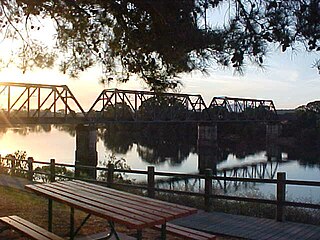
Hastings River, an open and trained intermediate wave dominated barrier estuary, is located in the Northern Tablelands and Mid North Coast districts of New South Wales, Australia.

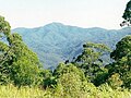
Mount Banda Banda, a mountain of the Mid North Coast region of New South Wales, Australia, is situated 320 kilometres (200 mi) from Sydney within the Willi Willi National Park. Banda Banda can be seen on the north western horizon from Port Macquarie. And seen on the south western horizon 39 km from the town of Kempsey. At 1,258 metres (4,127 ft) AHD it is the highest mountain in the region.

Ellenborough River, a perennial river of the Hastings River catchment, is located in the Mid North Coast region of New South Wales, Australia.
The Leycester Creek, a perennial stream of the Richmond River catchment, is located in Northern Rivers region in the state of New South Wales, Australia.
Mummel River, a watercourse of the Manning River catchment, is located in the Northern Tablelands and Mid North Coast districts of New South Wales, Australia.
Pappinbarra River, a perennial stream of the Hastings River catchment, is located in the Mid North Coast region of New South Wales, Australia.
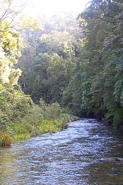
Stewarts River, a mostly perennial stream of the Mid North Coast region, is located in New South Wales, Australia.
Thone River, a perennial stream of the Hastings River catchment, is located in the Mid North Coast region of New South Wales, Australia.
Tobins River, a perennial stream of the Hastings River catchment, is located in the Northern Tablelands and Mid North Coast districts of New South Wales, Australia.

Forbes River, a perennial river of the Hastings River catchment, is located in the Mid North Coast region of New South Wales, Australia.
Maria River, a watercourse of the Hastings River catchment, is located in the Mid North Coast region of New South Wales, Australia.

The Back Creek, a perennial stream of the Richmond River catchment, is located in Northern Rivers region in the state of New South Wales, Australia.
The Coopers Creek, a perennial stream of the Richmond River catchment, is located in Northern Rivers region in the state of New South Wales, Australia.
The Tooloom Creek, a perennial stream of the Clarence River catchment, is located in the Northern Rivers region in the state of New South Wales, Australia.
The Pipers Creek, a watercourse that is part of the Hastings River catchment, is located in the Mid North Coast region of New South Wales, Australia.
The Ralfes Creek, a perennial stream that is part of the Hastings River catchment, is located in the Mid North Coast region of New South Wales, Australia.
The Eden Creek, a perennial stream of the Richmond River catchment, is located in Northern Rivers region in the state of New South Wales, Australia.

The Jeir Creek, a perennial river that is part of the Murrumbidgee catchment within the Murray–Darling basin, is located in the South West Slopes region of New South Wales, Australia.

Rollands Plains is a village and bounded rural locality in Mid North Coast of New South Wales, Australia.