
Port Macquarie, locally nicknamed Port, is a coastal city the local government area of Port Macquarie-Hastings. It is located on the Mid North Coast of New South Wales, Australia, about 390 km (242 mi) north of Sydney, and 570 km (354 mi) south of Brisbane. The city is located on the Tasman Sea coast, at the mouth of the Hastings River, and at the eastern end of the Oxley Highway (B56). The city with its suburbs had a population of 47,973 in June 2018 and an estimated population of 50,307 in June 2023.

Gunnedah is a town in north-eastern New South Wales, Australia and is the seat of the Gunnedah Shire local government area. In the 2021 census the town recorded a population of 8,338. Gunnedah is situated within the Liverpool Plains, a fertile agricultural region, with 80% of the surrounding shire area devoted to farming. The Namoi River flows west then north-west through the town providing water beneficial to agricultural operations in the area.

Bombala is a town in the Monaro region of south-eastern New South Wales, Australia, in Snowy Monaro Regional Council. It is approximately 485 kilometres (301 mi) south of the state capital, Sydney, and 80 kilometres (50 mi) south of the town of Cooma. The name derives from an Aboriginal word meaning "Meeting of the waters". The town lies on the banks of the Bombala River. At the 2021 census, Bombala had a population of 1,892.

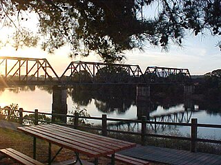
Wauchope ( ) is a town in the Mid North Coast region of New South Wales, Australia. It is within the boundaries of the Port Macquarie-Hastings Council area. Wauchope is inland on the Hastings River and the Oxley Highway 19 km (12 mi) west of Port Macquarie. The town is 383 km (238 mi) north of the state capital Sydney.
Hastings River, an open and trained intermediate wave dominated barrier estuary, is located in the Northern Tablelands and Mid North Coast districts of New South Wales, Australia.

Camden Council is a local government area in the Macarthur region of Sydney, in the state of New South Wales, Australia. The area is located south west of the Sydney central business district and comprises 201 square kilometres (78 sq mi) with an estimated population at the 2021 census of 119,325. The mayor of Camden is Cr. Ashleigh Cagney, a member of the Labor Party.
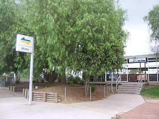
Minto is a suburb of Sydney, in the state of New South Wales, Australia. Minto is located 50 kilometres south-west of the Sydney central business district, in the local government area of the City of Campbelltown and is part of the Macarthur region.

Moss Vale is a town in the Southern Highlands of New South Wales, Australia, in the Wingecarribee Shire. It is located on the Illawarra Highway, which connects to Wollongong and the Illawarra coast via Macquarie Pass.

Port Macquarie-Hastings Council is a local government area in the Mid North Coast region of New South Wales, Australia.
Lake Cathie is a town in New South Wales, Australia about 15 minutes drive south of Port Macquarie. At the 2021 census, it had a population of 4,296.

Kew, New South Wales is a small town in the Mid North Coast region of New South Wales, Australia in the Port Macquarie-Hastings Council local government area. Kew is one of the communities that make up the Camden Haven district of Port Macquarie-Hastings.

Wilson River, a perennial river of the Hastings River catchment, is located in the Mid North Coast region of New South Wales, Australia.

Picton is a small town in the Macarthur Region of New South Wales, Australia, in the Wollondilly Shire, in south-western Sydney. The town is located approximately 90 kilometres south-west of the Sydney CBD, close to Camden and Campbelltown. It is also the administrative centre of Wollondilly Shire.
Laurieton is a coastal town on the Mid North Coast of the Australian state of New South Wales. Laurieton is the largest town in the Camden Haven district. Laurieton is 365 km north of Sydney and 42 km south of Port Macquarie. It lies between the base of North Brother Mountain and the Camden Haven River. At the 2016 census, it had a population of 1,986.
Camden Haven High School is a government-funded co-educational comprehensive secondary day school, located in Kew, a village near Laurieton, in the Mid North Coast region of New South Wales, Australia. The school is situated approximately two kilometres east of the Pacific Highway. The Aboriginal country the school is built on is Birpai Country.
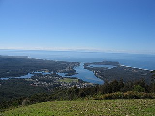
Camden Haven is a parish in the Mid North Coast region of New South Wales, Australia, approximately 30 km south of the major regional centre of Port Macquarie. The harbour is located where the Camden Haven River empties into the Tasman Sea.

Bonny Hills is a town in New South Wales, Australia on the Tasman Sea coast about 18 km south of Port Macquarie.
Maria River, a watercourse of the Hastings River catchment, is located in the Mid North Coast region of New South Wales, Australia.
Hastings Shire was a local government area in the Mid North Coast region of New South Wales, Australia.
The Hastings District Rugby League is a community rugby league competition. It features amateur teams from smaller towns around the Mid-North Coast and runs as a community competition similar to the Barwon Darling Rugby League and the Western Riverina Community Cup.


