
Coffs Harbour, locally nicknamed Coffs, is a coastal city on the Mid North Coast of New South Wales, Australia, 540 km (340 mi) north of Sydney, and 390 km (240 mi) south of Brisbane. It is one of the largest urban centres on the North Coast, with a population of 78,759 as per 2021 census. The Gumbaynggirr are the original people of the Coffs Harbour region.
Sawtell is a suburb of the City of Coffs Harbour in northern New South Wales, Australia. It borders Toormina to the West.

Ulong is a small village located on the Mid North Coast region, neighbouring the Northern Tablelands, of New South Wales, Australia. It has a community hall, public school, cafe-post office and an Ex-services Club.
Coffs Harbour is an electoral district of the Legislative Assembly in the Australian state of New South Wales. Since 2019 it has been represented by Gurmesh Singh of the National Party.
Toormina is a suburb in the City of Coffs Harbour, on the east coast of New South Wales, Australia. Located in the city's south, Toormina is near the seaside suburb of Sawtell.

Boambee is a suburb in the city of Coffs Harbour on the Mid North Coast of New South Wales, Australia. Boambee is west of Sawtell on the Pacific Highway. It is divided into two sections: semi-rural Boambee (2450) and the more suburban Boambee East (2452). These suburbs are divided by the Pacific Highway. In 2011, Boambee had a population of 1,545 people, while Boambee East had a population of 5,446 people.
Nana Glen is a small village in New South Wales, Australia, located 25 km inland north-west of Coffs Harbour in the City of Coffs Harbour. It is located on the Orara Way and at the juncture of two main roads, one leading to Lower Bucca. The Orara Way is the main thoroughfare through the township and is an alternative route between Grafton and Coffs Harbour. Nana Glen is situated between the township of Coramba and Glenreagh.The local Mayor is Alison Johnson MD.
Bonville is a small town located on the Mid North Coast of New South Wales, Australia, 11 kilometres south of Coffs Harbour and in the local government area of City of Coffs Harbour. It has a population of 1,891 as of 2006. The town's name supposedly derives from "Bongol Bongol/Bongil Bongil", which in Gumbaingirr, means a place where one stays a long time.

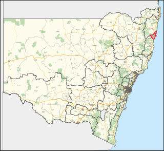
The City of Coffs Harbour is a local government area in the mid north coast region of New South Wales, Australia. The area under administration is 1,175 square kilometres (454 sq mi), expanded in 2004 to take in parts of the former Pristine Waters local government area.

Coffs Harbour Airport is the only airport serving the City of Coffs Harbour, in the New South Wales Mid North Coast region in Australia. The airport is located 3 km (1.9 mi) south of Coffs Harbour and is one of the busiest regional airports in the state, serving flights to the east coast capital cities, as well as some regional destinations. Coffs Harbour Airport has the capacity to handle large aircraft such as the Boeing 767 or Boeing 777 but is predominately served by regional airlines using smaller aircraft.

Woolgoolga is a town on the Mid North Coast of New South Wales, Australia. It is on the Pacific Highway, approximately 550 km north of Sydney and 365 km south of Brisbane. The closest city to Woolgoolga is Coffs Harbour, which lies 24.8 km to the south. Woolgoolga has two beaches on the Pacific Ocean. The area has long been a centre of banana growing in New South Wales, but this industry has declined in the face of competition from Queensland. Recent times have seen many banana plantations replaced by blueberries after banana sales slumped in the late 1990s.
The Coffs Harbour International Stadium is an Australian stadium located in the coastal city of Coffs Harbour, New South Wales.
A convincing ground was the name or journalistic euphemism for a place where sports were contested, having limited currency in the nineteenth century, predominantly in Australia and New Zealand.
Coffs Harbour Senior College is a government-funded co-educational comprehensive senior secondary day school, located within the Coffs Harbour Education Campus, on Hogbin Drive, Coffs Harbour, on the Mid North Coast region of New South Wales, Australia. The aboriginal country the school is built on is Gumbaynggirr Country.
Lowanna is a village in the Coffs Harbour hinterland, officially a suburb of the City of Coffs Harbour. It has a Community Hall, Primary School, Preschool, Tennis Court and General Store. The name Lowanna is an Aboriginal language word meaning "girl". Lowanna had a train station on the now-closed Dorrigo railway line.
Coffs Harbour, an electoral district of the Legislative Assembly in the Australian state of New South Wales, was created in 1981 and has always been held by the National party.

Park Beach is a suburb of Coffs Harbour, northern New South Wales, located in the north eastern part of the town. It has a population of around 5,000 which swells during summer as it is a coastal tourist destination containing many motels, backpackers and other forms of accommodation. The suburb of Park Beach is generally considered to be the area within the Ocean Parade and Orlando Street intersection at the south, the Orlando Street and Woolgoolga Road intersection, the turnoff from the Pacific Highway onto Macauleys Headland Drive, and the southern end of the Coffs Coast Regional Park.
New England Coaches is an Australian charter coach company based in Northern New South Wales.
Korora is a suburb of the City of Coffs Harbour in New South Wales, Australia, located 6 km north of the city centre. Korora is located in a basin that runs from the foothills of the Great Dividing Range in the west to Korora Bay in the east. It is bisected by the Pacific Highway, which runs south to north between Sydney and Brisbane. The section of Korora between the Pacific Highway and the coast is mainly residential, with some tourist facilities. The section west of the Highway consists of larger residential blocks and farms growing mainly bananas and blueberries. The west-most section of Korora is forested and includes part of the Ulidarra National Park. The Korora basin is drained by creeks that flow into Pine Brush Creek and enter the sea at Hills Beach.

Coffs Harbour Shire was a local government area in the Mid North Coast region of New South Wales, Australia.
