
The Wingecarribee River, a perennial river that is part of the Hawkesbury–Nepean catchment, is located in the Southern Highlands region of New South Wales, Australia.

The Budawang Range, commonly called The Budawangs, a rugged mountain range within the Budawang National Park and the Morton National Park, are part of a spur off the Great Dividing Range and are located in the South Coast region of New South Wales, Australia.
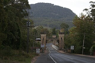
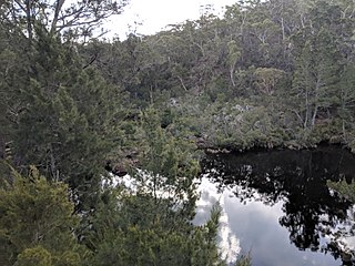
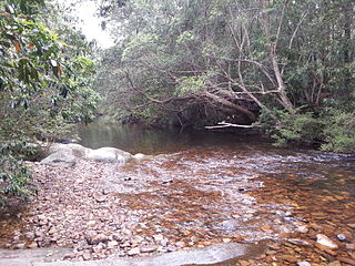
The Kangaroo River is a perennial river of the Shoalhaven catchment located in the Southern Highlands and Illawarra regions of New South Wales, Australia.
Barrengarry is a small village near the Southern Highlands of New South Wales, Australia, in City of Shoalhaven. It is situated north of Kangaroo Valley. At the 2021 census, it had a population of 214.
Upper Kangaroo River is a small village in the Southern Highlands of New South Wales, Australia, in Shoalhaven City Council. It is located on the Kangaroo River, a tributary of the Shoalhaven River. At the 2021 census, it had a population of 151.

Bermagui River is an open and trained semi-mature wave dominated barrier estuary or perennial river located in the South Coast region of New South Wales, Australia.
Bimberamala River, a perennial river of the Clyde River catchment, is located in the Southern Tablelands and the upper ranges of the South Coast regions of New South Wales, Australia.
Corindi River, an open mature wave dominated barrier estuary, is located in the Northern Rivers region of New South Wales, Australia.
Endrick River is a perennial river of the Shoalhaven catchment located in the Southern Tablelands region of New South Wales, Australia.
Lee Creek, a partly perennial river of the Hunter River catchment, is located in the Central Tablelands region of New South Wales, Australia.
The Nowlands Creek, a watercourse of the Clarence River catchment, is located in the Northern Tablelands region in the state of New South Wales, Australia.
The Tomaga River, an open mature wave dominated barrier estuary or perennial stream, is located in the South Coast region of New South Wales, Australia.
The Tonalli River, a perennial river that is part of the Hawkesbury-Nepean catchment, is located in the Blue Mountains region of New South Wales, Australia.
Yadboro River, a perennial river of the Clyde River catchment, is located in the Southern Tablelands and the upper ranges of the South Coast regions of New South Wales, Australia.
The Burke River, a watercourse that is part of the Nepean River catchment, is located in the Southern Highlands of New South Wales, Australia.
The Little River, a perennial river that is part of the Hawkesbury-Nepean catchment, is located in the Central Tablelands region of New South Wales, Australia.

The Mongarlowe River is a perennial river of the Shoalhaven catchment located in the Southern Tablelands region of New South Wales, Australia. It was also known as Little River, during the 19th century.
Jerrabattgulla Creek, a perennial stream of the Shoalhaven River catchment, is located in the Southern Tablelands region of New South Wales, Australia.
Cooba Bulga Stream, a mostly perennial stream of the Hunter River catchment, is located in the Hunter region of New South Wales, Australia.
Rouchel Brook, a perennial stream of the Hunter River catchment, is located in the Hunter region of New South Wales, Australia.

