| Brogo River Broga River [1] | |
|---|---|
| Location | |
| Country | Australia |
| State | New South Wales |
| Region | South East Corner (IBRA), South Coast |
| Local government area | Bega Valley |
| Town | Bega |
| Physical characteristics | |
| Source | Wadbilliga Range, Great Dividing Range |
| • location | Wadbilliga National Park |
| • elevation | 604 m (1,982 ft) |
| Mouth | confluence with the Bega River |
• location | near Bega |
• elevation | 6 m (20 ft) |
| Length | 80 km (50 mi) |
| Basin features | |
| River system | Bega River |
| Tributaries | |
| • left | Galoon Creek, Stony Creek (New South Wales) |
| • right | Green Creek (New South Wales), Robinsons Creek, Yankees Creek, Nelson Creek, House Creek (New South Wales), Double Creek |
| National park | Wadbilliga NP |
| [1] [2] | |
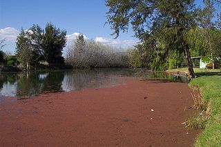
Brogo River, a perennial river that is part of the Bega River catchment, is located in the South Coast region of New South Wales, Australia.
Brogo River rises below the Wadbilliga Range, that is part of the Great Dividing Range, within the Wadbilliga National Park, 15 kilometres (9.3 mi) west of Cobargo and flows generally southeast, joined by eight minor tributaries, before reaching its confluence with the Bega River near Bega. The river descends 600 metres (2,000 ft) over its 80 kilometres (50 mi) course. [2]
At an elevation of 112 metres (367 ft) AHD , Brogo River is impounded by Brogo Dam to form Brogo Reservoir, a reservoir with a capacity of 8,980 megalitres (317×106 cu ft), that is used for environmental flows, hydro-power generation, irrigation, and water supply. [3]
Cudgegong River, a perennial stream that is part of the Macquarie catchment within the Murray-Darling basin, is located in the central western and Orana districts of New South Wales, Australia.

Lostock Dam is a minor rockfill and clay core embankment dam with a concrete lined, flip bucket spillway across the Paterson River upstream of the village of East Gresford in the Hunter region of New South Wales, Australia. The dam's purpose includes flood mitigation, irrigation, water supply and conservation. Mini hydro-power facilities were retrofitted in 2010. The impounded reservoir is also called Lostock Dam.
Cochrane Dam is a minor earthfill embankment dam with concrete spillway across Georges Creek, located in the South Coast region of New South Wales, Australia. The main purpose of the dam is to supply water for hydro-power at the downstream Brown Mountain Power Station and for irrigation purposes. The impounded reservoir is called Cochrane Lake.
Pindari Dam is a minor concrete faced rockfill embankment dam with an ungated uncontrolled rock cut with concrete sill spillway across the Severn River located upstream of the town of Ashford, in the North West Slopes region of New South Wales, Australia. The dam's purpose includes flood mitigation, hydro-power, irrigation, water supply and conservation. The impounded reservoir is called Lake Pindari.
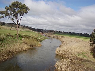
The Bemboka River, a perennial stream of the Bega River catchment, is located in the Monaro and South Coast regions of New South Wales, Australia.

Bermagui River is an open and trained semi-mature wave dominated barrier estuary or perennial river located in the South Coast region of New South Wales, Australia.
Campbells River, a perennial stream that is part of the Upper Macquarie catchment within the Murray–Darling basin, is located in the central–western region of New South Wales, Australia.
Dry River is a perennial river of the Murrah River catchment, located in the South Coast region of New South Wales, Australia.
The Maclaughlin River, a perennial river of the Snowy River catchment, is located in the Monaro region of New South Wales, Australia.
The Mowamba River, a perennial river of the Snowy River catchment, is located in the Snowy Mountains region of New South Wales, Australia.
The Nunnock River, a perennial stream of the Bega River catchment, is located in the Monaro region of New South Wales, Australia.

The Tuross River, an open semi-mature wave dominated barrier estuary or perennial stream, is located in the South Coast region of New South Wales, Australia.

The Wadbilliga River is a perennial stream of the Tuross River catchment that is located in the South Coast region of New South Wales, Australia.
The Bega River is an intermittently open intermediate wave dominated barrier estuary that is located in the South Coast region of New South Wales, Australia.
Yowrie River, a perennial river of the Tuross River catchment, is located in the upper ranges of the South Coast region of New South Wales, Australia.
Brogo Dam is a minor ungated rockfill embankment dam with an uncontrolled unlined rock cut spillway across the Brogo River upstream of Brogo in the South Coast region of New South Wales, Australia. The dam's purpose includes environmental flows, hydro-electric power generation, irrigation, and water supply. The impounded reservoir is also called Brogo Dam.
Yellow Pinch Dam is a major off-stream ungated rockfill embankment dam across the Yellow Pinch Creek upstream of Merimbula in the South Coast region of New South Wales, Australia. The dam's main purpose is water supply. The impounded reservoir is also called Yellow Pinch Dam.
Queens Pound River, a partly perennial river of the Tuross River catchment, is located in the upper ranges of the South Coast region of New South Wales, Australia.
Araluen Creek, a partly perennial stream of the Moruya River catchment, is located in the Southern Tablelands and South Coast regions of New South Wales, Australia.
The Back River, a perennial stream of the Tuross River catchment, is located in the Monaro and South Coast regions of New South Wales, Australia.
Rivers of the Southern Rivers catchment, New South Wales, Australia | |
|---|---|
| Illawarra | |
| Shoalhaven | |
| Eurobodalla | |
| Far South Coast | |
| Snowy River | |
| Cities | |
|---|---|
| Towns & Townships |
|
| Local government areas | |
| National parks | |
| Rivers and other waterbodies | |