
The Jervis Bay Territory is an internal territory of Australia. It was established in 1915 from part of New South Wales (NSW), in order to give the landlocked Australian Capital Territory (ACT) access to the sea.

The City of Shoalhaven is a local government area in the South Coast region of New South Wales, Australia. The area is about 200 kilometres (120 mi) south of Sydney. The Princes Highway passes through the area, and the South Coast railway line traverses the northern section, terminating at Bomaderry. At the 2021 census, the population was 108,531.

Moruya pronounced, is a town located on the far south coast of New South Wales, Australia, situated on the Moruya River. The Princes Highway runs through the town that is about 305 km (190 mi) south of Sydney and 175 km (109 mi) from Canberra. At the 2021 census, Moruya had a population of 4,295. Its built up area had a population of 2,762. The town relies predominantly on agriculture, aquaculture, and tourism. Moruya is administered by the Eurobodalla Shire Council and the shire chambers are located in the town.

Booderee National Park and Botanic Gardens, formerly Jervis Bay National Park and Jervis Bay Botanic Gardens, are located in the Jervis Bay Territory of Australia. The reserve is composed of two sections:

Nowra is a city in the South Coast region of New South Wales, Australia. It is located 160 kilometres (99 mi) south-southwest of the state capital of Sydney. As of the 2021 census, Nowra has an estimated population of 22,584. Situated in the southern reaches of the Sydney basin, Nowra is the seat and commercial centre of the City of Shoalhaven.

Port Broughton is a small South Australian town located at the northern extent of the Yorke Peninsula on the east coast of Spencer Gulf. It is situated about 170 km north-west of Adelaide, and 56 km south of Port Pirie. At the 2016 census, the town of Port Broughton had a population of 1,034.
Walpole is a town in the south-western region of Western Australia, located approximately 430 km (270 mi) south southeast of Perth, and 66 km (41 mi) west of Denmark.

Vincentia is a town in New South Wales, Australia in the City of Shoalhaven, on the shores of Jervis Bay. It is roughly 25 kilometres (16 mi) southeast of Nowra, and approximately 200 kilometres (120 mi) south of Sydney. At the 2016 census, the population of Vincentia was 3,290. It is also a tourist spot with a beach area featuring white sand and a number of motels.

Hyams Beach is a seaside village in the City of Shoalhaven, New South Wales, Australia, on the shores of Jervis Bay. At the 2016 census, it had a population of 112. The village, 180 km south of Sydney, is bordered by two beaches, Chinaman's Beach to the north and Seaman's Beach to the south, with Hyams Beach being in the centre. A seaside resort, its beach is known for having turquoise/aqua-coloured waters and fine, squeaky, brilliantly white sand composed of pure quartz.

The states and territories are administrative divisions in Australia, ruled by regional governments that constitute the level of governance between the federal government and local governments. States are self-governing polities with incomplete sovereignty and their own constitutions, legislatures, departments, and certain civil authorities that administer and deliver most public policies and programs. Territories can be autonomous and administer local policies and programs much like the states in practice, but are still legally subordinate to the federal government.
Blackalls Park is a suburb of the City of Lake Macquarie, Greater Newcastle in New South Wales, Australia to the immediate north-west of the town of Toronto on a bay west of Lake Macquarie.

Berrara is a small coastal town in the City of Shoalhaven in New South Wales, Australia. It is located 8 km south of Sussex Inlet on the Tasman Sea and Berrara Creek. At the 2016 census, it had a population of 297.

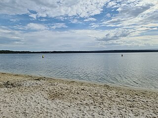
St Georges Basin is an open intermediate estuary, or inland sea, located in the South Coast region of New South Wales, adjacent to the Jervis Bay Territory.

Oallen is a locality in the Goulburn Mulwaree Council area, New South Wales, Australia. It is located on the Shoalhaven River and the Oallen Ford Road about 61 km southeast of Goulburn and 82 km southwest of Nowra. The Oallen Ford Road has recently been upgraded to improve the connection from Canberra and Goulburn to Nerriga, Nowra and Jervis Bay. At the 2016 census, Oallen had a population of 141.

Dolphin Point is a locality and residential area on the southern fringe of the Milton-Ulladulla conurbation, New South Wales, Australia. It is located about 7 km south of Ulladalla town centre on the southern shore of the Burrill Lake inlet and bounded to the east by the Tasman Sea. It is part of the Shoalhaven local government area. At the 2016 census, it had a population of 204.

Marlowe is a locality in the Queanbeyan–Palerang Regional Council, New South Wales, Australia. It is bounded by the left bank of the Mongarlowe River and the right bank of the Shoalhaven River. It lies on the road from Braidwood to Nowra about 24 km north of Braidwood and 96 km southwest of Nowra. At the 2021 census, it has a population of eight. It consists mainly of forest and grazing country. Marlowe includes the "rural place" and former village of Charleyong in a loop of the Mongarlowe River at 35°14′57″S149°55′02″E.
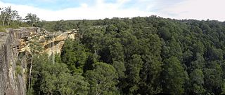
Tianjara is a locality in the City of Shoalhaven in New South Wales, Australia. It lies generally south of the Braidwood Road between Nowra and Nerriga. It is about 47 kilometres southwest of Nowra. Tianjara is fairly rugged sandstone country and largely consists of forest. Most of it lies within the Morton National Park or state forests.
Swanhaven is a coastal town in the City of Shoalhaven in New South Wales, Australia. It is located 5 km south of Sussex Inlet on the road to Berrara on the lagoon of Swan Lake and the Tasman Sea. At the 2016 census, it had a population of 193.

Cudmirrah is a small coastal town in the City of Shoalhaven in New South Wales, Australia. It is located 7 km south of Sussex Inlet on the road to Berrara on the lagoon of Swan Lake and the Tasman Sea. At the 2016 census, it had a population of 275.

Yatte Yattah is a historically significant suburb on the South Coast of New South Wales. It is located on the Princes Highway about 4 km north of Milton and 2 km south of Conjola Lake. At the 2021 Census, the population was 189. Settled in 1827, Yatte Yattah was a pioneer town in the decades preceding the establishment of nearby Milton and Ulladulla. Selected at the time for its highly fertile soils and lucrative red cedar, the first settlers in Yatte Yattah used convicts to procure timber, build roads and dig extensive drains along Narrawallee Creek. In 1827 a local aboriginal man helped Thomas Kendall cut a track from his land grant in Yatte Yattah to a natural bay in the south. Kendall turned the bay into a boat harbour so he could ship cedar and produce from Yatte Yattah to Sydney and Illawarra. Eventually this makeshift port would become known as Ulladulla Harbour. During this boom period Yatte Yattah had a functioning school, church and post office. Today, Yatte Yattah is characterised by picturesque farming estates and private rural retreats. There are views of Pigeon House Mountain and the Budawang Ranges. There are many surfing beaches near Yatte Yattah and with incereasing popularity the highway is known to become congested during peak holiday season.


