
Huskisson is a village in New South Wales, Australia in the City of Shoalhaven, on the shores of Jervis Bay. It is 24 km (14MI) south-east of Nowra.

Mongarlowe is a village in the Southern Tablelands of New South Wales, Australia in Queanbeyan-Palerang Regional Council. In former times, it was also known, in various contexts, as Little River, Monga, and Sergeants Point. The name, Mongarlowe, also applies to the surrounding area, for postal and statistical purposes.
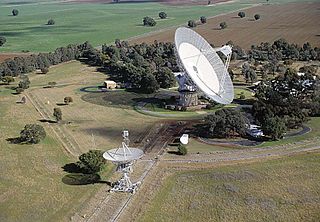
Alectown is a town in the Central West region of New South Wales, Australia. The town is on the Newell Highway and in the Parkes Shire local government area, 382 kilometres (237 mi), west north west of the state capital, Sydney. The name is also applied to the surrounding rural locality, for postal and statistical purposes.
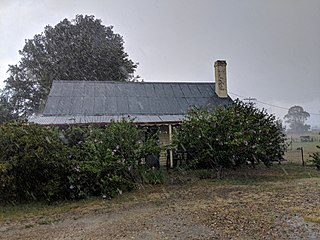
Jembaicumbene is a locality in the Southern Tablelands of New South Wales, Australia, located 8 km (5 miles) out along the Braidwood–Majors Creek Road. Once a thriving goldfield, it is now a peaceful valley on the way to Majors Creek. The mining village of the same name is now virtually a ghost town.

Hoskinstown is a locality in Queanbeyan-Palerang Regional Council, New South Wales, Australia. The locality, and what remains of the cluster of settlement of the same name, is 38 km southeast of Canberra the Capital city of Australia, and 299 km southwest of Sydney. At the 2021 census, it had a population of 191.

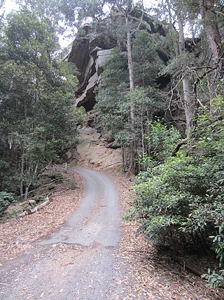
Sassafras is a locality in the City of Shoalhaven in New South Wales, Australia. It lies on the Braidwood Road, where it passes over the coastal escarpment on the road between Nowra and Nerriga. This road continues southwest to Braidwood, but this involves a section of unsealed road.. The sealed Oallen Ford Road branches off south of Nerriga, which connects via various sealed roads to Canberra and Goulburn. Sassafras is a small community of orchards in an area of extensive national parks. At the 2016 census, it had a population of 31.

Larbert is a locality in the Queanbeyan-Palerang Region of the Southern Tablelands region of New South Wales. It lies mostly north of the Kings Highway between Bungendore and Braidwood where it crosses the Shoalhaven River. At the 2021 census, it had a population of 34.

Monga is a locality in the Queanbeyan-Palerang Region, Southern Tablelands, New South Wales, Australia. It lies on the Kings Highway at the top of the Clyde Mountain, about 110 km east of Canberra and 22 km southeast of Braidwood. A large part of the locality forms part of the Monga National Park. At the 2016 census, it had a population of 14.

Durran Durra is a locality in the Queanbeyan–Palerang Regional Council, New South Wales, Australia. It is located on the road from Braidwood to Nowra about 15 km north of Braidwood and 100 km east of Canberra. At the 2021 census, it had a population of 114. It consists mainly of grazing country.

Marlowe is a locality in the Queanbeyan–Palerang Regional Council, New South Wales, Australia. It is bounded by the left bank of the Mongarlowe River and the right bank of the Shoalhaven River. It lies on the road from Braidwood to Nowra about 24 km north of Braidwood and 96 km southwest of Nowra. At the 2021 census, it has a population of eight. It consists mainly of forest and grazing country. Marlowe includes the "rural place" and former village of Charleyong in a loop of the Mongarlowe River at 35°14′57″S149°55′02″E.
Tomboye is a locality in the Queanbeyan–Palerang Regional Council, New South Wales, Australia. It is located on the north side of the Mongarlowe River on the road from Braidwood to Nowra about 28 km north of Braidwood and 93 km southwest of Nowra. At the 2016 census, it had a population of 40. It consists mainly of forest and grazing country.

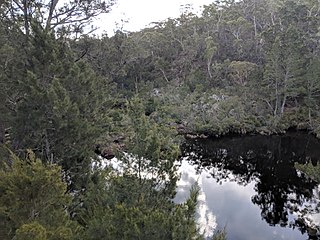
Wog Wog is a locality in the Queanbeyan–Palerang Regional Council, New South Wales, Australia. It is located on the south side of the Corang River and to the east of the road from Braidwood to Nowra about 34 km north of Braidwood and 96 km southwest of Nowra. At the 2021 census, it had a population of 15. It consists mainly of forest, including parts of the Morton National Park. Its eastern boundary runs along the Budawang Range and includes Wog Wog Mountain and Corang Peak.

Corang is a locality in the Queanbeyan–Palerang Regional Council, New South Wales, Australia. It is located on the north side of the Corang River and to the east of the road from Braidwood to Nowra about 46 km north of Braidwood and 75 km southwest of Nowra. At the 2016 census, it had a population of 13. It consists mainly of forest and most of it lies in the Morton National Park. Its eastern boundary runs along the Budawang Range and includes Mount Tarn, Sturgiss Mountain and Quiltys Mountain.
Coolumburra is a locality in the City of Shoalhaven in New South Wales, Australia. It lies on the Braidwood Road on the Endrick River between Nowra and Nerriga. This road continues southwest to Braidwood, but this involves a section of unsealed road. The sealed Oallen Ford Road branches off south of Nerriga, which connects via various sealed roads to Canberra and Goulburn. Coolumburra is heavily forested and part lies within the Morton National Park. At the 2016 census, it had a population of none.

Jerrawangala is a locality in the City of Shoalhaven in New South Wales, Australia. It consists of a small settlement on the Princes Highway south of Nowra and a large unpopulated area to the northwest that lies on both sides of the Braidwood Road between Nowra and Nerriga. It is about 35 kilometres south of Nowra and about 205 km south of Sydney. Jerrawangala is fairly rugged sandstone country and largely consists of forest. Much of it lies within the Jerrawangala National Park or state forests. Jerrawangala lookout is located to the east of the Braidwood Road. At the 2016 census, it had a population of 70.
The Wool Road was a historic road in New South Wales, Australia, that ran from Nerriga to what is now called Vincentia on Jervis Bay. It was constructed privately in 1841, using convict labour. Its purpose was to provide a shorter route to a seaport for wool grown at Braidwood and beyond. The historical significance of The Wool Road is that it was the first road, capable of being used by wheeled vehicles, linking the inland area around Braidwood to the South Coast. The road led to the foundation of the privately-owned port town of South Huskisson and the adjacent 'government townshIp' of Huskisson.

James Larmer was a government surveyor in the colony of New South Wales. Between 1830 and 1859, he surveyed land, roads and settlements in New South Wales. He was an Assistant Surveyor to the Surveyor-General, Sir Thomas Mitchell, from 1835 to 1855. In 1835, he was second in command of Mitchell's second expedition. He is also noteworthy for his recording of Aboriginal words from various parts of New South Wales.
Numeralla, is a village in Snowy Monaro Region of New South Wales, Australia. The name is also applied to the surrounding area, for postal and statistical purposes. In 2016, the population of the village and its surrounding area was 258. The village was known as Umaralla until 1972.
Currowan is a locality in the Eurobodalla Shire, on the South Coast of New South Wales, Australia. At the 2016 census, it had a population of 53.
Little River is a rural locality in the Snowy Valleys Council local government area of New South Wales, Australia. It lies is 6 km east of Tumut, in the southern side of the valley of the Goobarragandra River, just to the east of the confluence of that river with the Tumut River. The Goobarragandra River was once also known as 'Tumut Little River' or just as 'Little River', giving rise to the locality's name. At the 2021 census, it had a population of 38.

