
The City of Shoalhaven is a local government area in the south-eastern coastal region of New South Wales, Australia. The area is about 200 kilometres (120 mi) south of Sydney. The Princes Highway passes through the area, and the South Coast railway line traverses the northern section, terminating at Bomaderry. At the 2016 census, the population was 99,650.

Barrengarry is a small village near the Southern Highlands of New South Wales, Australia, in City of Shoalhaven. It is situated north of Kangaroo Valley. At the 2016 census, it had a population of 200.
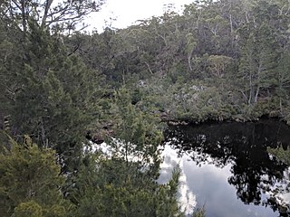
Upper Kangaroo River is a small village in the Southern Highlands of New South Wales, Australia, in Shoalhaven City Council. It is located on the Kangaroo River, a tributary of the Shoalhaven River. At the 2016 census, it had a population of 122.

Greenwell Point is a town in the Shoalhaven region of New South Wales, Australia. It is about 13 km east of Nowra on the South Coast. In the 2016 census of Population and Housing, the town had a population of 1,209.
Wandandian is a small village on the South Coast of New South Wales, Australia. It is located in the City of Shoalhaven on the Princes Highway about 30 kilometres south of Nowra.
Falls Creek is a small town south of Nowra, New South Wales in the Shoalhaven. It is situated on the Princes Highway.

Oallen is a locality in the Goulburn Mulwaree Council area, New South Wales, Australia. It is located on the Shoalhaven River and the Oallen Ford Road about 97 km southeast of Goulburn and 106 km southwest of Nowra. The Oallen Ford Road has recently been upgraded to improve the connection from Canberra and Goulburn to Nerriga, Nowra and Jervis Bay. At the 2016 census, Oallen had a population of 141.

Berry Mountain is a locality in the City of Shoalhaven in New South Wales, Australia. It lies west of the Princes Highway on the Kangaroo Valley Road between Berry and Kangaroo Valley. It lies about 23 kilometre north of Nowra and about 160 km south of Sydney. At the 2016 census, it had a population of 28. It lies on a ridge and is partly covered by temperate rain forest and partly by grasslands that were formerly used for dairying, but are now mainly used for rural residences.
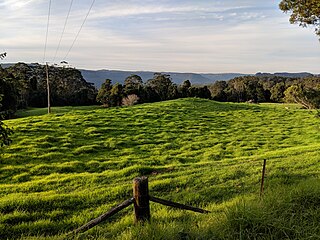
Bellawongarah is a locality in the City of Shoalhaven in New South Wales, Australia. It lies west of the Princes Highway on the Kangaroo Valley Road between Berry and Kangaroo Valley. It lies about 23 kilometre north of Nowra and about 160 km south of Sydney. At the 2016 census, it had a population of 127. It lies on a ridge and is partly covered by temperate rain forest and partly by grasslands that were formerly used for dairying, but are now mainly used for rural residences.
Coolumburra is a locality in the City of Shoalhaven in New South Wales, Australia. It lies on the Braidwood Road on the Endrick River between Nowra and Nerriga. This road continues southwest to Braidwood, but this involves a section of unsealed road. The sealed Oallen Ford Road branches off south of Nerriga, which connects via various sealed roads to Canberra and Goulburn. Coolumburra is heavily forested and part lies within the Morton National Park. At the 2016 census, it had a population of none.
Tianjara is a locality in the City of Shoalhaven in New South Wales, Australia. It lies generally south of the Braidwood Road between Nowra and Nerriga. It is about 47 kilometres southwest of Nowra. Tianjara is fairly rugged sandstone country and largely consists of forest. Most of it lies within the Morton National Park or state forests.

Jerrawangala is a locality in the City of Shoalhaven in New South Wales, Australia. It consists of a small settlement on the Princes Highway south of Nowra and a large unpopulated area to the northwest that lies on both sides of the Braidwood Road between Nowra and Nerriga. It is about 35 kilometres south of Nowra and about 205 km south of Sydney. Jerrawangala is fairly rugged sandstone country and largely consists of forest. Much of it lies within the Jerrawangala National Park or state forests. Jerrawangala lookout is located to the east of the Braidwood Road. At the 2016 census, it had a population of 70.

Yerriyong is a locality in the City of Shoalhaven in New South Wales, Australia. It lies about 17 km to the southwest of Nowra on the road to Nerriga and Canberra. It is largely made up of eucalyptus forest. At the 2016 census, it had a population of 25.

Bangalee is a suburb of Nowra in the City of Shoalhaven in New South Wales, Australia. It lies north of the Shoalhaven about 7 km to the northwest of Nowra. At the 2016 census, it had a population of 657.
Terara is a suburb of Nowra in the City of Shoalhaven in New South Wales, Australia. It lies on the southern bank of the Shoalhaven about 3 km to the north-east of Nowra. At the 2016 census, it had a population of 234.

Bundewallah is a locality in the City of Shoalhaven in New South Wales, Australia. It lies to the north of the Kangaroo Valley Road to the northwest of Berry. At the 2016 census, it had a population of 48.
Far Meadow is a locality in the City of Shoalhaven in New South Wales, Australia. It lies to the south of Coolangatta Road to the southeast of Berry. At the 2016 census, it had a population of 215.
Bolong is a locality in the City of Shoalhaven in New South Wales, Australia. It lies to the north of the Shoalhaven River and to the west of Broughton Creek. It is northeast of Nowra. At the 2016 census, it had a population of 104.

Durras North is a locality in the City of Shoalhaven in New South Wales, Australia. It lies between the Princes Highway and the Tasman Sea. It is 26 km northeast of Batemans Bay. At the 2016 census, it had a population of 27.

Conjola Park is a beach resort in the City of Shoalhaven, New South Wales, Australia. It lies on the south shore of a lagoon called Conjola Lake, just to the east of the Princes Highway on Lake Conjola Entrance Road, which connects to the resort of Lake Conjola. It lies about 15 km north of Ulladulla and 215 km south of Sydney. At the 2016 census, it had a population of 340.

